

- Usage in publication:
-
- Chaparral volcanics*
- Modifications:
-
- Named
- Dominant lithology:
-
- Rhyolite
- Andesite
- AAPG geologic province:
-
- Southwestern Basin-and-Range region
Summary:
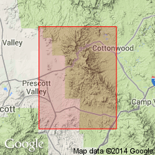
Are named as a formation of Alder group of Yavapai series for exposures in Chaparral Gulch, secs 16 and 17, T13N, R1E, Yavapai Co, AZ in Southwestern Basin-and-Range region. No type locality designated. Extends beyond southern limit of map area. Northern limit buried beneath Cenozoic rocks. Does not occur elsewhere in Jerome area. Lies between two major faults. Thickness and stratigraphic relations unknown. Is made up of gray rhyolitic and green to gray andesitic tuffaceous sedimentary rocks. The andesitic tuffaceous rock is variable in texture, structure, and mineral composition. Fine-grained, well-foliated and fissile rock is the most abundant. Rhyolitic tuffaceous rock is fine grained, finely laminated, ranging from pure rhyolite to mixed rhyolite and andesite. Quartz, orthoclase, microcline, and albite are the megascopic minerals. Are older Precambrian. Geologic map.
Source: GNU records (USGS DDS-6; Denver GNULEX).
- Usage in publication:
-
- Chaparral Volcanics*†
- Modifications:
-
- Abandoned
Summary:
Are abandoned because found to be same as upper part of the Spud Mountain Volcanics. Originally thought to occur southeast of Mount Chaparral fault in northwest corner of Prescott quad, Yavapai Co, AZ in Southwestern Basin-and-Range region. Now known that fault dies out and relation to Spud Mountain clarified.
Source: GNU records (USGS DDS-6; Denver GNULEX).
For more information, please contact Nancy Stamm, Geologic Names Committee Secretary.
Asterisk (*) indicates published by U.S. Geological Survey authors.
"No current usage" (†) implies that a name has been abandoned or has fallen into disuse. Former usage and, if known, replacement name given in parentheses ( ).
Slash (/) indicates name conflicts with nomenclatural guidelines (CSN, 1933; ACSN, 1961, 1970; NACSN, 1983, 2005, 2021). May be explained within brackets ([ ]).