The National Geologic Map Database is migrating to a new infrastructure. We apologize for any service disruptions during this process.
|
|---|


- Usage in publication:
-
- Chanute shales
- Modifications:
-
- Original reference
- Dominant lithology:
-
- Shale
- Sandstone
- AAPG geologic province:
-
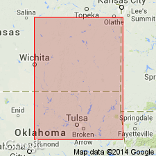
- Cherokee basin
Summary:
Pg. 109. Chanute shales. Shales and sandstones, with some coal, 100 to 150 feet thick, underlying Iola limestone and overlying Erie limestone.
Named from development in vicinity of Chanute, Neosho Co., southeastern KS.
Source: US geologic names lexicon (USGS Bull. 896, p. 399).

- Usage in publication:
-
- Chanute shale
- Chanute shale member
- Modifications:
-
- Overview
- AAPG geologic province:
-
- Cherokee basin
Summary:
As thus defined apparently overlies Drum limestone, the top division of †Erie limestone as defined. Subsequent reports defined Chanute as overlying Drum limestone and underlying Iola limestone, which was definition later (1915) followed by H. Hinds and F.C. Greene (Missouri Bur. Geol. and Mines v. 13), although, according to recent reports, the Iola and Drum limestones of Hinds and Greene are not true Iola and true Drum. Hinds and Greene treated Chanute formation as a member of Kansas City formation. (In Kansas, the Kansas City is treated as a group and the Chanute shale as a formation.)
See also "Modern classifications of the Pennsylvanian rocks of eastern Kansas and southeastern Nebraska," compiled by M.G. Wilmarth, Secretary of Committee on Geologic Names, USGS unpub. corr. chart, Oct. 1936, sheet 1.
Source: US geologic names lexicon (USGS Bull. 896, p. 399).
- Usage in publication:
-
- Chanute shale
- Modifications:
-
- Revised
- AAPG geologic province:
-
- Cherokee basin
Summary:
Pg. 18, 43, 51. True Chanute shale underlies true Iola limestone and overlies Drum limestone. The Chanute shale of Missouri geologists included true Chanute shale, true Drum limestone, and underlying Quivira shale, which is top part of Cherryvale shale of southeast Kansas. The Iola limestone of Hinds and Greene is Argentine-Frisbie limestone members of Wyandotte limestone. Age is Late Pennsylvanian (Missouri age).
Source: US geologic names lexicon (USGS Bull. 896, p. 399); GNC KS-NE Pennsylvanian Corr. Chart, sheet 2, Oct. 1936.

- Usage in publication:
-
- Chanute shale
- Modifications:
-
- Revised
- Areal extent
- AAPG geologic province:
-
- Cherokee basin
Summary:
Pg. 109-111. Chanute shale as here recognized underlies Iola limestone and overlies Drum limestone. Early usage of Chanute shale is somewhat confused because of miscorrelations of limestones above and below. It is clear, however, it was intended to designate the shale and thin sandstones that form plain extending east from Chanute to the prominent escarpment made by the Bronson limestones. The Iola limestone is well exposed in vicinity of Chanute and it can be traced without difficulty to Iola, about 20 miles to north. †Thayer shale is synonym of Chanute shale. There is disconformity at base of Chanute shale in part of southeastern Kansas and northern Oklahoma, also in vicinity of Chanute, where Drum limestone and underlying shale are eroded, so that sandstone of basal Chanute rests directly on different beds of upper part of Dennis limestone, which is uppermost division[?] of †Erie limestone. Thickness of Chanute ranges from 10+/- feet near Kansas City to 100+/- feet in southern Kansas; average in northeastern Kansas is 25+/- feet. Age is Late Pennsylvanian (Missouri age). [On p. 45 Moore shows Chanute shale of "old classification" as extending from top of Westerville limestone to base of Wyandotte limestone.]
See also "Modern classifications of the Pennsylvanian rocks of eastern Kansas and southeastern Nebraska," compiled by M.G. Wilmarth, Secretary of Committee on Geologic Names, USGS unpub. corr. chart, Oct. 1936, sheet 2.
Source: US geologic names lexicon (USGS Bull. 896, p. 399); GNC KS-NE Pennsylvanian Corr. Chart, sheet 2, Oct. 1936.
- Usage in publication:
-
- Chanute formation*
- Modifications:
-
- Revised
- AAPG geologic province:
-
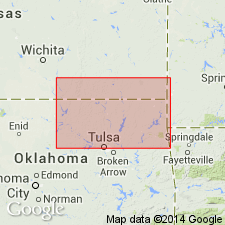
- Chautauqua platform
Summary:
Pg. 40 (table). Chanute formation. Lowermost formation in Ochelata group. Thickness about 200 feet near Kansas-Oklahoma State line; 40 feet or less in vicinity of Bartlesville. Normally overlies Drum limestone and underlies Iola limestone. Over Chautauqua Arch Country, in parts of which Drum limestone is absent, a prominent sandstone that forms lower part of Chanute is here named Noxie sandstone lentil; near State line, includes Cottage Grove sandstone in upper part. Age is Late Pennsylvanian (Missourian).
Source: US geologic names lexicon (USGS Bull. 1200, p. 718-719).
- Usage in publication:
-
- Chanute shale*
- Modifications:
-
- Revised
- Areal extent
- AAPG geologic province:
-
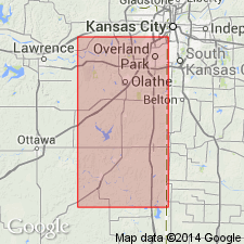
- Forest City basin
Summary:
Pg. 294 (table), 295. Chanute shale of Kansas City group. Chanute shale as used here [Adams County, Iowa] follows practice of Missouri Survey in including all beds between Wyandotte above and Westerville below. Includes Raytown and Cement City limestones which may be present in section but are difficult to recognize in well logs. Age is Late Pennsylvanian (Missourian).
Source: US geologic names lexicon (USGS Bull. 1200, p. 718-719).
- Usage in publication:
-
- Chanute shale
- Modifications:
-
- Revised
- AAPG geologic province:
-
- Forest City basin
Summary:
Pl. 1. Chanute shale of Kansas City group. Columnar section, Jackson and Cass Counties, Missouri, shows Chanute shale comprises (ascending) Quivira shale, Cement City limestone, Union Station shale (new), Paola limestone, Muncie Creek shale, Raytown limestone, and Liberty Memorial shale (new) members. Overlies Cherryvale shale, which includes Westerville limestone at top; underlies Iola limestone.
Source: US geologic names lexicon (USGS Bull. 1200, p. 718-719).
- Usage in publication:
-
- Chanute shale
- Modifications:
-
- Revised
- AAPG geologic province:
-
- Forest City basin
Summary:
Pg. 2031 (fig. 4), 2032-2033; F.C. Greene and W.V. Searight, 1949, Missouri Geol. Survey Water Res. Rpt. Inv., no. 11, p. vi (fig. 2), 12-13. Chanute shale. Miscorrelation of Iola formation by Haworth and Bennett (1908, Kansas Univ. Geol. Survey [Rpt.], v. 9) in tracing limestone in this part of section northeastward to Kansas City has been responsible for long standing error in nomenclature of [Upper Pennsylvanian] Missourian units in northeastern Kansas and northwestern Missouri. Settlement of Iola problem has led to changes in Missouri Survey's classification of middle and upper units of Kansas City group so as to bring interstate agreement in nomenclature. Union Station shale (Clair, 1943) is suppressed because it is synonym for Chanute shale as a whole. Paola limestone, Muncie Creek shale, and Raytown limestone, which were classed as members of Chanute shale are recognized as belonging to Iola formation. Liberty Memorial shale (Clair, 1943) is suppressed as junior synonym of Lane shale. Thus, Chanute shale overlies Drum limestone and underlies Iola formation.
Source: US geologic names lexicon (USGS Bull. 1200, p. 718-719).
- Usage in publication:
-
- Chanute formation
- Modifications:
-
- Areal extent
- AAPG geologic province:
-
- Nemaha anticline
Summary:
Chanute formation. Thickness of formation 6 to 7 feet east of Louisville, [Cass County], Nebraska; about 10 feet near Kansas City; 25 feet in northeastern Kansas; about 100 feet in southern Kansas. Age is Late Pennsylvanian (Missourian).
Source: US geologic names lexicon (USGS Bull. 1200, p. 718-719).
- Usage in publication:
-
- Chanute formation
- Modifications:
-
- Areal extent
- AAPG geologic province:
-
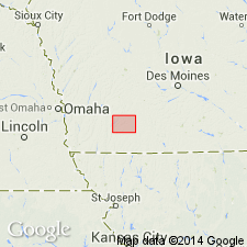
- Iowa shelf
- Forest City basin
Summary:
Pg. 418 (fig. 1), 420. Chanute formation of Kansas City group. Thickness about 2 feet in Madison and Adair Counties, Iowa. Underlies Iola formation; overlies Drum formation. Age is Late Pennsylvanian (Missourian).
Source: US geologic names lexicon (USGS Bull. 1200, p. 718-719).
- Usage in publication:
-
- Chanute formation*
- Modifications:
-
- Areal extent
- AAPG geologic province:
-
- Chautauqua platform
Summary:
Pg. 28-31, pls. 1, 2, measured sections. Chanute formation of Ochelata group. Rocks assigned to Chanute formation, in Creek County, Oklahoma, were included by Ohern (1910) in lower part of Ochelata member of his Ramona formation (southem area) and in lower part of unnamed interval between Dewey and Avant limestone lentils of Copan member of his Wann formation (northern area). According to classification used on Geologic Map of Oklahoma (Miser, 1926), these beds lie at base of Ochelata formation (Ochelata group), occupying lower part of interval between Dewey and Avant limestones. On Geologic Map of Oklahoma, (Miser, 1954), they are shown as Chanute formation, lying between Dewey formation below and Iola limestone (formation) above. Thickness in Creek County 45 to 110 feet. Formation crops out across Oklahoma in direction slightly west of south from Kansas-Oklahoma line to North Canadian River. Name is not applied farther south. Age is Late Pennsylvanian (Missourian).
Source: US geologic names lexicon (USGS Bull. 1200, p. 718-719).

- Usage in publication:
-
- Chanute shale*
- Modifications:
-
- Areal extent
- AAPG geologic province:
-
- Forest City basin
Summary:
Pg. 26, fig. 5. Chanute shale of Kansas City group. Consists of greenish-gray, fossiliferous upper shale bed of varying thickness separated from lower greenish-gray shale by thin coal smut. Thickness about 5 feet. Underlies Iola limestone; overlies Drum limestone. Age is Late Pennsylvanian (Missourian).
Source: US geologic names lexicon (USGS Bull. 1200, p. 718-719).
For more information, please contact Nancy Stamm, Geologic Names Committee Secretary.
Asterisk (*) indicates published by U.S. Geological Survey authors.
"No current usage" (†) implies that a name has been abandoned or has fallen into disuse. Former usage and, if known, replacement name given in parentheses ( ).
Slash (/) indicates name conflicts with nomenclatural guidelines (CSN, 1933; ACSN, 1961, 1970; NACSN, 1983, 2005, 2021). May be explained within brackets ([ ]).