- Usage in publication:
-
- Chandler Falls member
- Modifications:
-
- Original reference
- Dominant lithology:
-
- Limestone
- Dolomite
- Shale
- AAPG geologic province:
-
- Michigan basin
Summary:
Pg. 13, 14, 23-25. Chandler Falls member of Trenton formation. At Chandler Falls, consists of 45 feet of limestone, dolomite, shale and shaly limestone; calcareous layers vary in thickness from 1 to 18 inches and occur chiefly in lower part of section; shale and argillaceous limestone make up central and upper portions of exposure. Conglomerate about 5 feet thick occurs about 11 feet above base. This conglomerate probably marks base of Trenton. Underlies Groos Quarry member (new); overlies Bony Falls member (new) of Black River formation. Deposition was practically continuous at some localities from Black River to Trenton time and dividing line between the two formations becomes an arbitrary one. Age is Middle Ordovician.
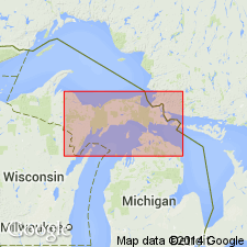
Type locality: at Chandler Falls, on Escanaba River, 3 mi north of Escanaba, in T. 39 N., R. 22 W., Delta Co., northern MI. Chandler Falls is site of hydroelectric powerplant.
Source: US geologic names lexicon (USGS Bull. 1200, p. 716-717).
For more information, please contact Nancy Stamm, Geologic Names Committee Secretary.
Asterisk (*) indicates published by U.S. Geological Survey authors.
"No current usage" (†) implies that a name has been abandoned or has fallen into disuse. Former usage and, if known, replacement name given in parentheses ( ).
Slash (/) indicates name conflicts with nomenclatural guidelines (CSN, 1933; ACSN, 1961, 1970; NACSN, 1983, 2005, 2021). May be explained within brackets ([ ]).

