

- Usage in publication:
-
- Chamita Formation
- Modifications:
-
- Named
- Dominant lithology:
-
- Sand
- Gravel
- AAPG geologic province:
-
- San Juan basin
Summary:
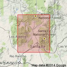
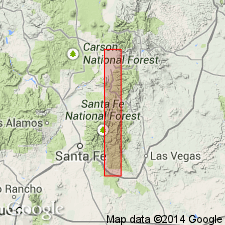
Named as uppermost of two formations of Santa Fe Group (revised) for nearby village; type section designated in NW 1/4 sec 10, and W 1/2 sec 3, T21N, R8E, Rio Arriba Co, NM in San Juan basin. The type area of Santa Fe Group is here restricted to north of Santa Fe, in the Rio Grande Valley (includes parts of northern Santa Fe Co (Estancia basin), southeastern Rio Arriba Co (San Juan basin), and southern Taos Co (San Luis basin). In this area, Santa Fe Group is divided into Chamita Formation (at top) and Tesuque Formation, with its 5 members (at base). Chamita consists of: coarse quartzitic sand or granules; some fine sand, silt, reworked tuff; occasional lenses of granitic cobbles; distinctive bands of pumiceous tuff, and quartzitic gravels locally. Distinctive at type section are two zones of white to pinkish tuffaceous beds--lower zone is 80 ft thick, and upper is 100 ft thick. Chamita unconformably overlies Ojo Caliente Sandstone Member (new) of Tesuque; unconformably overlain by younger formations, including Puye Conglomerate, Los Pinos Gravel, and others. Has an extensive fauna that is appreciably different from that previously reported from the Santa Fe type area, and was deposited during a segment of Hemphillian time. Thickness varies greatly due to erosion--is more than 700 ft thick at type section, 300 ft thick along Black Mesa, and 30 ft at Battleship Mountain. Of predominantly fluviatile origin. Geologic map, sections.
Source: GNU records (USGS DDS-6; Denver GNULEX).
- Usage in publication:
-
- Chamita Formation
- Modifications:
-
- Geochronologic dating
- AAPG geologic province:
-
- Estancia basin
Summary:
Chamita Formation of Santa Fe Group (of Galusha and Blick, 1971). At type locality, south of Black Mesa, between confluence of Rio Chama and Rio Grande, Rio Arriba County, north-central New Mexico, includes two tuffaceous zones separated by 150 m of section. Sample from middle of lower tuffaceous zone, yielded a fission-track age of 5.2 +/-0.4 Ma (zircon). Sample from uppermost lapillistone of upper tuffaceous zone, yielded a fission-track age of 5.6 +/-0.9 Ma (zircon).
Source: Modified from GNU records (USGS DDS-6; Denver GNULEX).
- Usage in publication:
-
- Chamita Formation*
- Modifications:
-
- Geochronologic dating
- AAPG geologic province:
-
- San Juan basin
Summary:
Two basalt flows, separated laterally by an area of erosion and of uncertain stratigraphic relationship, were dated from the Chamita Formation of Galusha and Blick (1971). One flow, cut by U.S. Hwy 84 near town of Chili, is part of a small volcanic center within the lower part of Chamita Formation; it yielded a K-Ar age of 8.3 +/-2.4 m.y. A second flow, sampled in Arroyo de la Presa, is cut by the western boundary faults of the Velarde graben and lies close to the base of Chamita Formation. This sample was dated at 9.9 +/-1.2 m.y. As shown by their K-Ar ages, both flows are about the same age. Area of report is Espanola basin, Rio Arriba Co, north-central NM in San Juan basin.
Source: GNU records (USGS DDS-6; Denver GNULEX).
For more information, please contact Nancy Stamm, Geologic Names Committee Secretary.
Asterisk (*) indicates published by U.S. Geological Survey authors.
"No current usage" (†) implies that a name has been abandoned or has fallen into disuse. Former usage and, if known, replacement name given in parentheses ( ).
Slash (/) indicates name conflicts with nomenclatural guidelines (CSN, 1933; ACSN, 1961, 1970; NACSN, 1983, 2005, 2021). May be explained within brackets ([ ]).