

- Usage in publication:
-
- Chalk Hills Formation*
- Modifications:
-
- Named
- Dominant lithology:
-
- Silt
- Sand
- Ash
- AAPG geologic province:
-
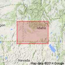
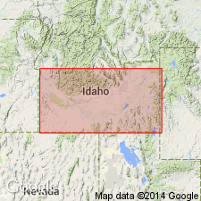
- Snake River basin
Summary:
Pg. 1199 (fig. 1), 1203, 1205-1206, pI. 1. Chalk Hills Formation of Idaho Group. Contains large amounts of siliceous volcanic ash (locally contains opal), but ash is subordinate to other fine-grained detrital material, chiefly silt and sand. Thickness about 300 feet at type locality where it rests on faulted Banbury Basalt. At Castle Creek, unconformably overlies Idavada Volcanics (new). Underlies Glenns Ferry Formation (new) with angular unconformity. Age is middle Pliocene, based on fossils (mammals, mollusks). Report includes generalized geologic map, cross section, stratigraphic chart.
Type locality: Chalk Hills, an area of badlands at head of Little Valley, 14 mi southwest of town of Bruneau, Owyhee Co., southwestern ID. Named from Chalk Hills. Formation continuously exposed as badlands from Little Valley eastward to head of Bruneau Valley at Hot Creek, 10 mi south of Bruneau. Also present along middle reach of Castle Creek and its western tributaries, Brown and Hart Creeks.
Source: US geologic names lexicon (USGS Bull. 1350, p. 140); supplemental information from GNU records (USGS DDS-6; Denver GNULEX).
- Usage in publication:
-
- Chalk Hills Formation*
- Modifications:
-
- Geochronologic dating
- AAPG geologic province:
-
- Snake River basin
Summary:
Pg. 236, 238. Chalk Hills Formation of Idaho Group. Sample of basalt from near Murphy, Owyhee Co., western Snake River Plain, southern ID, yielded K-Ar ages of at least 8.4 Ma (whole-rock); Hemphillian North American land mammal age [=Pliocene (Evernden and others, 1964, Amer. Jour. Sci., v. 262, p. 145-198, =Miocene (Berggren, 1972, Lethaia, v. 5, no. 2, p. 195-215)]. Report includes sample locality map, schematic stratigraphic-chronologic diagram, table of K-Ar ages.
Source: Publication.
- Usage in publication:
-
- Chalk Hills Formation*
- Modifications:
-
- Overview
- AAPG geologic province:
-
- Snake River basin
Summary:
Is formation in western Snake River Plain, southwestern ID. Samples of diatomaceous silt collected from basal two-thirds of formation in Owyhee Co, ID, in Snake River basin yield three new centric diatom species of the new genus MESODICTYON that appear to have wide geographic distribution and may be useful as biostratigraphic marker. Fossil mammals in Chalk Hills, initially considered to have been Pliocene in age (Shotwell in Malde and Powers, 1962) were later assigned to Hemphillian continental mammal age, or late Miocene (Berggren and Van Couvering, 1974; Everenden and others, 1964). Fossil fish (Smith and others, 1982), fission-track dating of volcanic ash (Kimmel, 1979, 1982), and radiometric dates on basalts (Armstrong and others, 1975) also place the deposits in late Miocene. Collectively. estimates put lacustrine deposition of Chalk Hills between about 10 and 7 m.y. ago.
Source: GNU records (USGS DDS-6; Denver GNULEX).
- Usage in publication:
-
- Chalk Hills Formation
- Modifications:
-
- Not used
Summary:
Not used in study area in northeast Owyhee Co, ID, Snake River basin. Sediments mapped by Malde and others (1963) as Tuana Gravel, Glenns Ferry Formation and Chalk Hills in northwest corner of sheet 1 of mapped area are here reassigned to sediments of the Hot Creek area of Miocene to Pleistocene age. Included in sediments of the Hot Creek area are all sediments between units informally referred to as basalt of Hot Creek and basalt of Winter Camp Butte. Basalt mapped by Malde and others (1963) as both basalt in Chalk Hills and Banbury Basalt in northern part of sheet 1 is here reassigned to basalt at Hot Creek. Because of uncertainty of age of basalts above and below sediments of Hot Creek area due to lack of radiometric age dates and because of confusion as to assignment of same basalt to both Glenns Ferry and Banbury, it is unrealistic to assign sediments and basalt to previously established stratigraphic units.
Source: GNU records (USGS DDS-6; Denver GNULEX).
For more information, please contact Nancy Stamm, Geologic Names Committee Secretary.
Asterisk (*) indicates published by U.S. Geological Survey authors.
"No current usage" (†) implies that a name has been abandoned or has fallen into disuse. Former usage and, if known, replacement name given in parentheses ( ).
Slash (/) indicates name conflicts with nomenclatural guidelines (CSN, 1933; ACSN, 1961, 1970; NACSN, 1983, 2005, 2021). May be explained within brackets ([ ]).