The National Geologic Map Database is migrating to a new infrastructure. We apologize for any service disruptions during this process.
|
|---|


- Usage in publication:
-
- Cerro Rubio Quartz Latite*
- Modifications:
-
- Original reference
- Dominant lithology:
-
- Quartz latite
- AAPG geologic province:
-
- San Juan basin
Summary:
Pg. 18 (fig. 8), 57-58, pl. 1. Cerro Rubio Quartz Latite. A light- to dark-gray rock which, at southerly of the two domes, weathers grayish red. Intruded into Cerro Toledo Rhyolite (new) on west side of Cerro Rubio. Tshirege Member (new) of Bandelier Tuff on east side of the dome lies unconformably against the quartz latite. Age is Pleistocene.
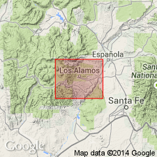
Type section: two conical extrusive volcanic domes that form Cerro Rubio, Los Alamos area, [Lat. 35 deg. 56 min. 45 sec. N., Long. 106 deg. 24 min. 05 sec. W., Valle Toledo 7.5-min quadrangle, Sandoval Co.], north-central NM. Also exposed on unnamed peak on northeast side of Valles Caldera north of Valle de los Posos.
Source: US geologic names lexicon (USGS Bull. 1350, p. 139).
For more information, please contact Nancy Stamm, Geologic Names Committee Secretary.
Asterisk (*) indicates published by U.S. Geological Survey authors.
"No current usage" (†) implies that a name has been abandoned or has fallen into disuse. Former usage and, if known, replacement name given in parentheses ( ).
Slash (/) indicates name conflicts with nomenclatural guidelines (CSN, 1933; ACSN, 1961, 1970; NACSN, 1983, 2005, 2021). May be explained within brackets ([ ]).