- Usage in publication:
-
- Centerburg Till
- Modifications:
-
- Revised
- AAPG geologic province:
-
- Appalachian basin
Summary:
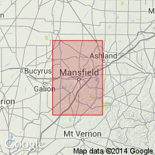
Revises Forsythe's (1961) "Centerburg soil" to Centerburg Till. Is named for town of Centerburg, southwestern Knox Co., central OH. Occurs in southwestern Richland Co. near Kings Corners in area of about 3 square miles. Margin can be traced northwestward into Morrow Co. where it joins Killbuck-lobe equivalent (Hiram Till). Is also traced southward into Morrow Co. where it connects with Centerburg margin extended northward from Knox Co. Typically is silty, sandy, and slightly pebbly, but appears clayey because weathered till is very sticky when moist. Where oxidized, till is dark brown. Thin silt cap is present in places. Thickness of till in Richland Co. not determined, but has been observed as ranging from less than 2 ft to 4 or 5 ft in Morrow Co. Shown on map as in contact with and younger than Mount Liberty Till of Scioto lobe. Age is Pleistocene (Wisconsinan, Woodfordian).
Source: GNU records (USGS DDS-6; Reston GNULEX).

- Usage in publication:
-
- Centerburg till*
- Modifications:
-
- Revised
- AAPG geologic province:
-
- Appalachian basin
Summary:
Recognized as an informal unit because it was not defined according to the Code of Stratigraphic Nomenclature (American Commission on Stratigraphic Nomenclature, 1961). Centerburg till was defined solely on the basis of areal distribution of soil catena and was not described in terms of its lithology, texture, or stratigraphic position. No evidence was presented to demonstrate that the "till" with the distinctive soil profile was younger than other "tills" in same region on which other soil catenas developed. [Fullerton disregards Totten (1973) who does describe Centerburg Till as a rock-stratigraphic unit including composition, thickness, texture, nature of contact, distribution, and weathering zones. Because the till is thin it is all weathered to some degree. Thus, the original "Centerburg soil" was developed on a thin till to which the same name was later applied.]
Source: GNU records (USGS DDS-6; Reston GNULEX).
For more information, please contact Nancy Stamm, Geologic Names Committee Secretary.
Asterisk (*) indicates published by U.S. Geological Survey authors.
"No current usage" (†) implies that a name has been abandoned or has fallen into disuse. Former usage and, if known, replacement name given in parentheses ( ).
Slash (/) indicates name conflicts with nomenclatural guidelines (CSN, 1933; ACSN, 1961, 1970; NACSN, 1983, 2005, 2021). May be explained within brackets ([ ]).

