

- Usage in publication:
-
- Ceja Member
- Modifications:
-
- Original reference
- Dominant lithology:
-
- Sandstone
- Conglomerate
- Mudstone
- AAPG geologic province:
-
- San Juan basin
Summary:
Pg. 18-20. Ceja Member of Santa Fe Formation. Buff, gray; thin- to medium-bedded, medium- to coarse-grained sandstone; thick-bedded conglomerate, containing subrounded to angular pebbles to large boulders; and mudstone. Thickness 64.3 m. Overlies informal "Middle Red" member, which is main body of Santa Fe Formation. Underlies informal Ortiz gravel (Pleistocene). Age is Pliocene.
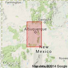
Type section: exposure along south side of El Rincon, a box canyon in west slope of Ceja Mesa, 19 km west of Albuquerque, in NE/4 SE/4 sec. 19, T. 10 N., R. 1 E. [unsurveyed], Bernalillo Co., central NM.
Source: US geologic names lexicon (USGS Bull. 1564, p. 30).
- Usage in publication:
-
- Ceja Member
- Modifications:
-
- Revised
- AAPG geologic province:
-
- San Juan basin
Connell, S.D., Koning, D.J., and Cather, S.M., 1999, Revisions to the stratigraphic nomenclature of the Santa Fe Group, northwestern Albuquerque basin, New Mexico: New Mexico Geological Society Field Conference Guidebook, no. 50, p. 337-354.
Summary:
Pg. 339 (fig. 3). Ceja Member of Arroyo Ojito Formation of Santa Fe Group. Transferred Ceja Member (sensu Kelley, 1977) to newly named Arroyo Ojito Formation of Santa Fe Group. Consists of medium- to thick-bedded conglomerate and lesser coarse-grained sandstone. Age is late Miocene to early Pleistocene (Hemphillian to Blancan NALMA); Pliocene-Pleistocene boundary = 1.8 Ma.
Source: Publication.
- Usage in publication:
-
- Ceja Formation*
- Modifications:
-
- Revised
- AAPG geologic province:
-
- Estancia basin
- San Juan basin
Summary:
Pg. 10 (fig. 3), 12 of pamphlet, geol. map. Ceja Formation of Santa Fe Group. Kelley's (1977) Ceja Member of his "Santa Fe Formation" is raised to formation rank. Essentially = "Upper Buff" member of Santa Fe Formation of Bryan and McCann (1937). Consists of consolidated, moderately cemented, light-gray to brown, sandy, polymict pebble to boulder conglomerate, coarse pebbly sand, and sparse interbeds of reddish-brown silty mudstone. Thickness up to 225 feet in quadrangle. Is top formation of Santa Fe Group; generally underlies the Llano de Albuquerque surface. Overlies "Middle Red" formation; is separated from it by an erosional unconformity (represents hiatus from about 6 to 4.5 Ma). Age is Pliocene. Vertebrate fossils recovered from the Ceja Formation are lower and middle Blancan (about 4.5 to 2.5 Ma; citing Morgan and Lucas, 2000, New Mexico Mus. Nat. Hist. Sci. Bull., no. 16, p. 217-240).
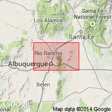
Type section (citing Kelley, 1977; Lambert, 1968 Univ. New Mexico PhD dissert.) stated to be at El Rincon along the Rio Puerco valley escarpment about 2 mi north of the crossing of I-40, in NE/4 SE/4 sec. 19, T. 10 N., R. 1 E., unsurveyed (approx. UTM Zone 13, NAD 1927, 329,000 E.; 3,884,000 N.).
Source: Publication.
- Usage in publication:
-
- Ceja Formation
- Modifications:
-
- Areal extent
- AAPG geologic province:
-
- San Juan basin
Summary:
Pg. 15 (fig. 2), 21 (fig. 6), 22-23, App. B. Ceja Formation of Santa Fe Group. Typically contains a lower interval of interbedded sand and mud, and an upper interval that is predominantly sandy and pebbly to cobbly sand with scattered small boulders. Thickness 94 to 104 m. Divided into (descending) Rio Puerco Member, Atrisco Member, and [informal] Santa Ana Mesa member. Disconformably overlies Arroyo Ojito Formation of Santa Fe Group. Fossils. Age is Pliocene (Blancan to earliest Irvingtonian); Pliocene-Pleistocene boundary = 1.8 Ma. [ca. 2010 Pliocene-Pleistocene boundary = 2.5 Ma; Rio Puerco Member and upper part of Atrisco Member are Pleistocene (see chart on p. 21).]
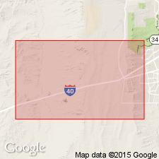
Type section (El Rincon section) stated to be from UTM Zone 13s, NAD83, 327,394 m E.; 3,882,052 m N. (base of section) to 329,425 m E.; 3,884,250 m N. (top), [approx. Lat. 35 deg. 04 min. 00 sec. N., Long. 106 deg. 53 min. 34 sec. W. to Lat. 35 deg. 05 min. 13 sec. N., Long. 106 deg. 52 min. 14 sec. W.], La Mesita Negra and La Mesita Negra SE 7.5-min quadrangles, Bernalillo Co., north-central NM.
Source: Publication.
For more information, please contact Nancy Stamm, Geologic Names Committee Secretary.
Asterisk (*) indicates published by U.S. Geological Survey authors.
"No current usage" (†) implies that a name has been abandoned or has fallen into disuse. Former usage and, if known, replacement name given in parentheses ( ).
Slash (/) indicates name conflicts with nomenclatural guidelines (CSN, 1933; ACSN, 1961, 1970; NACSN, 1983, 2005, 2021). May be explained within brackets ([ ]).