

- Usage in publication:
-
- Cedarville limestone
- Modifications:
-
- Named
- Dominant lithology:
-
- Limestone
- AAPG geologic province:
-
- Cincinnati arch
Summary:
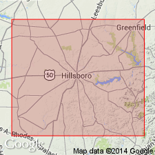
Named for Cedarville, Greene Co., southwestern OH. Forms top of Niagara group in Highland Co., and northward in southwestern OH, except near Hillsboro and at a few other places where overlain by Hillsboro sandstone. Consists of a series of magnesian limestones, 10 to 90 ft thick, containing abundant large and noticeable fossils, most prominently PENTAMERUS OBLONGUS and MEGALOMUS CANADENSIS; also includes series of very thin-bedded and fragile limestones in which PENTAMERUS rarely occurs but which is largely composed of fossil remains and other shells. Underlain by Blue Cliff or Springfield limestone.
Source: GNU records (USGS DDS-6; Reston GNULEX).
- Usage in publication:
-
- Cedarville formation
- Modifications:
-
- Revised
- AAPG geologic province:
-
- Cincinnati arch
Summary:
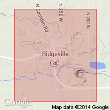
Stratigraphically expanded below to include 43 ft of dolomite formerly included in the Huntington dolomite, as exposed at Ridgeville, Randolph Co., IN. As redefined, total thickness of Cedarville formation is 95 ft.
Source: GNU records (USGS DDS-6; Reston GNULEX).
- Usage in publication:
-
- Cedarville dolomite
- Modifications:
-
- Revised
- AAPG geologic province:
-
- Cincinnati arch
Summary:
Chart 3. Cedarville dolomite of Durbin group. Shown on correlation chart as uppermost unit in Durbin group. Underlies Peebles dolomite. [Age is Middle Silurian.]
Source: US geologic names lexicon (USGS Bull. 1200, p. 693-694).
- Usage in publication:
-
- Cedarville dolomite*
- Modifications:
-
- Areal extent
- AAPG geologic province:
-
- Cincinnati arch
Summary:
Referred to as Cedarville dolomite, replacing Cedarville limestone, and noted as occurring in IN. Age is Silurian.
Source: GNU records (USGS DDS-6; Reston GNULEX).
- Usage in publication:
-
- Cedarville dolomite
- Modifications:
-
- Overview
- AAPG geologic province:
-
- Cincinnati arch
Summary:
Silurian section in Yellow Springs region shows Cedarville dolomite as much as 50 ft thick, above Springfield dolomite. Top of section. Age is Silurian (Niagaran).
Source: GNU records (USGS DDS-6; Reston GNULEX).
For more information, please contact Nancy Stamm, Geologic Names Committee Secretary.
Asterisk (*) indicates published by U.S. Geological Survey authors.
"No current usage" (†) implies that a name has been abandoned or has fallen into disuse. Former usage and, if known, replacement name given in parentheses ( ).
Slash (/) indicates name conflicts with nomenclatural guidelines (CSN, 1933; ACSN, 1961, 1970; NACSN, 1983, 2005, 2021). May be explained within brackets ([ ]).