- Usage in publication:
-
- Cedarville series
- Modifications:
-
- Named
- Biostratigraphic dating
- Dominant lithology:
-
- Andesite
- AAPG geologic province:
-
- Modoc Plateau province
- Great Basin province
Summary:
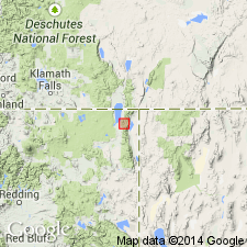
Name Cedarville series given to series of andesitic rocks making up great bulk of Warner Range west of Cedarville, CA. Divided into: "Lower Cedarville" (3,700 feet of andesitic agglomerates, tuffs, conglomerates, intercalated flows and about 5 % of non-volcanic sedimentary deposits, "Middle Lava layer" (150 to 500 feet thick, and "Upper Cedarville" (andesitic tuffs, agglomerates, intercalated flows and about 5% of non-volcanic sedimentary deposits). Lower Cedarville contains flora of early Miocene or possibly latest Oligocene age (R.W. Chaney). Upper Cedarville contains fossil flora considered by R.W. Chaney to be Mascall (middle and late Miocene) age. Units of series shown separately on geologic map of Warner Range, CA. Underlies Warner basalt (new).
Source: GNU records (USGS DDS-6; Menlo GNULEX).
- Usage in publication:
-
- Upper Cedarville beds
- Modifications:
-
- Areal extent
- Biostratigraphic dating
- AAPG geologic province:
-
- Great Basin province
Summary:
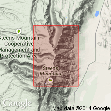
Upper Cedarville Beds of Russell (1928) extended into Warner Lakes area, Lake Co, OR, since overlying Warner Basalt was recognized here. Upper Cedarville Beds overlies Steens Basalt (new). Fossil leaves indicate middle Miocene age. "Vertebrate remains, however, found in same beds indicate later age." p.114.
Source: GNU records (USGS DDS-6; Menlo GNULEX).
- Usage in publication:
-
- Cedarville andesite
- Modifications:
-
- Redescribed
- Areal extent
- Dominant lithology:
-
- Andesite
- AAPG geologic province:
-
- Modoc Plateau province
- Great Basin province
Summary:
Cedarville Andesite [name variation] is shown on reconnaissance geological map of Modoc Lava-Bed 1x1 deg quad, CA. "It may be correlated with Cedarville Andesites [Russell, 1928] of Miocene age in the Warner Mountains. Whether it represents both the Upper and Lower Cedarville or only one of them is not known." p.259
Source: GNU records (USGS DDS-6; Menlo GNULEX).
- Usage in publication:
-
- Upper Cedarville formation
- Modifications:
-
- Revised
- Areal extent
- AAPG geologic province:
-
- Modoc Plateau province
- Great Basin province
Summary:
Beds of Pliocene age previously referred to "upper" Cedarville [by Russell, 1928] are called Alturas formation [Dorf, 1933]. Upper Cedarville formation is relatively widespread through much of Modoc Co, CA and in Hays Canyon range of northern Washoe Co, NV. Thickness totals 3500 ft. Contains late Miocene flora near its top surface at Pit River and at 49 Camp, NV. "Middle lava layer" and "lower" Cedarville formation of Russell (1928) not recognized outside of Warner Range.
Source: GNU records (USGS DDS-6; Menlo GNULEX).
- Usage in publication:
-
- Upper Cedarville formation
- Modifications:
-
- Areal extent
- AAPG geologic province:
-
- Great Basin province
Summary:
Upper Cedarville formation recognized by Fuller (1931) in Warner Lakes area [Lake Co, OR] is considered to be Thousand Creek formation which also overlies Steens basalt in area 40 mi eastward. This restriction made on basis that mammalian remains are not known from Upper Cedarville formation as described by Fuller (1931).
Source: GNU records (USGS DDS-6; Menlo GNULEX).
- Usage in publication:
-
- Upper Cedarville Formation
- Modifications:
-
- Geochronologic dating
- AAPG geologic province:
-
- Modoc Plateau province
- Great Basin province
Summary:
K-Ar age of 19.8 Ma from welded tuff from Upper Cedarville Formation was collected at "49er Camp" location near Cedarville, California. Tuff is interbedded with leaf-bearing diatomite and tuffaceous shales containing Upper Cedarville Flora from upper 200 feet of formation.
Source: GNU records (USGS DDS-6; Menlo GNULEX).
- Usage in publication:
-
- Cedarville Series
- Modifications:
-
- Geochronologic dating
- AAPG geologic province:
-
- Modoc Plateau province
- Great Basin province
Summary:
Rb-Sr age of approximately 40 Ma obtained from lower part of Cedarville Series of Russell (1928), approximately 40 to 35 Ma from middle lava layer, and less than 35 Ma from upper part. Map shows samples collected east of Alturas, Modoc Co, CA. "Unusually low values of 0.7029 {Sr87/Sr86 ratio] obtained from the Eocene Cedarville Series of Russell (1928) suggest that these lava flows were derived from still another source material" [than were late Miocene rock]. p.1393
Source: GNU records (USGS DDS-6; Menlo GNULEX).
- Usage in publication:
-
- Cedarville Series
- Modifications:
-
- Age modified
- AAPG geologic province:
-
- Modoc Plateau province
- Great Basin province
Summary:
Unit age is late Oligocene to Miocene. Includes mostly andesitic flows, tuff and mudflow breccia beds, with minor basalt flows and rhyolite tuff. [no basis given for age assignment].
Source: GNU records (USGS DDS-6; Menlo GNULEX).
For more information, please contact Nancy Stamm, Geologic Names Committee Secretary.
Asterisk (*) indicates published by U.S. Geological Survey authors.
"No current usage" (†) implies that a name has been abandoned or has fallen into disuse. Former usage and, if known, replacement name given in parentheses ( ).
Slash (/) indicates name conflicts with nomenclatural guidelines (CSN, 1933; ACSN, 1961, 1970; NACSN, 1983, 2005, 2021). May be explained within brackets ([ ]).

