- Usage in publication:
-
- Cedar Valley limestone*
- Modifications:
-
- Named
- Dominant lithology:
-
- Limestone
- AAPG geologic province:
-
- Iowa shelf
Summary:
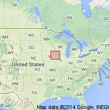
Chap. III. The indurated rocks. Cedar Valley limestone. Named for exposures in valley of Cedar River, eastern IA. Extends from MN State line to Muscatine Co. in belt 50 mi wide. Consists of limestones ranging from pure to argillaceous, dolomitic, or perhaps carbonaceous; sometimes divided by smooth bedding planes, again massive, elsewhere finely laminated; usually brecciated in peculiar manner; some strata horizontal, others locally inclined at all angles. Thickness more than 60 ft. Overlaps underlying Independence shale; overlies Hackberry shale.
Source: GNU records (USGS DDS-6; Reston GNULEX).

- Usage in publication:
-
- Cedar Valley Limestone*
- Modifications:
-
- Overview
- AAPG geologic province:
-
- Illinois basin
Summary:
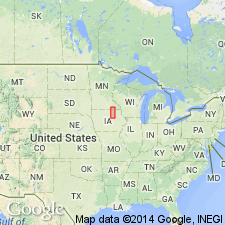
Cedar Valley is part of the Kaskaskia Sequence (strata between major unconformity at base of Middle Devonian and next higher unconformity). Conformably overlies Wapsipinicon; unconformably underlies Upper Devonian New Albany Shale Group. No type section designated. Underlies large area in north-central and northwestern IL. Exposed in Rock Island area where Mississippi River and tributaries have cut into Mississippi River Arch. Southward, overlaps Wapsipinicon and thins out on flank of Sangamon Arch, except at southeastern and southwestern ends of arch where it is continuous with Lingle Limestone. Strata immediately south, in Calhoun and Jersey Cos., has been assigned to Cedar Valley, rather than Lingle, because they are more similar to Cedar Valley. In northern outcrop area, divided into (ascending) Hoing Sandstone Member, Solon Member, Rapid Member, and Coralville Member. South and southwest of Rock Island, Solon and Rapid Members are not differentiated. Contains abundant brachiopods and corals. Conodont fauna indicate Upper Devonian of uppermost beds in most areas. Correlates with Hamilton strata in NY and upper part of Vernon Limestone in Indiana.
Source: GNU records (USGS DDS-6; Reston GNULEX).

- Usage in publication:
-
- Cedar Valley Group
- Modifications:
-
- Revised
- AAPG geologic province:
-
- Iowa shelf
- Wisconsin arch
Summary:
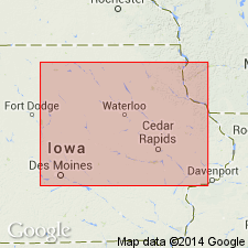
Raised from formation rank to group status in northern, southeastern, and central IA, Iowa shelf, and northwestern IL on the Wisconsin arch, although "nomenclatural problems in the classic Johnson County area have not been rectified." Raised to group status because of the ability to recognize individual depositional cycles and their individual transgressive-regressive elements within the Cedar Valley of northern IA. Divided in IA into (ascending): "Unit B," Lithograph City Formation (new), and Shell Rock Formation (newly assigned to group). Lithograph City divided into (ascending): Osage Springs, Thunder Woman Shale, and Idlewild Members--all new--in north central and central IA. Lithograph City divided into State Quarry (reduced in stratigraphic rank) and Andalusia (new) Members in east-central and southeast IA. [Only the Lithograph City and its members described]. Measured sections, cross section, graphic sections. Fossils (mostly conodonts, brachiopods) listed. Middle Devonian-Upper Devonian boundary lies somewhere in Lithograph City.
Source: GNU records (USGS DDS-6; Denver GNULEX).

- Usage in publication:
-
- Cedar Valley Group
- Modifications:
-
- Principal reference
- Revised
- AAPG geologic province:
-
- Iowa shelf
- Illinois basin
- Lincoln anticline
- Wisconsin arch
Summary:
Name applied to predominantly carbonate sequence above the Pinicon Ridge Formation (new) of Wapsipinicon Group (rank raised) and beneath Lime Creek or Sweetland Creek Formations. Nomenclature charts, cross sections, graphic sections. Divided into (ascending): 1) Little Cedar Formation (new) and its Solon, Bassett, Chickasaw Shale, Eagle Center, Hinkle, Rapid Members--Bassett, Chickasaw, Eagle Center, Hinkle newly named; 2) Coralville Formation (rank raised) and its Gizzard Creek, Iowa City, Cou Falls Members, all newly named; 3) Lithograph City Formation (new) and its Osage Springs, Thunder Woman, Idlewild, State Quarry, and Andalusia Members--all but State Quarry newly named; 4) Shell Creek Formation and its Mason City, Rock Grove, Nora Members. These units of Cedar Valley occur in IA and adjacent southeast MN, Iowa shelf; northeast MO, Lincoln anticline; western IL, Illinois basin and Wisconsin arch. No type designated, so "primary" reference section designated at Conklin Quarry, secs 5 and 32, T80N, R6W and SW NW NW sec 33, T80N, R6W, Johnson Co, IA; lower 3 formations present in this composite. Is 23-40 m thick in southeast IA; 80-120 m thick in north and central IA. Dominantly fossiliferous limestone in southeast IA, northern IL; limestone in northern IA; dolomite, anhydrite in central IA. Middle (Givetian) and Late (Frasnian) Devonian age; series boundary lies in Osage Springs, State Quarry Members of Lithograph City.
Source: GNU records (USGS DDS-6; Denver GNULEX).
For more information, please contact Nancy Stamm, Geologic Names Committee Secretary.
Asterisk (*) indicates published by U.S. Geological Survey authors.
"No current usage" (†) implies that a name has been abandoned or has fallen into disuse. Former usage and, if known, replacement name given in parentheses ( ).
Slash (/) indicates name conflicts with nomenclatural guidelines (CSN, 1933; ACSN, 1961, 1970; NACSN, 1983, 2005, 2021). May be explained within brackets ([ ]).

