

- Usage in publication:
-
- Cedar Springs Dolomite Bed
- Modifications:
-
- Named
- Dominant lithology:
-
- Dolomite
- AAPG geologic province:
-
- Anadarko basin
Summary:
Pg. 32 (fig. 7), 33 (fig. 8), 34, 205, pl. 1. Cedar Springs Dolomite Bed. Name given to dolomite at base of Blaine Formation, conformably overlying Flowerpot [Flower-pot] Shale and grading upward into Medicine Lodge Gypsum. Thickness about 9 inches at type area where it is light gray, fine-grained, oolitic, and massive, and has a few compact portions that are nonoolitic. In central Major County, unit is almost 3 feet thick, the lower 1.5 feet being argillaceous, with a 3-foot thick impure massive gypsum beneath it included in [Flower-pot] Shale.
Type section: exposed in high bluff along east bank of Sand Creek in NW/4 sec. 20, T. 20 N., R. 12 W., southern Major Co. Named from town of Cedar Springs in north-central part of Major Co.
Source: US geologic names lexicon (USGS Bull. 1350, p. 134-135).

- Usage in publication:
-
- Cedar Springs Dolomite Bed
- Modifications:
-
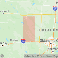
- Areal extent
- AAPG geologic province:
-
- Anadarko basin
Summary:
Pg. 30-32. In Blaine County, the Cedar Springs is same as in type area except that it is 1 or 2 inches thick. Southward into Canadian County, grades laterally into Chickasha Formation.
Source: US geologic names lexicon (USGS Bull. 1350, p. 135).
For more information, please contact Nancy Stamm, Geologic Names Committee Secretary.
Asterisk (*) indicates published by U.S. Geological Survey authors.
"No current usage" (†) implies that a name has been abandoned or has fallen into disuse. Former usage and, if known, replacement name given in parentheses ( ).
Slash (/) indicates name conflicts with nomenclatural guidelines (CSN, 1933; ACSN, 1961, 1970; NACSN, 1983, 2005, 2021). May be explained within brackets ([ ]).