- Usage in publication:
-
- Cedar Ridge Till*
- Modifications:
-
- Named
- Dominant lithology:
-
- Till
- AAPG geologic province:
-
- Wind River basin
Summary:
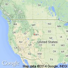
Named for Cedar Ridge, north side of Bull Lake, T3N, R3W, Fremont Co., WY in the Wind River basin. Is the oldest of three tills in the Wind River Range that were formerly assigned to the Buffalo till. Term Buffalo till not used in this report. Is separated from the underlying Tertiary conglomerate by a brown soil. Section measured on Cedar Ridge [not designated as type] 44 to 54 ft thick consists of 40 to 50 ft of gray, massive, unsorted, compact, stony silty sand, a till with a few boulders, local lenses of angular gravel and overlying brown soil; unconformably underlies Sacagawea Ridge Till (new) at Cedar Ridge section. Consists of predominantly fresh crystalline rocks derived from interior of range. The erosion surface at the top of the conglomerate over which the ice advanced is about 1,000 ft above the present canyon floor at the mountain front. Of pre-Wisconsin, Pleistocene age.
Source: GNU records (USGS DDS-6; Denver GNULEX).
For more information, please contact Nancy Stamm, Geologic Names Committee Secretary.
Asterisk (*) indicates published by U.S. Geological Survey authors.
"No current usage" (†) implies that a name has been abandoned or has fallen into disuse. Former usage and, if known, replacement name given in parentheses ( ).
Slash (/) indicates name conflicts with nomenclatural guidelines (CSN, 1933; ACSN, 1961, 1970; NACSN, 1983, 2005, 2021). May be explained within brackets ([ ]).

