The National Geologic Map Database is migrating to a new infrastructure. We apologize for any service disruptions during this process.
|
|---|


- Usage in publication:
-
- Cave Branch Bed
- Modifications:
-
- Named
- Dominant lithology:
-
- Shale
- AAPG geologic province:
-
- Appalachian basin
Summary:
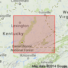
Named as a bed in Newman Limestone. Named for Cave Branch, a tributary of Licking River, northeastern Menifee and northwestern Morgan Cos., east-central KY. Consists of dark-green to greenish-gray, platy to bladed, clayey shale with abundant detrital quartz (silt to very fine sand). Thickness is 0.75 m, ranging from 0.15 to 1.15 m. Overlies informal Paoli-Beaver Bend Limestone member (at type section) or St. Louis Limestone Member; underlies informal Reelsville-Beech Creek Limestone member. Age is Late Mississippian.
Source: GNU records (USGS DDS-6; Reston GNULEX).
- Usage in publication:
-
- Cave Branch Bed*
- Modifications:
-
- Revised
- AAPG geologic province:
-
- Appalachian basin
Summary:
Cave Branch Bed of Newman Limestone (Dever, 1980) reassigned as Cave Branch Bed of Slade Formation. Previously included by various authors in many named units that are now excluded from the area of outcrop of Cave Branch Bed. Occurs along Cumberland Escarpment in eastern KY. Composed of shale. Thickness ranges from 0 to 5 m. Disconformably overlies St. Louis or Mill Knob Member of Slade. Upper contact sharp and conformable. Age is Late Mississippian.
Source: GNU records (USGS DDS-6; Reston GNULEX).
For more information, please contact Nancy Stamm, Geologic Names Committee Secretary.
Asterisk (*) indicates published by U.S. Geological Survey authors.
"No current usage" (†) implies that a name has been abandoned or has fallen into disuse. Former usage and, if known, replacement name given in parentheses ( ).
Slash (/) indicates name conflicts with nomenclatural guidelines (CSN, 1933; ACSN, 1961, 1970; NACSN, 1983, 2005, 2021). May be explained within brackets ([ ]).