The National Geologic Map Database is migrating to a new infrastructure. We apologize for any service disruptions during this process.
|
|---|


- Usage in publication:
-
- Catahoula sandstone
- Modifications:
-
- Original reference
- Dominant lithology:
-
- Sandstone
- AAPG geologic province:
-
- Gulf Coast basin
- Mid-Gulf Coast basin
Summary:
Pg. 84, 85, 90. Catahoula (Grand Gulf) sandstone. Name proposed from typical development of formation in Catahoula Parish, Louisiana, and used for lower or typical Grand Gulf of Hilgard as exposed at Grand Gulf, Mississippi. Includes the sandstone-bearing clays between Vicksburg and Fleming. Age is Oligocene. Thickness 1,000 feet.
Source: US geologic names lexicon (USGS Bull. 896, p. 367).
- Usage in publication:
-
- Catahoula sandstone
- Modifications:
-
- Revised
- AAPG geologic province:
-
- Gulf Coast basin
Summary:
Catahoula sandstone. Nonmarine sandstone, 0 to 750 feet thick, representing all or portions of marine Chattahoochee and Vicksburg formations in Mississippian embayment. Underlies Hattiesburg clay. In Mississippi and eastern Louisiana overlies marine Vicksburg limestone. In western Louisiana and eastern border of Texas the lower part of this nonmarine sandstone is contemporaneous with marine Vicksburg limestone, which is absent there, and Catahoula rests on marine Fayette sandstone, of [Jackson] Eocene age.
Source: US geologic names lexicon (USGS Bull. 896, p. 367).

- Usage in publication:
-
- Catahoula sandstone*
- Catahoula tuff*
- Modifications:
-
- Overview
- AAPG geologic province:
-
- Arkla basin
- Gulf Coast basin
- Mid-Gulf Coast basin
- Upper Mississippi embayment*
Summary:
Catahoula sandstone; Catahoula tuff (in southern Texas). Type Chattahoochee formation is now [ca. 1936] known to be of early Miocene age and same as Tampa limestone, while Catahoula sandstone may be of late Oligocene age. According to C.W. Cooke (AAPG Bull., v. 19, no. 8, 1935, p. 1162) it appears to be older than Tampa limestone. In southern Texas the Catahoula becomes a tuff, and unconformably underlies Oakville sandstone (late middle and early late Miocene) and unconformably overlies Frio clay of Oligocene(?) age. The Catahoula is unfossiliferous and may be either early Miocene or late Oligocene. The USGS at present classifies it as Miocene(?) (lower Miocene?).
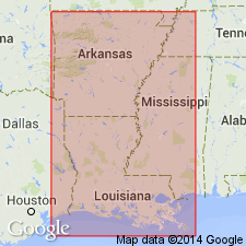
Recognized in Louisiana, Mississippi, southern Alabama, and eastern Texas.
Source: US geologic names lexicon (USGS Bull. 896, p. 367).

- Usage in publication:
-
- Catahoula formation
- Modifications:
-
- Revised
- AAPG geologic province:
-
- Gulf Coast basin
Summary:
Pg. 700+. Catahoula formation of Gueydan group. In eastern Texas, divided into two members Chita (new) and Onalaska. In south Texas, divided into three members (ascending): Gant, Soledad, and Chusa. Age is late Oligocene or early Miocene.
Source: Publication; US geologic names lexicon (USGS Bull. 1200, p. 668-670).
- Usage in publication:
-
- "Catahoula"
- Modifications:
-
- Revised
- AAPG geologic province:
-
- Mid-Gulf Coast basin
Summary:
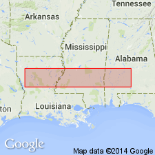
Pg. 12-22. Catahoula group, Clarke and Wayne Counties, Mississippi, comprises (ascending) Bucatunna member, Lower Chickasawhay member, Upper Chickasawhay member, and "Catahoula." Overlies Vicksburg group; underlies Citronelle.
Source: US geologic names lexicon (USGS Bull. 1200, p. 668-670).
- Usage in publication:
-
- Catahoula formation
- Modifications:
-
- Revised
- AAPG geologic province:
-
- Arkla basin
Summary:
Pg. 110-134, geol. map. Catahoula formation. In Catahoula Parish, formation is composed largely of tuffaceous sandstones, sands, and clays, with some loose sands and hard silicified sandstones. Maximum thickness 350 feet. Includes Cassel Hill member (new) in lower part and Chalk Hills member (new) above. Unconformably underlies Citronelle(?) formation. Age is considered Miocene (geol. map).
Source: Publication; US geologic names lexicon (USGS Bull. 1200, p. 668-670).
- Usage in publication:
-
- Catahoula formation
- Modifications:
-
- Revised
- AAPG geologic province:
-
- Gulf Coast basin
Summary:
Pg. 67, table facing p. 17. Catahoula formation. In southeastern Texas, includes Dunlap Quarry sandstone member. [Age is Miocene(?) and/or Oligocene(?).]
Source: US geologic names lexicon (USGS Bull. 1200, p. 668-670).
- Usage in publication:
-
- Catahoula formation
- Modifications:
-
- Areal extent
- AAPG geologic province:
-
- Arkla basin
Summary:
Pg 142-149. In Grant and la Salle Parishes, Louisiana, Catahoula formation comprises two mappable units, lower tuffaceous siltstone member and an upper thicker member composed of lenticular sands, clays, and silts. Grades downward into sands and clays of Vicksburg group. Underlies Montgomery member (new) of Pleistocene. Age is considered Miocene (geol. map).
Source: Publication; US geologic names lexicon (USGS Bull. 1200, p. 668-670).
- Usage in publication:
-
- Catahoula formation
- Modifications:
-
- Areal extent
- AAPG geologic province:
-
- Gulf Coast basin
Summary:
Pg. 143-147. Catahoula formation of Grand Gulf group. Lower formation in Grand Gulf group in report on Avoyelles and Rapides Parishes, Louisiana. Underlies Fleming formation; [contact placed at base of first calcareous clay-bearing sequence]. Name Catahoula became widely used and has appeared in literature of adjacent coastwise States. Its usage can be justly criticized because lower limit of formation has never been accurately defined and upper limit was not and cannot be established from type locality where beds pass beneath Mississippi River flood plain. No section published permits a lithologic correlation to be established, yet usage of name has been extended into subsurface on lithology. Only part of Catahoula formation found at surface in Rapides Parish is upper 100 feet of siltstones and intercalated sand lentils exposed in northwestern top of parish. Catahoula-Vicksburg contact not exposed in Rapides Parish and lower limit of Catahoula in subsurface is arbitrarily placed on first appearance of Vicksburg fossils. Report includes geologic map, stratigraphic table, cross sections.
Source: US geologic names lexicon (USGS Bull. 1200, p. 668-670); supplemental information from GNU records (USGS DDS-6; Denver GNULEX).
- Usage in publication:
-
- Catahoula formation
- Catahoula group†
- Modifications:
-
- Areal extent
- AAPG geologic province:
-
- Gulf Coast basin
Summary:
Pg. 1136-1138. Term Catahoula group should be dropped, leaving Gulf Coast Miocene composed of three formations: Fleming, Catahoula, and Chickasawhay. Believed that there is not sufficient evidence of sufficient lithologic or paleontologic change to warrant placing division between Miocene and Oligocene strata at base of Fleming; hence, entire Catahoula should be considered Miocene in age. Subsurface data.
Source: US geologic names lexicon (USGS Bull. 1200, p. 668-670).
- Usage in publication:
-
- Catahoula sandstone
- Modifications:
-
- Areal extent
- AAPG geologic province:
-
- Mid-Gulf Coast basin
Summary:
Pg. 1315 (fig. 1), 1344-1354. The "Upper Chickasawhay" of Shreveport Geol. Soc. Gdbk., 11th Ann. Field Trip, is herein named Paynes Hammock sand. This sand intertongues at west with nonfossiliferous beds referred to Catahoula sandstone and with the Paynes Hammock tongue below Catahoula tongue. Paynes Hammock sand and equivalent beds on west referred to Catahoula sandstone are correlated with Tampa limestone. Upper part of Catahoula may be Alum Bluff in age. Miocene.
Source: US geologic names lexicon (USGS Bull. 1200, p. 668-670).
- Usage in publication:
-
- Catahoula tuff*
- Modifications:
-
- Areal extent
- AAPG geologic province:
-
- Gulf Coast basin
Summary:
Pg. 14. Catahoula tuff described in Karnes County, Texas. Thickness about 480 feet. Unconformably overlies and progressively overlaps underlying Frio clay and upper part of Jackson formation. Underlies Oakville sandstone. Because of stratigraphic relations, believed to be early Miocene.
Source: US geologic names lexicon (USGS Bull. 1200, p. 668-670).
- Usage in publication:
-
- Catahoula formation
- Modifications:
-
- Revised
- AAPG geologic province:
-
- Gulf Coast basin
Summary:
Catahoula formation described in Grimes, Brazos, and Burleson Counties, east-central Texas. Thickness about 350 feet in Grimes County. Basal member is Chita, 10 to 50 feet thick. About 70 to 100 feet above Chita in south-central Brazos County is Dunlap [Quarry] sandstone, 0 to 40 feet thick. About 175 feet above base of Catahoula is Corough sandstone (new), 0 to 40 feet thick. Overlies Whitsett formation; underlies Oakville formation.
Source: US geologic names lexicon (USGS Bull. 1200, p. 668-670).
- Usage in publication:
-
- Catahoula formation
- Modifications:
-
- Revised
- AAPG geologic province:
-
- Gulf Coast basin
Summary:
Pg. 35, 37. Catahoula formation, in Fashing field, Atascosa County, Texas, includes Gueydan ash member at base.
Source: US geologic names lexicon (USGS Bull. 1200, p. 668-670).

- Usage in publication:
-
- Catahoula sandstone*
- Catahoula tuff*
- Catahoula formation*
- Modifications:
-
- Overview
- AAPG geologic province:
-
- Mid-Gulf Coast basin
Summary:
The USGS currently [ca. 1960] designates the age of the Catahoula as Miocene(?) and Oligocene(?) in some areas on the basis of a study now in progress [Eargle, 1964, USGS Prof. Paper 475-D, Geol. Survey Research 1963, art. 130].
Source: US geologic names lexicon (USGS Bull. 1200, p. 668-670).
- Usage in publication:
-
- Catahoula Sandstone
- Modifications:
-
- Revised
- AAPG geologic province:
-
- Mid-Gulf Coast basin
Summary:
Pg. D44 (table), D45-D46. Catahoula Sandstone (surface and subsurface). Divided into (descending): (1) upper part, gray to olive sand, silt, and silty clay, 250 to 700 feet thick, Miocene; and (2) Tatum Limestone Member, white to gray sandy limestone and marl, glauconitic calcarenite, 90 to 300 feet thick, Oligocene(?) and Miocene(?).
Study area in vicinity of Tatum salt dome, Lamar Co., southern MS.
Source: Publication.
- Usage in publication:
-
- Catahoula Formation
- Modifications:
-
- Mapped 1:250k
- Dominant lithology:
-
- Mudstone
- Sand
- AAPG geologic province:
-
- Gulf Coast basin
Summary:
Pamphlet [p. 2]. Catahoula Formation. Mudstone and sand. Upper part mudstone, tuffaceous, sandy, light gray; weathers dark gray. Lower 10 to 80 feet, quartz sand, coarse-grained, grains polished, opal cement common; fossil wood abundant; forms cuesta; thickness 250 to 300 feet. Overlies Whitsett Formation (Eocene or Oligocene) and underlies Fleming Formation (Miocene). Age is Miocene.
[Mapped in northwestern part and along northern edge of map sheet, in Grimes, Walker, Trinity, Polk, Tyler, and Jasper Cos., eastern TX.]
Source: Publication.

- Usage in publication:
-
- Catahoula Formation
- Modifications:
-
- Mapped 1:250k
- Dominant lithology:
-
- Clay
- Sandstone
- AAPG geologic province:
-
- Gulf Coast basin
Summary:
Catahoula Formation. Clay and sandstone; clay, bentonitic, noncalcareous except for some calcareous concretions locally, light olive gray; sandstone, fine- to medium-grained, friable, tuffaceous, cross-bedded lenses, light gray to brown. Thickness 120 to 300 feet; thins northeastward. Overlies Whitsett Formation (Eocene and Oligocene(?)); underlies Oakville Sandstone (Miocene). Age is Miocene; is lowermost Miocene unit mapped in this sheet.
Mapped in Karnes, De Witt, Gonzales, Lavaca, and Fayette Cos., southeastern TX.
Source: Modified from GNU records (USGS DDS-6; Denver GNULEX).

- Usage in publication:
-
- Catahoula Formation
- Modifications:
-
- Mapped 1:250k
- AAPG geologic province:
-
- Gulf Coast basin
Summary:
Catahoula Formation. Composite thickness about 855 feet. Overlies Frio Formation (Oligocene); [in northernmost Live Oak County, where Frio is absent, overlies Whitsett Formation (Eocene) of Jackson Group]. Lies below Oakville Sandstone. In southern part of sheet divided into (descending) Chusa Tuff Member, Soledad Volcanic Conglomerate Member, and Fant Tuff Member. Age is Miocene.
[Mapped in Duval, McMullen, Live Oak, and Karnes Cos., southern TX.]
Source: Publication.
- Usage in publication:
-
- Catahoula "Formation"
- Modifications:
-
- Overview
- AAPG geologic province:
-
- Mid-Gulf Coast basin
Summary:
Recent surface and subsurface studies of Catahoula in south-central MS have revealed major problems and misconceptions about Neogene stratigraphy in this part of the Gulf basin. A mappable bounding sequence above the Catahoula-Bucatunna Formation contact does not exist in the study area. The Hattiesburg Formation above the Catahoula appears to wedge out before reaching outcrop. Therefore differentiation between updip sandy gravels of the Catahoula and similar facies of the Citronelle Formation is difficult at best. Study by Cameron and Day (in prep) ascertained that the Catahoula reaches a thickness of 625 ft and has a three-tiered stratigraphy: (a) a basal unit (75-325 ft) composed of sands and subordinate fine-grained facies; (b) a relatively fine-grained middle unit (250-350 ft) composed of silts and clays with discontinuous sand bodies; and (c) an upper unit (175-325 ft) composed largely of sand and gravels. Most are fluvial channel and associated floodplain deposits. An attempt should be made to correlate the Catahoula in MS to that defined by recent studies in LA.
Source: GNU records (USGS DDS-6; Reston GNULEX).
- Usage in publication:
-
- Catahoula Formation
- Modifications:
-
- Overview
- Dominant lithology:
-
- Gravel
- Sand
- Silt
- Clay
- AAPG geologic province:
-
- Mid-Gulf Coast basin
Summary:
In MS, Catahoula Formation overlies the Paynes Hammock Sand. In outcrop Catahoula consists of a up to 600 ft of generally nonmarine to marginal marine (fluvial to deltaic?) partially carbonaceous, varicolored gravel, sand, silt, and clay. Contact with the Paynes Hammock has been reported variously as gradational, disconformably, and conformable. Age of the Catahoula has been disputed as unit contains no age-diagnostic fossils. Assignment depends on nature of contact with the Paynes Hammock. If it is gradational as suggested by MacNeil (1944), then the Catahoula is late Oligocene, in part. If the contact is disconformable, then the Catahoula may be either Oligocene or Miocene, or both.
Source: GNU records (USGS DDS-6; Reston GNULEX).
- Usage in publication:
-
- Catahoula Formation
- Modifications:
-
- Overview
- AAPG geologic province:
-
- Mid-Gulf Coast basin
Summary:
Catahoula of this study has been arbitrarily defined as those sediments found above the Vicksburg limestones, or the Bucatunna Formation, and beneath the Citronelle or terrace deposits of previous workers. Catahoula sediments show a greater degree of induration than those of similar appearance in the area. A mappable contact between the Catahoula and overlying Hattiesburg Formation has never been found and because they are so similar, the authors recommend that they be considered a single mapping unit. The Catahoula crops out in the mapping area, only in the Mize quad. Unit is composed of sandy silt, silt, and clay, interbedded with sandstone layers. The silt and clay commonly display blocky to conchoidal rock fracture. The sandstones are fine-grained. Kaolinite is the dominant clay mineral. Unit also contains mica and smectite. Age is Miocene.
Source: GNU records (USGS DDS-6; Reston GNULEX).
- Usage in publication:
-
- Catahoula Formation
- Modifications:
-
- Not used
- AAPG geologic province:
-
- Mid-Gulf Coast basin
GNU Staff, 1995, Draft copy of Otvos, E.G., Mississippi Gulf Coast; geologic evolution, stratigraphy, coastal geomorphology, and Gulf-wide Pleistocene correlations, USGS Bull. XXXX (unpublished): U.S. Geological Survey Digital Data Series, DDS-6, 1 CD-ROM., release 3
Summary:
A maximum 4,900-ft-thick Miocene sequence underlies younger sandy-clayey alluvial-paralic deposits in MS. In absence of clearly definable and correlatable litho- or biostratigraphic horizons to bracket them, application of formation names, previously assigned to paralic-alluvial intervals (Oligocene to Miocene Catahoula Formation, Miocene Hattiesburg and Pascagoula Formations, and Pliocene Graham Ferry Formation; Brown and others, 1944) is unacceptable in MS. In intervals for which a Miocene or Pliocene age cannot be established, the term "undifferentiated Neogene clastics" is recommended. Whenever applicable, the names Pascagoula and Graham Ferry Members of Pensacola Formation are now used. Author follows usage of Otvos (1994).
Source: GNU records (USGS DDS-6; Reston GNULEX).
For more information, please contact Nancy Stamm, Geologic Names Committee Secretary.
Asterisk (*) indicates published by U.S. Geological Survey authors.
"No current usage" (†) implies that a name has been abandoned or has fallen into disuse. Former usage and, if known, replacement name given in parentheses ( ).
Slash (/) indicates name conflicts with nomenclatural guidelines (CSN, 1933; ACSN, 1961, 1970; NACSN, 1983, 2005, 2021). May be explained within brackets ([ ]).