The National Geologic Map Database is migrating to a new infrastructure. We apologize for any service disruptions during this process.
|
|---|


- Usage in publication:
-
- Catahoula group
- Modifications:
-
- Original reference
- AAPG geologic province:
-
- Mid-Gulf Coast basin
Summary:
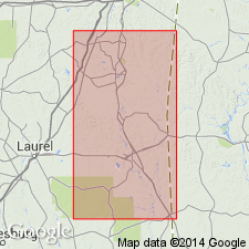
Pg. 4+. Catahoula group as here defined unconformably underlies Citronelle formation and unconformably overlies Byram marl [restricted], and includes (descending): "Catahoula" of previous reports, Upper Chickasawhay member, Lower Chickasashay member, and Bucatunna member. [The Chickasawhay and Bucatunna members were included in original definition of Byram marl (top formation of the Oligocene Vicksburg group), and are still so included by the USGS, which still uses Catahoula sandstone, as originally defined.] Age is Miocene(?) and Oligocene. Recognized in southeastern Mississippi [Clarke and Wayne Counties].
Source: US geologic names lexicon (USGS Bull. 367-368).
- Usage in publication:
-
- Catahoula group†
- Catahoula formation
- Modifications:
-
- Not used
- AAPG geologic province:
-
- Gulf Coast basin
Summary:
Pg. 1136-1138. Term Catahoula group should be dropped, leaving Gulf Coast Miocene composed of three formations: Fleming, Catahoula, and Chickasawhay. Believed that there is not sufficient evidence of sufficient lithologic or paleontologic change to warrant placing division between Miocene and Oligocene strata at base of Fleming; hence, entire Catahoula should be considered Miocene in age. Subsurface data.
Source: US geologic names lexicon (USGS Bull. 1200, Catahoula Fm entry p. 668-669).
For more information, please contact Nancy Stamm, Geologic Names Committee Secretary.
Asterisk (*) indicates published by U.S. Geological Survey authors.
"No current usage" (†) implies that a name has been abandoned or has fallen into disuse. Former usage and, if known, replacement name given in parentheses ( ).
Slash (/) indicates name conflicts with nomenclatural guidelines (CSN, 1933; ACSN, 1961, 1970; NACSN, 1983, 2005, 2021). May be explained within brackets ([ ]).