

- Usage in publication:
-
- Castner limestone*
- Modifications:
-
- Named
- Dominant lithology:
-
- Limestone
- Dolomite
- Diabase
- AAPG geologic province:
-
- Southwestern Basin-and-Range region
Summary:
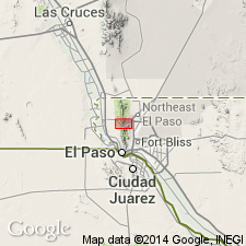
Named for Castner Range in Fort Bliss Military Reservation, El Paso Co, TX. Type locality designated at 1.5 mi southeast of North Franklin Mountain and 0.5 mi northwest of mouth of Fusselman Canyon. Occurs in two exposures near southeast base of North Franklin Mountain, Southwestern Basin-and-Range region. Outcrop has ribbed appearance. Consists of limestone--thinly and evenly bedded, light gray, green and blue, fine to coarse grained. Green limestone highly altered containing abundant metamorphic minerals such as serpentine, tremolite and garnet. Thin layers of dark-gray hornfels and lenses of dark-gray chert project from weathered surfaces giving outcrop ribbed appearance. Hornfels, consisting of metamorphosed siltstone and shale, increase toward top. Algal structures containing COLLENIA FREQUENS occur near base. Uncemented, spherical grains of clear dolomite present at base. Diabase sills intrude and are included as part of unit. Thickness at type is 1,111 ft. Is oldest unit in report area; unconformably underlies Mundy breccia (new). Geologic map. Resembles Allamoore formation of Van Horn area, TX (100 mi to east of Franklin Mountains). Precambrian age based on stratigraphic position and character and degree of metamorphism.
Source: GNU records (USGS DDS-6; Denver GNULEX).
- Usage in publication:
-
- Castner Limestone*
- Modifications:
-
- Overview
- AAPG geologic province:
-
- Southwestern Basin-and-Range region
Summary:
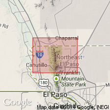
Geologic map shows exposures of unit (mapped with overlying Mundy Breccia) at type locality on east flank of North Franklin Mountain and at 1.8 mi and 0.6 mi south of Texas-New Mexico border in Franklin Mountains, El Paso Co, TX, Southwestern Basin-and-Range region. Stratigraphic table. Generalized stratigraphic chart. Oldest exposed unit in Franklin Mountains. Late Precambrian age.
Source: GNU records (USGS DDS-6; Denver GNULEX).
For more information, please contact Nancy Stamm, Geologic Names Committee Secretary.
Asterisk (*) indicates published by U.S. Geological Survey authors.
"No current usage" (†) implies that a name has been abandoned or has fallen into disuse. Former usage and, if known, replacement name given in parentheses ( ).
Slash (/) indicates name conflicts with nomenclatural guidelines (CSN, 1933; ACSN, 1961, 1970; NACSN, 1983, 2005, 2021). May be explained within brackets ([ ]).