- Usage in publication:
-
- Castlegate sandstone
- Modifications:
-
- Original reference
- Dominant lithology:
-
- Sandstone
- AAPG geologic province:
-
- Uinta basin
Summary:
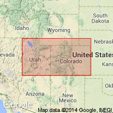
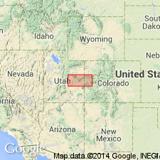
Pg. 24. Castlegate sandstone. 500 feet thick, lies at top of Laramie [so-called] coal-bearing series in Book Cliffs coal field, and is materially different from the other sandstones in this formation. It is very compact and broken by joints and cross joints into large blocks. Rests on a layer of shale. Age is Late Cretaceous.
[Named from Castlegate, Carbon Co., Book Cliffs, eastern UT, where it forms a gate-like passage in Price River Canyon 2+/- mi above the town.]
Source: US geologic names lexicon (USGS Bull. 896, p. 365).
- Usage in publication:
-
- Castlegate sandstone member*
- Modifications:
-
- Revised
- AAPG geologic province:
-
- Paradox basin
Summary:
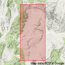
Pg. 150-151, 445. Castlegate sandstone member of Price River formation of Mesaverde group. Massive cliff-forming conglomeratic sandstone 150 to 400 feet thick. Contains abundant conglomerate. Forms basal member of Price River formation. Rests, with at least local unconformity, on Blackhawk formation in Wasatch Plateau. [Age is Late Cretaceous.]
Source: US geologic names lexicon (USGS Bull. 896, p. 365).
- Usage in publication:
-
- Castlegate sandstone*
- Castlegate sandstone member*
- Modifications:
-
- Revised
- AAPG geologic province:
-
- Paradox basin
Summary:
Used as the basal member of the Price River formation of Mesaverde group on the eastern Wasatch Plateau and western Book Cliffs. Raised in stratigraphic rank in central Book Cliffs from a member of Price River formation to Castlegate sandstone, a formation in the Mesaverde group. Area is in the Paradox basin. Overlies Blackhawk formation. Underlies Sego sandstone (rank raised). Of middle Campanian, Late Cretaceous age. Correlation chart.
Source: GNU records (USGS DDS-6; Denver GNULEX).
- Usage in publication:
-
- Castlegate member
- Modifications:
-
- Revised
- AAPG geologic province:
-
- Paradox basin
- Uinta basin
- Piceance basin
Summary:
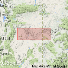
Name applied to basal massive, cross-bedded, white or pink sandstone of Price River formation. Name changed from Castlegate sandstone member to Castlegate member because it also contains some coal-bearing rocks. The sandstone changes from coarse to fine grained eastward. The part of the Castlegate deposited on an inland floodplain (western Book Cliffs, Emery and Carbon Cos, UT, Paradox and Uinta basins) is assigned to Farrer facies (formerly Farrer member), the non-coal-bearing facies of Price River. The part of the Castlegate deposited in a lagoon (eastern Book Cliffs, Emery and Grand Cos, UT, Paradox basin into Garfield and Mesa Cos, CO, Piceance basin) is assigned to Neslen facies (formerly Neslen member), the coal-bearing facies of Price River. The east edge of the non-coal-bearing area is in vicinity of Horse Canyon, Emery Co. Sandstones of the floodplain environment are white due to presence of kaolinized feldspar and calcareous cement. Ranges from 90 ft thick near Crescent Canyon, Grand Co, UT, to 500 ft at Castlegate to 0 at West Salt Creek, Garfield Co, CO. Overlies Mancos shale. Underlies Buck tongue of Mancos, or upper unnamed part of Farrer facies in western Book Cliffs. In eastern Book Cliffs, Castlegate is basal member of five named members of Price River, and the younger member is the Sego member (formerly Sego sandstone member). Of medial Montana, Late Cretaceous age. Cross sections.
Source: GNU records (USGS DDS-6; Denver GNULEX).
- Usage in publication:
-
- Castlegate sandstone*
- Modifications:
-
- Overview
- AAPG geologic province:
-
- Paradox basin
Summary:
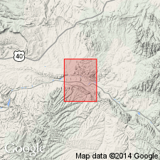
Is a unit of formation rank in the Mesaverde group in the Paradox basin that lies above the Blackhawk formation, and beneath the Price River formation in the western Book Cliffs and beneath the Buck tongue of the Mancos shale in the central Book Cliffs. Passes eastward into Mancos. As much as 190 ft thick in report area. Ranges from conglomeratic sandstone (west) to fine-grained siltstone (east). Fossils listed. Ten sections measured. Of Late Cretaceous age. Columnar sections.
Source: GNU records (USGS DDS-6; Denver GNULEX).
- Usage in publication:
-
- Castlegate Sandstone*
- Modifications:
-
- Areal extent
- AAPG geologic province:
-
- Green River basin
- Piceance basin
Summary:
Mapped in northwest part of quad, Moffat and Rio Blanco Cos, CO, Greater Green River and Piceance basins. Castlegate is an eastward-thinning sandstone tongue of Mesaverde Group ["tongue" as used here is meant to imply form rather than rank; Castlegate in this area is a formation-rank unit]; separates overlying Buck Tongue of Mancos Shale from underlying main body of Mancos. Thickness is 40-60 ft. Late Cretaceous age.
Source: GNU records (USGS DDS-6; Denver GNULEX).
- Usage in publication:
-
- Castlegate Sandstone*
- Modifications:
-
- Revised
- Age modified
- Areal extent
- AAPG geologic province:
-
- Uinta basin
Summary:
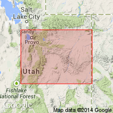
Is a unit of late Campanian age (age refined) above the Sego Sandstone and below Tuscher and Farrer Formations. Palynomorphs identified (fossil lists) in NE1/4 SE1/4 sec 10, T16S, R14E; NW1/4 sec 6, T17S, R15E; and SW1/4 sec 26, T12S, R9E, Carbon Co, UT, Uinta basin. Bluecastle Member removed from Neslen Formation and designated Bluecastle Tongue of Castlegate Sandstone. Is equivalent to the upper part of the Castlegate in Price Canyon. Name used on the east part Wasatch Plateau, Wasatch uplift, and in Price River-to Sunnyside-to Green River areas, Carbon Co, UT in the Uinta basin. Correlation chart. Paleogeographic descriptions. Lithofacies descriptions.
Source: GNU records (USGS DDS-6; Denver GNULEX).
For more information, please contact Nancy Stamm, Geologic Names Committee Secretary.
Asterisk (*) indicates published by U.S. Geological Survey authors.
"No current usage" (†) implies that a name has been abandoned or has fallen into disuse. Former usage and, if known, replacement name given in parentheses ( ).
Slash (/) indicates name conflicts with nomenclatural guidelines (CSN, 1933; ACSN, 1961, 1970; NACSN, 1983, 2005, 2021). May be explained within brackets ([ ]).

