

- Usage in publication:
-
- Castle Hayne marl*
- Modifications:
-
- Named
- Dominant lithology:
-
- Marl
- Limestone
- AAPG geologic province:
-
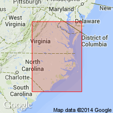
- Atlantic Coast basin
Summary:
Castle Hayne marl, here named, is a distinctly calcareous formation with little or no glauconite present. Consists of fine-grained calcareous marls or limestones. Vaughan states that the fossils form an entirely distinct fauna, unlike any known in SC or northward. Unit is assigned to Eocene. Unconformably overlain by St. Marys Formation (Miocene), and unconformably underlain by Trent formation.
Source: GNU records (USGS DDS-6; Reston GNULEX).
- Usage in publication:
-
- Castle Hayne Formation*
- Modifications:
-
- Revised
- Areal extent
- Age modified
- Biostratigraphic dating
- Overview
- AAPG geologic province:
-
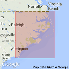
- Atlantic Coast basin
Summary:
Revised as Castle Hayne Formation to reflect varied lithology. Ideal Cement Co. quarry, just east of Castle Hayne, New Hanover Co., NC, is here designated a type locality. Consists of cobble- to pebble-sized, sandy, calcareous clasts, usually subrounded to well rounded and often coated with phosphate and glauconite. Occasional quartz pebbles and flat clay chips also present, along with very fine sand, glauconite, and phosphate in cream-colored micrite matrix. Fossils include shark and ray teeth, occasional worn bones, and mollusks. Correlation chart implies restriction from SC where Santee Limestone occupies same position. Best exposed in three large quarries in Castle Hayne area. Subdivided into three members. New Hanover Member (oldest) is phosphatic lithocalcirudite with CUBITOSTREA SELLAEFORMIS supporting a middle middle Eocene age and equivalence to Lisbon Formation of AL. Comfort Member (middle member) is calcirudite grading to calcarenite with PECTEN MEMBRANOSUS Mortoni, PECTEN CLARKEANUS, and CRASSATELLA ALTA Conrad supporting a late middle Eocene (Claibornian) age and equivalence to Gosport Sand in AL. Spring Garden Member (youngest) is biocalcirudite with MACROCALLISTA NEUSENSIS (Harris) (=MACROCALLISTA PEROVATA (Conrad)), a common Claibornian fossil, CRASSATELLA ALTA, and BATHYTORMUS PROTEXTUS (Conrad) supporting a latest middle Eocene age and equivalence with Gosport Sand in AL.
Source: GNU records (USGS DDS-6; Reston GNULEX).
- Usage in publication:
-
- Castle Hayne Limestone*
- Modifications:
-
- Overview
- AAPG geologic province:
-
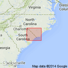
- Atlantic Coast basin
Summary:
Normally a subsurface unit in this area, but is exposed in two large quarries, one north and one south of Rose Hill, NC. Age is middle Eocene (Lutetian), following evidence from Ward and others (1978).
Source: GNU records (USGS DDS-6; Reston GNULEX).
- Usage in publication:
-
- Castle Hayne Formation
- Modifications:
-
- Areal extent
- Overview
- AAPG geologic province:
-
- Atlantic Coast basin
Summary:
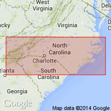
Eocene Castle Hayne Formation occurs in the eastern third of the study area and thickness is extremely variable. Thins abruptly at western margin. Faunal control is sparse. Most common benthic foraminifers are MELONIS PLANATUS and GYROIDINOIDES OCTOCAMERATUS. Correlations are based on lithology. Tan to cream bryozoan limestone of the Comfort Member and the phosphate-pebble conglomerate of the New Hanover Member are distinct. High phosphate content in the latter allows reliable correlation from gamma ray logs. Castle Hayne is generally recognized in cuttings as a light-gray or white moldic limestone or bryozoan-rich limestone, the upper part frequently containing traces of finely disseminated phosphate or glauconite. Age given here is Eocene.
Source: GNU records (USGS DDS-6; Reston GNULEX).
- Usage in publication:
-
- Castle Hayne Formation
- Modifications:
-
- Geochronologic dating
- AAPG geologic province:
-
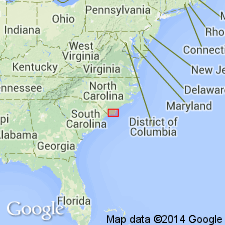
- Atlantic Coast basin
Summary:
The material analyzed in this study consisted of long-ranging, nondiagnostic fossil shells and sandy, glauconitic limestones. Phosphatic materials gave inconsistent results. The age of deposition for each unit was assigned by comparing 87Sr/86Sr results with the seawater strontium curve. Authors were able to place only broad limits on the age of the Castle Hayne Formation, though successful in narrowly defining the age of younger units using strontium isotope data. The Castle Hayne could only be constrained to no younger than late Eocene and no older than latest Paleocene.
Source: GNU records (USGS DDS-6; Reston GNULEX).
For more information, please contact Nancy Stamm, Geologic Names Committee Secretary.
Asterisk (*) indicates published by U.S. Geological Survey authors.
"No current usage" (†) implies that a name has been abandoned or has fallen into disuse. Former usage and, if known, replacement name given in parentheses ( ).
Slash (/) indicates name conflicts with nomenclatural guidelines (CSN, 1933; ACSN, 1961, 1970; NACSN, 1983, 2005, 2021). May be explained within brackets ([ ]).