

- Usage in publication:
-
- Casselman Formation
- Modifications:
-
- Named
- Dominant lithology:
-
- Limestone
- Sandstone
- Coal
- AAPG geologic province:
-
- Appalachian basin
Summary:
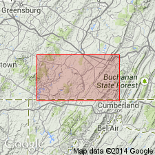
Named as uppermost formation in Conemaugh Group. Named for Casselman River valley in Somerset Co., southwestern PA, and Garrett Co., western MD. Occurs in Berlin syncline. Contains as many as 15 thin, nonpersistent coal beds and eight freshwater limestone or calcareous zones. Subdivided into (ascending) lower Grafton sandstone, Federal Hill coal, upper Grafton sandstone, Birmingham red bed, Barton limestone, Barton coal, Wellersburg limestone, Wellersburg coal, Morgantown sandstone, lower Clarysville coal, Niverton shale, upper Clarksburg limestone, upper Clarysville coal, Lonaconing coal, unnamed coal, Franklin coal, unnamed fresh-water limestone, Franklin "rider" coal, unnamed coal, lower Pittsburg limestone, Little Pittsburg coal, and Morgantown coal. Also includes unnamed shale beds in middle part of formation. Beds are variable and difficult to trace. Thickness is about 500 ft. Overlies Glenshaw Formation (new); underlies Pittsburg coal bed of Monongahela [Formation?]. Age is Pennsylvanian.
Source: GNU records (USGS DDS-6; Reston GNULEX).
- Usage in publication:
-
- Casselman Formation*
- Modifications:
-
- Age modified
- Overview
- AAPG geologic province:
-
- Appalachian basin
Summary:
Age changed to Late Pennsylvanian. Includes beds from top of Ames Limestone Member of Glenshaw Formation to base of Pittsburg coal.
Source: GNU records (USGS DDS-6; Reston GNULEX).
For more information, please contact Nancy Stamm, Geologic Names Committee Secretary.
Asterisk (*) indicates published by U.S. Geological Survey authors.
"No current usage" (†) implies that a name has been abandoned or has fallen into disuse. Former usage and, if known, replacement name given in parentheses ( ).
Slash (/) indicates name conflicts with nomenclatural guidelines (CSN, 1933; ACSN, 1961, 1970; NACSN, 1983, 2005, 2021). May be explained within brackets ([ ]).