The National Geologic Map Database is migrating to a new infrastructure. We apologize for any service disruptions during this process.
|
|---|


- Usage in publication:
-
- Cassel Hill member
- Modifications:
-
- Original reference
- AAPG geologic province:
-
- Arkla basin
Summary:
Pg. 121-122. Cassel Hill member of Catahoula formation. Loose, noncalcareous sands and sandy clays which commonly contain considerable silicified wood; occurs at base of the Catahoula. Thickness as much as 45 feet; near Cassel Hill 15 to 25 feet thick. Unconformably overlies Vicksburg formation. Separated from overlying Chalk Hills member (new) by an interval of massive sandstone and gray tuff. Age is Miocene.
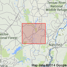
Well developed in vicinity of Cassel Hill, in NE/4 sec. 9, T. 10 N., R. 5 E., Catahoula Parish, east-central LA.
Source: US geologic names lexicon (USGS Bull. 1200, p. 661).
For more information, please contact Nancy Stamm, Geologic Names Committee Secretary.
Asterisk (*) indicates published by U.S. Geological Survey authors.
"No current usage" (†) implies that a name has been abandoned or has fallen into disuse. Former usage and, if known, replacement name given in parentheses ( ).
Slash (/) indicates name conflicts with nomenclatural guidelines (CSN, 1933; ACSN, 1961, 1970; NACSN, 1983, 2005, 2021). May be explained within brackets ([ ]).