The National Geologic Map Database is migrating to a new infrastructure. We apologize for any service disruptions during this process.
|
|---|


- Usage in publication:
-
- Cass limestone bed
- Modifications:
-
- Original reference
- Dominant lithology:
-
- Limestone
- AAPG geologic province:
-
- Nemaha anticline
Summary:
Pg. 41, 58. Cass limestone bed of Scranton shale member of Shawnee formation. Is 12 feet thick, overlies Plattford shale and lies 13+/- feet below White Cloud shale, all in Scranton shale. Age is Late Pennsylvanian (Missouri age). Report includes cross sections, measured sections, geologic maps, stratigraphic tables.
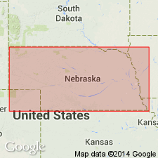
Named from exposures along Platte River northwest of South Bend, Cass Co., southeastern NE.
Source: US geologic names lexicon (USGS Bull. 896, p. 363); GNC KS-NE Pennsylvanian Corr. Chart, sheet 1, Oct. 1936; supplemental information from GNU records (USGS DDS-6; Denver GNULEX).
- Usage in publication:
-
- Cass limestone†
- Modifications:
-
- Abandoned
Summary:
Pg. 11. †Cass limestone. Is abandoned, as another name [what?] has priority.
Source: US geologic names lexicon (USGS Bull. 896, p. 363); GNC KS-NE Pennsylvanian Corr. Chart, sheet 1, Oct. 1936.

- Usage in publication:
-
- Cass limestone†
- Modifications:
-
- Abandoned
Summary:
Pg. 210. States †Cass limestone is abandoned. Does not belong in Scranton shale. [Did not explain where it does belong.]
Source: US geologic names lexicon (USGS Bull. 896, p. 363); GNC KS-NE Pennsylvanian Corr. Chart, sheet 2, Oct. 1936.

- Usage in publication:
-
- Cass limestone
- Modifications:
-
- Overview
Summary:
E.C. Reed (Asst. State Geol. Nebraska), 1936 (letter dated Oct. 16) states Cass limestone is still being used in Nebraska. It is not yet definitely known which bed in Kansas and Missouri is its equivalent, and until this is decided Cass will be used. We believe it may be = Amazonia or Haskell limestone.
See also "Modern classifications of the Pennsylvanian rocks of eastern Kansas and southeastern Nebraska," compiled by M.G. Wilmarth, Secretary of Committee on Geologic Names, USGS unpub. corr. chart, Oct. 1936, 2 sheets.
Source: US geologic names lexicon (USGS Bull. 896, p. 363).

- Usage in publication:
-
- Cass limestone
- Modifications:
-
- Revised
Summary:
Pg. 29-30. Cass limestone of Douglas group. When named in 1927, exact age relation of the Cass was not known, but since that time it has been found that this subdivision is cyclothemal formation composed of 3 members (ascending): Shoemaker formation (redefined), Little Pawnee shale (new), and Haskell limestone. Thickness 17 feet or more. Underlies Robbins shale; overlies Plattford formation. Age is Late Pennsylvanian (Virgilian).
Source: US geologic names lexicon (USGS Bull. 1200, p. 660-661).
For more information, please contact Nancy Stamm, Geologic Names Committee Secretary.
Asterisk (*) indicates published by U.S. Geological Survey authors.
"No current usage" (†) implies that a name has been abandoned or has fallen into disuse. Former usage and, if known, replacement name given in parentheses ( ).
Slash (/) indicates name conflicts with nomenclatural guidelines (CSN, 1933; ACSN, 1961, 1970; NACSN, 1983, 2005, 2021). May be explained within brackets ([ ]).