

- Usage in publication:
-
- Cash Smith Formation
- Modifications:
-
- Original reference
- Dominant lithology:
-
- Slate
- Shale
- AAPG geologic province:
-
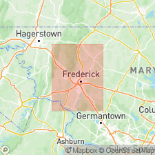
- Piedmont-Blue Ridge province
Summary:
Cash Smith Formation. Dark-gray to black, thin-bedded, strongly cleaved phyllitic shale or slate, grading upward into thin-bedded calcareous shale with limestone nodules. Total thickness not determined. Overlies the Araby Formation and underlies, probably by thrust fault contact, the Frederick Formation. Correlates with the Kinzers Shale of Lancaster County, Pennsylvania. Fossils. Age is considered Early Cambrian based on the occurrence of SALTERELLA sp. and OLENELLUS GETZI (tentatively identified by Ellis Yochelson, USGS, personal commun., 1978).
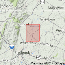
Type locality [no longer exists]: on Cash Smith Road, 2,000 ft (approx. 600 m) north of Coppermine Road, Woodsboro 7.5-min quadrangle, Frederick Co., western MD.
Source: Publication; GNU records (USGS DDS-6; Reston GNULEX).
- Usage in publication:
-
- Cash Smith Formation
- Modifications:
-
- [Not used]
- AAPG geologic province:
-
- Piedmont-Blue Ridge province
Summary:
Pg. 10. Cash Smith Formation; Cash Smith shale interval. Type section along Cash Smith Road, west of Woodsboro, has all but been removed and concealed, but it clearly lies within Araby Formation, as outcrops to the west indicate, and is not stratigraphically above it. A second shaly unit, similar in appearance, believed by Edwards (1988) to be same as Cash Smith Shale, is present somewhat stratigraphically higher and within the lower part of the Frederick Formation. It was the second shale that Edwards mapped as the Cash Smith Formation, even though the type locality is within the Lower Cambrian Araby Formation. Because of inconsistencies between the type locality, age, and stratigraphic position of the type Cash Smith Formation, it is herein recommended that the term Cash Smith Formation be abandoned. Inasmuch as the shale at the type locality cannot be traced laterally, and the shale mapped by Edwards (1988) is not the same as the shale at the type locality, a stratigraphic revision of this interval is warranted.
Lower shale interval at type included in Araby Formation; higher shale interval included in Monocacy Member (new) of Frederick Formation.
Source: Publication.
For more information, please contact Nancy Stamm, Geologic Names Committee Secretary.
Asterisk (*) indicates published by U.S. Geological Survey authors.
"No current usage" (†) implies that a name has been abandoned or has fallen into disuse. Former usage and, if known, replacement name given in parentheses ( ).
Slash (/) indicates name conflicts with nomenclatural guidelines (CSN, 1933; ACSN, 1961, 1970; NACSN, 1983, 2005, 2021). May be explained within brackets ([ ]).