

- Usage in publication:
-
- Cash Creek Quartzite*
- Modifications:
-
- Original reference
- Dominant lithology:
-
- Quartzite
- AAPG geologic province:
-
- Idaho Mountains province
Summary:
Pg. J7, J18-J19. Cash Creek Quartzite. Varicolored (white, gray, orange, pink, purple), chiefly medium- to thick-bedded quartzite, in part cross-laminated. Upper two-thirds nearly pure quartzite and pebbly quartzite; lower third contains up to 5 percent altered feldspar. Has a few thin layers of shale and silty quartzite. Thickness estimated between 1,200 and 1,300 feet. Rocks previously included in Kinnikinic Quartzite (here restricted) by C.P. Ross (1937). At type section, basal part (<200 feet) covered by Challis Volcanics. Where base is exposed about 1 mile south, disconformably(?) overlies an unnamed carbonate unit. Conformably underlies an unnamed siltstone and shale unit, which contains Middle Cambrian fossils, notably trilobites PAGETIA sp. and NISUSIA sp., and echinoderm GOGIA sp. (identified by A.R. Palmer, USGS, written commun., 1965, USGS fossil collns. 5461-CO, 5462-CO). Age is considered Early(?) to Middle Cambrian.
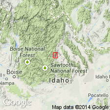
Type section: in steep cliffs on west side of Squaw Creek [now Paasasikwana Naokwaide], about 0.25 mi south of mouth of Cash Creek, [in NE/4 sec. 29, T. 12 N., R. 17 E., approx. Lat. 44 deg. 20 min. 40 sec. N., Long. 114 deg. 28 min. 50 sec. W., Clayton 7.5-min quadrangle (2023 ed.), Salmon-Challis National Forest], Custer Co., central ID. Named from Cash Creek.
[Additional locality information from USGS GNIS database and USGS historical topographic map collection TopoView, accessed on September 4, 2023. Geographic feature Squaw Creek renamed Paasasikwana Naokwaide (U.S. Board on Geographic Names, September 2022, USGS GNIS FeatureID 391283) in accordance with the Department of the Interior's Secretarial Order 3404, discontinuing use of derogatory term squaw.]
Source: Publication; US geologic names lexicon (USGS Bull. 1520, p. 55).
For more information, please contact Nancy Stamm, Geologic Names Committee Secretary.
Asterisk (*) indicates published by U.S. Geological Survey authors.
"No current usage" (†) implies that a name has been abandoned or has fallen into disuse. Former usage and, if known, replacement name given in parentheses ( ).
Slash (/) indicates name conflicts with nomenclatural guidelines (CSN, 1933; ACSN, 1961, 1970; NACSN, 1983, 2005, 2021). May be explained within brackets ([ ]).