

- Usage in publication:
-
- Caseyville sandstone
- Caseyville conglomerate
- Modifications:
-
- Original reference
- Dominant lithology:
-
- Sandstone
- Conglomerate
- AAPG geologic province:
-
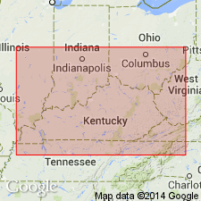
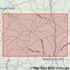
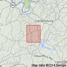
- Illinois basin
Summary:
Pgs. 48, 49, 62, and plate showing section of Lower Coal Measures. Caseyville sandstone (also Caseyville conglomerate). Pebbly sandstone and conglomerate [thickness not stated] resting on Millstone Grit in western Kentucky. [Age is Pennsylvanian.]
[Named from Caseyville, Union Co., western KY.]
[GNC remark (ca. 1936, US geologic names lexicon, USGS Bull. 896, p. 361): In some places in this report these beds seem to be treated as part of "Millstone grit," but in plate showing section of Lower Coal Measures they rest on "Millstone grit."]
Source: US geologic names lexicon (USGS Bull. 896, p. 361).
- Usage in publication:
-
- Caseyville conglomerate
- Modifications:
-
- Revised
- Dominant lithology:
-
- Sandstone
- Conglomerate
- Shale
- AAPG geologic province:
-
- Illinois basin
Summary:
Pg. 27. Caseyville conglomerate. Coarse, cross-bedded, conglomeratic, cliff-forming sandstones, in 20 to 60-foot beds, alternating with thin beds of shale up to 20 feet thick, containing thin coal seams. Thickness about 200 feet. Unconformably overlies Mississippian and underlies Tradewater formation. [This is adopted definition of the USGS.]
Source: US geologic names lexicon (USGS Bull. 896, p. 361).
- Usage in publication:
-
- Caseyville sandstone
- Modifications:
-
- Revised
- Dominant lithology:
-
- Sandstone
- Conglomerate
- AAPG geologic province:
-
- Illinois basin
Summary:
p. 15-19. Caseyville sandstone of Pottsville group. Is basal formation of the Pottsville. Adopted by the USGS (Feb. 1916) in sense used by Glenn in 1912. Includes all beds from top of sparsely pebbly sandstone exposed at Caseyville to the base of the Pennsylvanian series, which is more strata than Caseyville conglomerate of Owens (1856). (Owen's use was for upper part of this Caseyville sandstone.) On p. 16 (section of Caseyville) thickness stated to be 511 feet. Includes 2-foot-thick Battery Rock coal [later called Gentry Coal Member]. Underlies Tradewater formation of Pottsville group and rests on Mississippian. Fossils (plants). [David White] says plants are middle or lower Pottsville. Age is Pennsylvanian. Recognized in western Kentucky and southeastern Illinois.
Named from exposures at Caseyville, Union Co., western KY by Owen (1856).
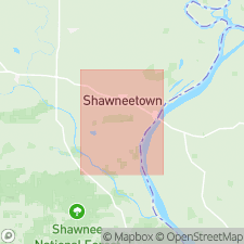
[Type area]: measured from outcrops on IL shore of Ohio River, btw. mouth of Saline River and Gentrys Landing below Battery Rock, in T. 11 S., R. 10 E., Shawneetown quadrangle, Hardin Co., southeastern IL.
Source: Publication; GNC index card files (Reston, VA); US geologic names lexicon (USGS Bull. 896, p. 361).

- Usage in publication:
-
- Caseyville formation
- Modifications:
-
- Revised
- Reference
- Dominant lithology:
-
- Sandstone
- Conglomerate
- Shale
- Siltstone
- AAPG geologic province:
-
- Illinois basin
Summary:
Pg. 8 (fig. 1), 28-30, 44 (table 1), 61-62 (app.), pl. 1. Caseyville formation of McCormick group. Defined as lower formation in McCormick group (new). Includes strata from base of Pennsylvanian to top of Pounds sandstone member. Corresponds to Caseyville formation as defined by Lee (1916) and probably to strata referred to as Caseyville conglomerate by Owen (1856). Caseyville as previously used in Illinois (Weller, 1940) is thus redefined to exclude 40 to 60 feet of strata (including Reynoldsburg coal) above Pounds sandstone and below Grindstaff sandstone that are here included in overlying Abbott formation (new). Characterized by dominance of sandstone and prominent development of sandy shale and siltstone. Thickness commonly 350 feet. Unconformably overlies Mississippian rocks. Age is Early Pennsylvanian. [GNC remark, ca. 1966 (US geologic names lexicon, USGS Bull. 1200, p. 657): The USGS has abandoned use of the term Pottsville in Kentucky and Illinois.] Type area defined by Lee (1916). Supplementary [Reference] section given.
In southwestern Illinois, includes (descending): Pounds sandstone member, Drury shale member, Battery Rock sandstone member, and Wayside sandstone member.
In southeastern Illinois, includes (descending): Pounds sandstone member, Gentry coal member (new), Sellers limestone member, Battery Rock sandstone member, and Lusk shale member.
Type area (geol. section 1, app.; see Wallace Lee, 1916, Geol. KY part of Shawneetown quadrangle, Kentucky Geol. Survey [Rpt.], 4th ser., v. 4, pt. 2, p. 15-16): measured from outcrops on IL shore of Ohio River, btw. mouth of Saline River and Gentrys Landing below Battery Rock, in T. 11 S., R. 10 E., Shawneetown quadrangle, Hardin Co., southeastern IL.
Supplementary [Reference] section (geol. section 2, app.): exposures along Illinois Central RR, beginning over the RR tunnel near Zion Church, in NW/4 SW/4 SE/4 sec. 31, T. 11 S., R. 5 E., Harrisburg 15-min quadrangle, southward to Mississippian-Pennsylvanian contact about 1.5 mi north of Robbs, in NE/4 SE/4 NE/4 sec. 18, T. 12 S., R. 5 E., Brownfield 15-min quadrangle, Pope Co., southeastern IL.
Source: Publication; US geologic names lexicon (USGS Bull. 1200, p. 657.)
- Usage in publication:
-
- Caseyville Formation*
- Modifications:
-
- Overview
- AAPG geologic province:
-
- Illinois basin
Summary:
Caseyville Formation is composed of sandstone, siltstone, and shale. Sandstone: yellowish-brown, grayish-yellow, and gray sandstone; weathers red and reddish brown; fine to medium grained, some coarse grained; massive to thin bedded, locally cross-bedded; grades into siltstone and shale; in places contains clay balls, ferruginous lenses or concretions and rounded clear quartz pebbles as much as 1/8 inch in diameter. Conglomeratic sandstone at base exposed in southeast corner of quadrangle. Siltstone: light-gray, gray, yellowish-brown, and brown, thin-bedded, locally micaceous. Shale: light- to dark-gray and yellowish-brown; weathers reddish brown; locally clayey. Basal Pennsylvanian formation. Unconformity at base has maximum relief of about 250 ft, as deep as the base of the Waltersburg Member of Buffalo Wallow Formation. Thickness is 390+. Unconformably underlain by Mississippian rocks. Highest formation in quadrangle.
Source: GNU records (USGS DDS-6; Reston GNULEX).

- Usage in publication:
-
- Caseyville Formation
- Modifications:
-
- Overview
- AAPG geologic province:
-
- Illinois basin
Summary:
Preferred usage of Illinois Geological Survey in 1975 is Caseyville Formation of McCormick Group. Primarily sandstone, siltstone, and shale. The sandstones are composed of quartz and very little clay and mica. Most contain quartz granules and pebbles, commonly less than half inch in diameter. The coarser sandstones reach about 100 ft thick and show relatively uniform cross-bedding with dip directions to the west, south, or southwest. Several coal seams, most somewhat lenticular, occur in the formation. Limestone is rare. The Caseyville is as much as 500 ft thick but 350 ft is common maximum. Unconformably overlies Mississippian rocks; underlies the Abbott Formation. Divided into Lusk Shale, Wayside Sandstone, Battery Rock Sandstone, Drury Shale, Sellers Limestone, Gentry Coal, and Pounds Sandstone Members.
Source: GNU records (USGS DDS-6; Reston GNULEX).
- Usage in publication:
-
- Caseyville Formation
- Modifications:
-
- Revised
- AAPG geologic province:
-
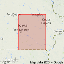
- Iowa shelf
Summary:
Identified in outcrops in the Mississippi River Valley in Muscatine Co, IA on the Iowa shelf where it unconformably overlies Devonian rocks and underlies the "Spoon" Formation. Two coal members named. The lower coal is named Wildcat Den Coal Member; it overlies 2.5 ft of unnamed gray shale of the basal Caseyville at Wildcat Den; overlies unnamed gray siltstone along Hwy 22, NE1/4, sec, T77N, R1W, Muscatine Co, IA. Cross sections. Graphic sections. Of Pennsylvanian, Morrowan age.
Source: GNU records (USGS DDS-6; Denver GNULEX).

- Usage in publication:
-
- Caseyville Formation
- Modifications:
-
- Revised
- Biostratigraphic dating
- Overview
- AAPG geologic province:
-
- Illinois basin
Summary:
The Caseyville Formation crops out extensively in the southern parts of all three quads included in this study. Thickness varies from 170 ft to more than 450 ft. Unit is characterized by white to light gray, relatively clean, quartzose sandstone. Commonly contains well-rounded granules and small pebbles of white quartz. Texture varies from very fine to very coarse grained, and bedding from very thin to massive. Four previously named members are recognized in the area: (ascending) Wayside, Battery Rock Sandstone, Drury, and Pounds Sandstone. The Drury is here changed from Drury Shale Member to Drury Member and revised to include the Gentry Coal Bed (rank reduced). The Wayside is here revised from Wayside Sandstone Member to Wayside Member because it contains large proportions of shale and siltstone. The Caseyville is assigned a Morrowan age based on palynological data.
Source: GNU records (USGS DDS-6; Reston GNULEX).
- Usage in publication:
-
- Caseyville Formation
- Modifications:
-
- Overview
- Revised
- AAPG geologic province:
-
- Illinois basin
Summary:
Caseyville Formation crops out through much of the southern one-third of the Goreville quad. Massive sandstones, more than 100 ft thick, produce large cliffs, ledges, and steep slopes. Composite thickness of the Caseyville in south-central to southwestern outcrop area ranges from 340 to 360 ft. For the most part, the Caseyville is composed of sandstones, quartz-pebble conglomerates, siltstones, shales, and claystones. Here subdivided into (ascending) Wayside Member (with its Omar sandstone lentil), Battery Rock Sandstone Member, Drury Member (with its Dutchman Creek sandstone lentil), and Pounds Sandstone Member. Caseyville is Early and Middle Pennsylvanian (Morrowan). [Morrowan here considered to extend into the Middle Pennsylvanian.]
Source: GNU records (USGS DDS-6; Reston GNULEX).
- Usage in publication:
-
- Caseyville Formation
- Modifications:
-
- Areal extent
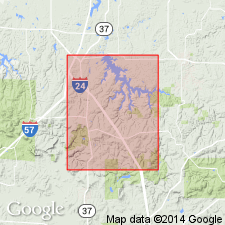
- AAPG geologic province:
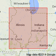
-
- Illinois basin
Summary:
Caseyville lithologies (quartz arenite and quartz-pebble conglomerate) are present in Indiana, but are largely confined to valley fill in paleovalleys cut into Mississippian strata. Author suggests that a few changes in nomenclature may be in order.
Source: GNU records (USGS DDS-6; Reston GNULEX).
- Usage in publication:
-
- Caseyville Formation
- Modifications:
-
- Overview
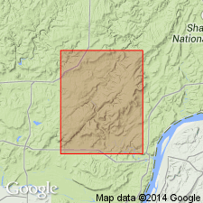
- AAPG geologic province:
-
- Illinois basin
Summary:
Because most Pennsylvanian outcrops in the Waltersburg quad consists of sandstone, only "Wayside" sandstone lentils, the Battery Rock Sandstone Member, and the Pounds Sandstone Member were mapped. The "Wayside" and "Drury" Members are poorly defined and described in both their respective type areas and in the Waltersburg quad. Both are poorly exposed and their contacts generally concealed. The two cannot be differentiated from each other where the intervening Battery Rock is absent. These members are referred to as "Wayside" and "Drury" because of their questionable status as valid lithostratigraphic units in the Waltersburg quad.
Source: GNU records (USGS DDS-6; Reston GNULEX).
For more information, please contact Nancy Stamm, Geologic Names Committee Secretary.
Asterisk (*) indicates published by U.S. Geological Survey authors.
"No current usage" (†) implies that a name has been abandoned or has fallen into disuse. Former usage and, if known, replacement name given in parentheses ( ).
Slash (/) indicates name conflicts with nomenclatural guidelines (CSN, 1933; ACSN, 1961, 1970; NACSN, 1983, 2005, 2021). May be explained within brackets ([ ]).