

- Usage in publication:
-
- Casey till member
- Modifications:
-
- Overview
- Dominant lithology:
-
- Till
- Loam
- AAPG geologic province:
-
- Illinois basin
Summary:
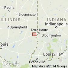
The Banner Formation in the study area includes two members: the basal informal Casey till member and the overlying Lierle Clay Member. The Casey was informally described by J.P. Ford (1970). It has been correlated with the Hillery Till Member near Danville by Kettles (1980). Unit is composed of gray loam to clay loam diamicton that contains a mean grain-size distribution of 38 percent sand, 38 percent silt, and 24 percent clay. Wood fragments are abundant. Where exposed the Casey is commonly oxidized to a yellowish brown to brown color. The till has been identified east and west of the Martinsville site in outcrops near Mill Creek and north of the town of Casey. Unit reaches 15 ft in thickness at these localities. Age is Pleistocene (pre-Illinoian).
Source: GNU records (USGS DDS-6; Reston GNULEX).
For more information, please contact Nancy Stamm, Geologic Names Committee Secretary.
Asterisk (*) indicates published by U.S. Geological Survey authors.
"No current usage" (†) implies that a name has been abandoned or has fallen into disuse. Former usage and, if known, replacement name given in parentheses ( ).
Slash (/) indicates name conflicts with nomenclatural guidelines (CSN, 1933; ACSN, 1961, 1970; NACSN, 1983, 2005, 2021). May be explained within brackets ([ ]).