- Usage in publication:
-
- Casey limestone
- Modifications:
-
- Named
- Dominant lithology:
-
- Limestone
- Chert
- AAPG geologic province:
-
- Cincinnati arch
Summary:
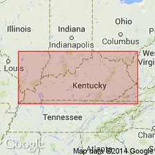
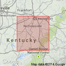
Named for Casey Co., central KY where relationship of this limestone to Beechwood limestone was first distinguished. In central KY, is top member of Boyle limestone. Exposed near Kidd's store in southwest part of Casey Co. Upper 3 to 8 ft or more consists of thick-bedded, gray, rather fine-grained limestone with numerous irregular masses of chert. Lower 2 or more ft consists of somewhat sandy limestone, in lower part of which is a 2-inch band crowded with shells of AMBOCOELIA UMBONATA Underlies Duffin layer (basal bed of New Albany shale); unconformably overlies Beechwood member of Sellersburg limestone. Age is Middle Devonian (Hamilton).
Source: GNU records (USGS DDS-6; Reston GNULEX).

- Usage in publication:
-
- Casey Member
- Modifications:
-
- Revised
- Biostratigraphic dating
- Overview
Summary:
Reduced in rank to Casey Member of Beechwood Formation of Boyle Group. At its type locality at Kidds Store, Casey Co., Casey is 7.90 to 9.50 ft thick and consists of two parts: an upper cherty limestone (3.60-4.20 ft thick) and a lower limy dolomite (4.30 to 5.30 ft thick) with abundant agatized AMBOCOELIA UMBONATA in chert stringers (revising McFarlan and White's (1952) Upper A. AMBOCOELIA Zone). Casey is considered equivalent to upper member of Beechwood Formation on northwestern side of Cincinnati Arch and not younger than any known Beechwood, for the upper part of Casey (a cherty, crystalline, crinoidal limestone) contains large, long-flanged DOLATOCRINUS columnals, large "cog-wheel" crinoid columnals, and ANCYROCRINUS, as does upper member of Beechwood on northwestern side of Cincinnati Arch. In addition, Casey occupies same relative stratigraphic position as does upper member of Beechwood on northwestern side of the arch, and Casey of eastern KY is separated from middle (unnamed) member of Beechwood by a disconformity and associated bone bed, just as upper member of Beechwood is separated from middle member by a disconformity and bone bed in northwestern KY. Bone bed is located at base of Casey (base of Upper AMBOCOELIA UMBONATA Zone) and consists of fish teeth, fish-bone fragments, abundant quartz sand, and associated phosphatic nodules and glauconite grains. Age is Middle Devonian (Hamiltonian).
Source: GNU records (USGS DDS-6; Reston GNULEX).
For more information, please contact Nancy Stamm, Geologic Names Committee Secretary.
Asterisk (*) indicates published by U.S. Geological Survey authors.
"No current usage" (†) implies that a name has been abandoned or has fallen into disuse. Former usage and, if known, replacement name given in parentheses ( ).
Slash (/) indicates name conflicts with nomenclatural guidelines (CSN, 1933; ACSN, 1961, 1970; NACSN, 1983, 2005, 2021). May be explained within brackets ([ ]).

