

- Usage in publication:
-
- Cascade River schist
- Modifications:
-
- Named
- Dominant lithology:
-
- Schist
- AAPG geologic province:
-
- Cascades province
Summary:
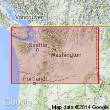
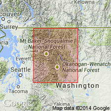
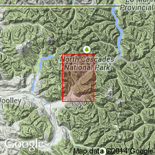
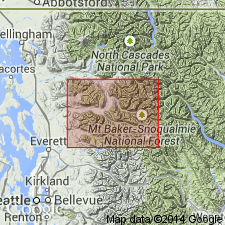
Area of investigation consists of 3 southeast-trending, structural belts south of Cascade Pass, Northern Cascade Mountains, WA. Central belt consists of the Cascade River schist (new) (first described by Misch, unpub thesis, 1952, and Bryant, unpub thesis, 1955), LeConte gneiss (new), Magic Mountain gneiss (new), and Spider Mountain schist (new). Cascade River schist is composed of chlorite schist, two-mica schist, biotite paragneiss, calcic-mica schist, and minor metaconglomerate and marble, which are derived from eugeosynclinal sedimentary rocks. To northwest unit is low-grade and rich in relict clastic grains. To west, Eldorado gneiss (new) appears to have been tectonically mixed with Cascade River schist. Underlies Magic Mountain gneiss. [age not stated]
Source: GNU records (USGS DDS-6; Menlo GNULEX).

- Usage in publication:
-
- Cascade River Schist
- Modifications:
-
- Revised
- AAPG geologic province:
-
- Cascades province
Summary:
Shown on geologic map of Skagit region of Northern Cascades as unit in Skagit Metamorphic Suite which also includes Skagit Gneiss. Cascade River Schist and Skagit Gneiss were traced southeast from map area for another 30 mi by theses mapping (Tabor, 1961; Adams, 1961; Libby, 1964; Grant, in progress). "Martin Ridge Schist" of Holden quad south of 48 deg 15' (Dubois, 1954 thesis) is now known to be Cascade River Schist. Stratigraphic age of Cascade River Schist (and its equivalents in Skagit Gneiss) is not known. Cascade River Schist sequence may contain Chilliwack strata [late Paleozoic] but it could be older. Age of Skagit metamorphism is not known either, beyond its being older than mid-Cretaceous orogeny and presumably older than latest Triassic-Jurassic-Early Cretaceous deposition.
Source: GNU records (USGS DDS-6; Menlo GNULEX).
- Usage in publication:
-
- Cascade River Schist
- Modifications:
-
- Age modified
- AAPG geologic province:
-
- Cascades province
Summary:
Shown on generalized geologic sketch map of central portion of Northern Cascade Mountains, WA. Consists of phyllite, schist, and gneiss derived mainly from clastic rocks, some of which were probably tuffaceous. Subordinate metaconglomerate locally contains plutonic cobbles similar in composition to some pre-Late Cretaceous rocks in Northern Cascades. Age is probably late Paleozoic (Misch, 1966, p.114-115).
Source: GNU records (USGS DDS-6; Menlo GNULEX).
- Usage in publication:
-
- Cascade River Schist
- Modifications:
-
- Revised
- AAPG geologic province:
-
- Cascades province
Summary:
Cascade River Schist of the Skagit Metamorphic Suite is divided into two [informal] subunits. The metamorphosed supracrustal rocks = Cascade River Schist (SENSU STRICTO) consist of low-grade schists: phyllite schists, highly quartzose in part, graphitic in places; albite phyllites, leucogreenschists, some greenschists, actinolitic in parts of the biotite zone. The medium-grade Cascade River Schist consists of micaschists ranging from highly quartzose to fairly basic; amphibolites; minor bands of marble, calc-silicate rocks, and garbenschiefer. Age is pre-Tertiary.
Source: GNU records (USGS DDS-6; Menlo GNULEX).
- Usage in publication:
-
- Cascade River Schist*
- Modifications:
-
- Adopted
- AAPG geologic province:
-
- Cascades province
Summary:
Cascade River Schist of Tabor (1962) and Misch (1966, 1979) is adopted. Consists of the predominantly metasedimentary and metavolcanic rocks and their on-strike continuations exposed along the Cascade River, for which the unit is named, east of the Marblemount pluton (=Marblemount Meta Quartz Diorite of Misch, 1966). In the Sauk River quad, consists of mostly mica-quartz-plagioclase schist, biotite paragneiss, hornblende-biotite schist, calcareous mica schist, metaconglomerate, and rare amphibolite, hornblende schist, and marble. (Rocks exposed southwest of the Marblemount pluton and included in the Cascade River Schist as defined by Misch [1966, 1979] are here excluded [=stratigraphically restricted) from the here-redefined Cascade River Schist and are included in the Napeequa Schist [new]). Unconformable contact with the adjacent Marblemount pluton is problematic (is either intrusive or gradational; coarse-grained metaplutonic rocks [root pluton] through hypabyssal dikes to surficial volcanic rocks [island arc]). On the east, unit is in tectonic contact with the Eldorado Orthogneiss of Misch (1966). Structurally overlain by the Magic Mountain Gneiss (new). Metamorphic age is Late Cretaceous and early Tertiary; protolith age is uncertain
Source: GNU records (USGS DDS-6; Menlo GNULEX).
For more information, please contact Nancy Stamm, Geologic Names Committee Secretary.
Asterisk (*) indicates published by U.S. Geological Survey authors.
"No current usage" (†) implies that a name has been abandoned or has fallen into disuse. Former usage and, if known, replacement name given in parentheses ( ).
Slash (/) indicates name conflicts with nomenclatural guidelines (CSN, 1933; ACSN, 1961, 1970; NACSN, 1983, 2005, 2021). May be explained within brackets ([ ]).