- Usage in publication:
-
- Casamero Member
- Modifications:
-
- Named
- Dominant lithology:
-
- Sandstone
- Mudstone
- Conglomerate
- Siltstone
- AAPG geologic province:
-
- San Juan basin
Summary:
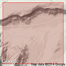
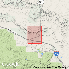
Named upper member of Morrison Formation. Replaces name Brushy Basin Member in report area. Source of geographic name not stated. Type locality designated SW1/4 NW1/4 sec 4, T14N, R12W, McKinley Co, NM, San Juan basin. Consists: 1) basal rusty-brown to greenish, medium- to fine-grained, poorly sorted sandstone with clay cement 4 ft thick; 2) variegated chocolate to red-brown and gray mudstone locally sandy with nodular zones grading upward into sandstone and siltstone 34 ft thick; 3) gritty to pebbly buff (gray-weathering) conglomerate with calcareous cement grading upward into soft, friable, green-buff siltstone and sandstone 10 ft thick; 4) covered interval green-gray siltstone and mudstone 10 ft thick; 5) massive, cliff-forming, medium- to coarse-grained, poorly sorted quartz sandstone 22 ft thick at type measured section. Pebbles in unit 3 mostly quartzite 2 m-10 mm diameter. Sandstone in unit 5 intricately cross-bedded in laminae 5 mm-5 cm thick. Boundary between Casamero and underlying Prewitt Member of Morrison gradational or sharp lithologic break. At Casamero type, Prewitt massive, coarse- to medium-grained, poorly sorted conglomeratic sandstone. Overlain by Dakota Formation, a massive, cliff-forming, buff-brown, arkosic, partly conglomeratic sandstone with carbonaceous fragments and coal lenses. Casamero only member closely resembling type Morrison. Except for unit 5, forms soft friable outcrops. Jurassic age implied.
Source: GNU records (USGS DDS-6; Denver GNULEX).

- Usage in publication:
-
- Casamero Member
- Modifications:
-
- Not used
Summary:
Term Brushy Basin Member, upper member of Morrison Formation, used in preference to term Casamero Member of Morrison in this quad. Casamero, named by Smith (1967) as the upper member of the Morrison in the Casamero area, is shown on a correlation diagram as exactly equivalent to the Brushy Basin as mapped in this report.
Source: GNU records (USGS DDS-6; Denver GNULEX).
For more information, please contact Nancy Stamm, Geologic Names Committee Secretary.
Asterisk (*) indicates published by U.S. Geological Survey authors.
"No current usage" (†) implies that a name has been abandoned or has fallen into disuse. Former usage and, if known, replacement name given in parentheses ( ).
Slash (/) indicates name conflicts with nomenclatural guidelines (CSN, 1933; ACSN, 1961, 1970; NACSN, 1983, 2005, 2021). May be explained within brackets ([ ]).

