

- Usage in publication:
-
- Carthage limestone
- Modifications:
-
- Named
- Dominant lithology:
-
- Limestone
- AAPG geologic province:
-
- Illinois basin
Summary:
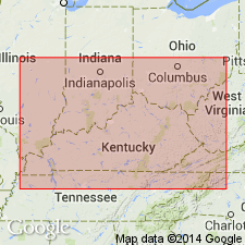
Name Carthage limestone applied to limestone lying in upper part of Coal Measures of southwestern coal field bordering Ohio River 1 mi below Uniontown, Union Co., KY, where it is about 8 ft thick. Separated from overlying coal No. 18 by 50 ft of sandstone and shale. Extends into southern IL. [Lies in upper part of McLeansboro formation.] Age is Pennsylvanian.
Source: GNU records (USGS DDS-6; Reston GNULEX).
- Usage in publication:
-
- Carthage Limestone Member*
- Modifications:
-
- Revised
- AAPG geologic province:
-
- Illinois basin
Summary:
Carthage Limestone Member revised as member of Sturgis Formation (new). Lisman Formation abandoned, but its Providence Limestone, Anvil Rock Sandstone, Madisonville Limestone, and Carthage Limestone Members are retained as part of the lower half of the new Sturgis Formation. Upper half of Sturgis consists of rocks previously assigned to Henshaw Formation (also abandoned). The Lisman and Henshaw could not be distinguished lithologically.
Source: GNU records (USGS DDS-6; Reston GNULEX).

- Usage in publication:
-
- Carthage Limestone Member
- Modifications:
-
- Areal extent
- Reference
- AAPG geologic province:
-
- Illinois basin
Summary:
Carthage Limestone Member of Bond Formation extends to IN. Replaces Shoal Creek Limestone, now restricted. Type locality of Shoal Creek (of Kosanke and others, 1960) is reference section for Carthage. Thickness is 1.5 to 1.8 m thick in Posey Co. Thins to less than 1 ft north of Sullivan Co. Underlies St. Wendel Sandstone Member of Bond Formation. Overlies Parker Coal Member of Patoka Formation. Age is Late Pennsylvanian (Missourian). (Annotation by D.D. Carr.)
Source: GNU records (USGS DDS-6; Reston GNULEX).
For more information, please contact Nancy Stamm, Geologic Names Committee Secretary.
Asterisk (*) indicates published by U.S. Geological Survey authors.
"No current usage" (†) implies that a name has been abandoned or has fallen into disuse. Former usage and, if known, replacement name given in parentheses ( ).
Slash (/) indicates name conflicts with nomenclatural guidelines (CSN, 1933; ACSN, 1961, 1970; NACSN, 1983, 2005, 2021). May be explained within brackets ([ ]).