

- Usage in publication:
-
- Carrizo schists
- Modifications:
-
- Original reference
- Dominant lithology:
-
- Schist
- AAPG geologic province:
-
- Southwestern Basin-and-Range region
Summary:
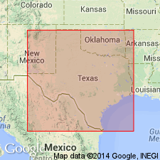
Pg. 681-683. Carrizo schists. The southern part of Carrizo Mountains is built up of reddish, gray, and lighter and darker greenish crystalline schists, with numerous quartz dykes, tilted and upheaved by this quartz and by granitic and granitoid rocks, which on north and northwest side protrude through the schists. On south side these schists disappear under limestones, and these under the recent soil of the flats and gravel hills. * * * The crystalline schists cross Texas and Pacific RR near Allamore [Allamoore], running into a low ridge, which 6 miles west of Van Horn Station disappears in the flat at foot of the Carboniferous cliffs, which rest on non-fossiliferous red and brown sandstones and grit. * * * The grit in its most southern exposure in Carrizo Mountains occurs in Round Mountain at Allamore [Allamoore], rising above the flat and the low Carboniferous limestone hills that run parallel with Texas and Pacific RR to about 1 mile west of Allamore [Allamoore]. On east side of this gritty butte the red schistose rocks disappear under the grit strata, reappearing occasionally in the more northern part of Carrizo Mountains, together with serpentinous, basaltic, and greenstone intrusions. [Age is Precambrian.]
Named from Carrizo Mountains, El Paso Co. [now in Hudspeth Co.], TX.
Source: US geologic names lexicon (USGS Bull. 896, p. 355-356).
- Usage in publication:
-
- Carrizo formation*
- Modifications:
-
- Redescribed
- Age modified
- Dominant lithology:
-
- Schist
- Quartzite
- Slate
- AAPG geologic province:
-
- Southwestern Basin-and-Range region
Summary:
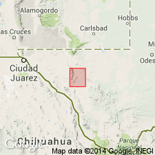
Pg. 3, geol. map. Carrizo formation. A complex of quartzite, slate, quartz and mica schists, chlorite schists, and metamorphosed igneous rocks, which outcrops in Carrizo Mountains south of Texas and Pacific RR. The schists are chiefly of sedimentary origin, but a small part of formation consists of schists which presumably represent igneous sills that were injected in thin layers between the sediments. Oldest exposed formation in Carrizo Mountains; covers about 22 sq mi in southwest corner of Van Horn quadrangle, Hudspeth and Culberson Counties, Texas. Underlies (sequence concealed) Millican formation (new). Age is Algonkian(?), based on stratigraphic relations.
Source: US geologic names lexicon (USGS Bull. 896, p. 355-356); supplemental information from GNU records (USGS DDS-6; Denver GNULEX).

- Usage in publication:
-
- Carrizo Mountain schist
- Modifications:
-
- Revised
- AAPG geologic province:
-
- Southwestern Basin-and-Range region
Summary:
Carrizo Mountain schist. Because of conflict of Carrizo with the Eocene Carrizo sand of Texas, the Texas Geological Survey and the USGS now call this formation Carrizo Mountain schist.
Source: US geologic names lexicon (USGS Bull. 896, p. 355-356).
- Usage in publication:
-
- Carrizo Mountain schist*
- Modifications:
-
- Areal extent
- AAPG geologic province:
-
- Southwestern Basin-and-Range region
Summary:
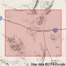
Pg. 144 (fig. 1), 145-147. Carrizo Mountain schist. Described in Van Horn region, Culberson and Hudspeth Counties, Texas, where it consists of a number of contrasting types of metamorphic rocks which can be separately mapped over wide areas. These rocks fall into two main groups, one of which appears to lie stratigraphically below the other: (1) lower group is largely of igneous origin, includes rhyolites and greenstones with varying degrees of schistosity, exposed along U.S. Highway 80 southeast of Allamoore; and (2) upper group largely sedimentary origin, comprises a basal unit of gray, cross-bedded quartzite at least 1,000 feet thick that stands in high hogback ridges, overlain by a thick succession of slates, banded cherts, and limestones, exposed in a northeastward-trending synclinal belt across Carrizo Mountains. Cut everywhere by veins of quartz and pegmatite. Northward, overthrusted onto newly named Allamoore limestone, formerly lower part of †Millican formation of Richardson (here abandoned). Includes oldest rocks of region. Age is Precambrian. Report includes stratigraphic chart, regional sketch map.
Source: US geologic names lexicon (USGS Bull. 1200, p. 648-649); supplemental information from GNU records (USGS DDS-6; Denver GNULEX).
- Usage in publication:
-
- Carrizo Mountain group (informal)
- Modifications:
-
- Revised
- AAPG geologic province:
-
- Southwestern Basin-and-Range region
Summary:
Pg. 20-24, pl. 2. Carrizo Mountain group (informal). Described as a body of metamorphic rocks of great thickness which in individual areas can be subdivided into a variety of rock types, most of which are mappable as separate entities. Many of these entities are well defined sedimentary units a thousand or more feet thick, which would be formations in their own right in sequence less disturbed and more widely exposed. Unit does not correspond with other formations as these are commonly differentiated in Texas. Although it is impracticable to subdivide unit into named subdivisions, it deserves informal designation as a group in much same manner as metamorphic units in Alaska and Canada. USGS prefers term formation. Term group is used in this report without prejudice as to whatever usage may be adopted in subsequent reports of the USGS.
Source: US geologic names lexicon (USGS Bull. 1200, p. 648-649).
- Usage in publication:
-
- Carrizo Mountain group (informal)
- Modifications:
-
- Mapped
- AAPG geologic province:
-
- Southwestern Basin-and-Range region
Summary:
All Precambrian rocks in Wylie Mountains and vicinity are referred to Carrizo Mountain group [informal]. Unconformably underlies Powwow conglomerate.
Source: US geologic names lexicon (USGS Bull. 1200, p. 648-649).
- Usage in publication:
-
- Carrizo Mountain Group [informal]
- Modifications:
-
- Areal extent
- AAPG geologic province:
-
- Southwestern Basin-and-Range region
Summary:
Carrizo Mountain Group [informal]. Is exposed in several fault-block mountain ranges near Van Horn, Texas (Southwestern Basin-and-Range region). Consists of metamorphosed pelitic, psammitic [arenaceous], and minor carbonate sedimentary rocks interbedded with rhyolitic welded ash-flow tuffs, diabasic sills, volumetrically minor granodioritic intrusions. Sedimentary units are 50 percent psammites (quartzites, arkoses) that retain cross-bedding and ripple marks, 25 percent pelites (originally mudstone and tuffs), and 25 percent mixed psammites, pelites, carbonates. Rhyolites are fine-grained quartz-feldspar matrix with varying amounts of potassium feldspar, quartz, opaque phenocrysts. The diabases are composed of amphibole, plagioclase, and ilmenite; some are massive and have well preserved subophitic texture. Ash-flow tuffs and terrigenous sediments were intruded by diabase. Rb-Sr dating of rhyolites yielded a 1.27 +/-0.07 Ga emplacement age. Continental margin back-arc basin suggested for tectonic setting. Report includes geochemistry analyses.
Source: Modified from GNU records (USGS DDS-6; Denver GNULEX).
For more information, please contact Nancy Stamm, Geologic Names Committee Secretary.
Asterisk (*) indicates published by U.S. Geological Survey authors.
"No current usage" (†) implies that a name has been abandoned or has fallen into disuse. Former usage and, if known, replacement name given in parentheses ( ).
Slash (/) indicates name conflicts with nomenclatural guidelines (CSN, 1933; ACSN, 1961, 1970; NACSN, 1983, 2005, 2021). May be explained within brackets ([ ]).