The National Geologic Map Database is migrating to a new infrastructure. We apologize for any service disruptions during this process.
|
|---|


- Usage in publication:
-
- Carnahan Bayou member
- Modifications:
-
- Original reference
- Dominant lithology:
-
- Siltstone
- AAPG geologic province:
-
- Gulf Coast basin
Summary:
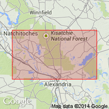
Pg. 118 (fig. 26), 154-158, geol. map. Carnahan Bayou member of Fleming formation of Grand Gulf group. Group of siltstones with intercalated sand lenses, local brackish-water clays, and thin tuffaceous beds. Thickness more than 125 feet. Underlies Dough Hills member; overlies Lena member (all of Fleming formation). Age is Miocene.
Basal beds are typically exposed in roadcuts along U.S. Highway 71W, south of Lena, Rapides Parish, central LA. Named from Carnahan Bayou [Carnahan Creek, Boyce and Lena 7.5-min quadrangles, Rapides Parish, central LA (USGS GNIS database, accessed May 27, 2012)].
Source: US geologic names lexicon (USGS Bull. 1200, p. 390).
For more information, please contact Nancy Stamm, Geologic Names Committee Secretary.
Asterisk (*) indicates published by U.S. Geological Survey authors.
"No current usage" (†) implies that a name has been abandoned or has fallen into disuse. Former usage and, if known, replacement name given in parentheses ( ).
Slash (/) indicates name conflicts with nomenclatural guidelines (CSN, 1933; ACSN, 1961, 1970; NACSN, 1983, 2005, 2021). May be explained within brackets ([ ]).