The National Geologic Map Database is migrating to a new infrastructure. We apologize for any service disruptions during this process.
|
|---|


- Usage in publication:
-
- Carrollton Mountain porphyry
- Modifications:
-
- Original reference
- AAPG geologic province:
-
- South Oklahoma folded belt
Summary:
Pg. 135, 136. Carrollton Mountain porphyry. Two types of porphyry, including rhyolites, amygdaloids, and some tuffs. Assigned to Archean(?). The Saddle Mountain porphyry, of slightly different type, probably belongs here.
[Named from Carlton Mountains, Comanche Co., Wichita Mountains, southwestern OK.]
Source: US geologic names lexicon (USGS Bull. 896, p. 349).
- Usage in publication:
-
- Carlton porphyry
- Modifications:
-
- Original reference
- AAPG geologic province:
-
- South Oklahoma folded belt
Gould, C.N., 1904, Geology of the Wichita Mountains of Oklahoma: Oklahoma Department of Geology and Natural History Biennial Report, no. 3, p. __.
Summary:
Pg. 18, 20. Mentions Carlton porphyry, which apparently is same as Carrollton Mountain porphyry of Bain, the geographic feature being now spelled Carlton. Age is pre-Cambrian.
[Named from Carlton Mountains, Comanche Co., Wichita Mountains, southwestern OK.]
Source: US geologic names lexicon (USGS Bull. 896, p. 349).
- Usage in publication:
-
- Carlton Mountain porphyry
- Modifications:
-
- Areal extent
- AAPG geologic province:
-
- South Oklahoma folded belt
Summary:
Pg. 64. Carlton Mountain porphyry mentioned in discussion of igneous rocks of Wichita Mountains. Plate 2 shows granite-porphyry mapped in vicinity of Carlton Mountains, Comanche County, southwestern Oklahoma. [May be same as Carrollton Mountain porphyry, the geographic feature now being Carlton Mountains.]
Source: US geologic names lexicon (USGS Bull. 1200, p. 641).
- Usage in publication:
-
- Carlton granophyre
- Carlton porphyry
- Modifications:
-
- Revised
- AAPG geologic province:
-
- South Oklahoma folded belt
Summary:
Pg. 39-48. Carlton granophyre [also Carlton porphyry]. Porphyritic granophyre; fine-grained; purple when fresh; weathers tan. Resembles Davidson granophyre, but differs in that it carries phenocrysts of quartz, and orthoclase or microperthite, or both, which comprise about 11 percent of the rock. Considered later than Davidson granophyre, and is intruded by Lugert granophyre.
Composes nearly all of Carlton Mountains.
Source: US geologic names lexicons (USGS Bull. 896, p. 349; USGS Bull. 1200, p. 640).
- Usage in publication:
-
- Carlton rhyolite
- Modifications:
-
- Redefined
- AAPG geologic province:
-
- South Oklahoma folded belt
Summary:
The Carlton is a typically porphyritic and locally perlitic rhyolite with major phenocrysts of microperthite and minor phenocrysts of quartz, orthoclase, sodic plagioclase, and magnetite. Groundmass is micro- to cryptocrystalline and occasionally a micrographic intergrowth of quartz and feldspar. Believed to be surface equivalent of one of Wichita
granites.
Source: US geologic names lexicon (USGS Bull. 1200, p. 641).
- Usage in publication:
-
- Carlton Rhyolite Group
- Modifications:
-
- Revised
- AAPG geologic province:
-
- South Oklahoma folded belt
- Ouachita folded belt
- Palo Duro basin
- Anadarko basin
Summary:
Raised in rank to Carlton Rhyolite Group in report area, southern Oklahoma, where it is present in "Wichita Province" (east to west, mostly in subsurface): western Bryan Co (Ouachita tectonic belt province); Marshall, Love, Carter, Murray, Jefferson, Stephens, Grady, Cotton, Comanche, Kiowa, and northern Greer Cos (South Oklahoma folded belt province); Jackson Co (Palo Duro basin); and Caddo, Beckham, and Washita Cos (Anadarko basin). Is an extrusive rock, consisting mainly of rhyolite flows and tuffs, together with beds of agglomerate and sills of diabase. Includes Colbert Porphyry of western Murray Co. Represents the last stage of basement-rock filling of the southern Oklahoma geosyncline. Maximum exposed thickness 3,600 ft on Bally Mountain [sec 34, T6N, R14W, Kiowa Co]. Lower part intruded by numerous thick sills of Wichita Granite Group; Wichita is the intrusive equivalent of Carlton. Probably unconformably overlies the extrusive Navajoe Mountain Basalt-Spilite Group and Raggedy Mountain Gabbro Group, Navajoe Mountain's intrusive equivalent (both new, of Early Cambrian? age. Reagan Sandstone, Honey Creek Limestone, and lower part of Arbuckle Group (all of Late Cambrian age) are the locally overlying rocks, separated from Carlton and other basement rocks by an unconformity. Dated by four isotopic age determinations as Middle Cambrian?, 525 +/-25 m.y. Geologic map. Generalized sections.
Source: GNU records (USGS DDS-6; Denver GNULEX).
- Usage in publication:
-
- Carlton Rhyolite Group
- Modifications:
-
- Principal reference
- Dominant lithology:
-
- Rhyolite
- Tuff
- Agglomerate
- Basalt
- Diabase
- AAPG geologic province:
-
- South Oklahoma folded belt
- Ouachita folded belt
- Palo Duro basin
- Anadarko basin
Summary:
Pg. 38-53. Carlton Rhyolite Group. Includes all rhyolitic rocks in Wichita Mountains and Arbuckle Mountains, and their equivalents in subsurface, which underlie at least 7,000 sq mi of southern Oklahoma. Most rocks are part of an enormous volcanic field, locally at least 4,500 feet thick, and are chiefly rhyolitic flows, water-laid tuff, agglomerate, and welded tuff. Rhyolites of Wichita Mountains previously called Carrollton Mountain porphyry by Bain (1900), Carlton Mountain porphyry by Taff (1904), and Carlton granophyre by Hoffman (1930). Rhyolites of East Timbered Hills and West Timbered Hills of the Arbuckle Mountains previously called Colbert porphyry by Reeds (1910). Age is probably Middle Cambrian, based on absolute age of 525 +/-25 Ma.
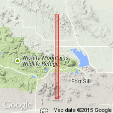
Type locality: Bally Mountain, on north flank of Wichita Mountains, in sec. 27, T. 6 N., R. 14 W., Bally Mountain 7.5-min quadrangle, Kiowa Co., southwestern OK, where a sequence of stratiform flows and tuff, 3,600 feet thick, has been measured.
Group makes up low range of hills near Lawton, at eastern edge of Wichita Mountains, Fort Sill Military Reservation, once called Carlton (Carrollton) Mountains; these are now individually named hills (e.g., Jones Ridge, Signal Mountain, Medicine Bluffs, Carlton Mountain).
Source: Publication.
For more information, please contact Nancy Stamm, Geologic Names Committee Secretary.
Asterisk (*) indicates published by U.S. Geological Survey authors.
"No current usage" (†) implies that a name has been abandoned or has fallen into disuse. Former usage and, if known, replacement name given in parentheses ( ).
Slash (/) indicates name conflicts with nomenclatural guidelines (CSN, 1933; ACSN, 1961, 1970; NACSN, 1983, 2005, 2021). May be explained within brackets ([ ]).