

- Usage in publication:
-
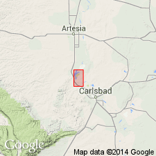
- Carlsbad limestone member
- Modifications:
-
- Original reference
- Dominant lithology:
-
- Limestone
- AAPG geologic province:
-
- Permian basin
Summary:
Pg. 12-13, and map; N.H. Darton, 1926, GSA Bull., v. 37, p. 419. Carlsbad limestone member of Chupadera formation. Limestone, with thin beds of sandstone and possibly some rock salt, underlying Castile formation and overlying Seven Rivers gypsiferous member of Chupadera formation. According to Darton it is top member of Chupadera formation, and also forms upper part of Capitan limestone, which caps El Capitan at southern end of Guadalupe Mountains in Texas. Thickness 40 to 800 or more feet. [Age is Permian.]
[Typographic error (US geologic names lexicon, USGS Bull. 896): date of Meinzer and others publication stated to be 1926; should be 1927.]
Source: US geologic names lexicon (USGS Bull. 896, p. 349).
- Usage in publication:
-
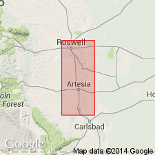
- Carlsbad limestone tongue
- Modifications:
-
- Areal extent
- AAPG geologic province:
-
- Permian basin
Summary:
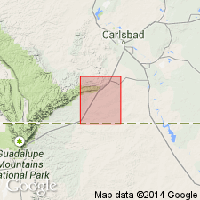
Carlsbad limestone tongue of Capitan limestone. In Roswell artesian basin it is almost entirely thin-bedded dolomitic limestone, 35 to 40 feet thick, but disapears entirely east of Lakewood. Overlies Seven Rivers tongue of Pecos formation. [Age is Permian.]
[Typographic error (US geologic names lexicon, USGS Bull. 896): date of publication stated to be 1932; should be 1933.]
Source: US geologic names lexicon (USGS Bull. 896, p. 349).
- Usage in publication:
-
- Carlsbad limestone*
- Modifications:
-
- Revised
- AAPG geologic province:
-
- Permian basin
Summary:
Further studies show: (1) Uppermost part of Carlsbad limestone is younger than Capitan limestone and the rest of it is contemporaneous with and grades laterally into the Capitan. (2) In places the Carlsbad is overlain by a thin wedge of uppermost part of Castile anhydrite, and in other places its uppermost part grades laterally into Three Twins member of Chalk Bluff formation. (3) Lower part of the Carlsbad grades laterally into Seven Rivers gypsiferous member of Chalk Bluff formation. (4) In places a thin tongue (Azotea tongue) of upper part of Carlsbad limestone overlies Seven Rivers gypsiferous member of Chalk Bluff formation. (5) The Carlsbad rests on Queen sand member of Chalk Bluff formation. [Age is Permian.]
[This is present (ca. 1936) approved definition of the USGS.]
Source: US geologic names lexicon (USGS Bull. 896, p. 349).
- Usage in publication:
-
- Carlsbad limestone*
- Modifications:
-
- Mapped 1:48k
- AAPG geologic province:
-
- Permian basin
Summary:
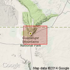
Pg. 64-69, pls. 2, 3. Carlsbad limestone. Described and mapped in southern Guadalupe Mountains, western Texas. [Age is Late Permian (Guadalupe).]
Source: US geologic names lexicon (USGS Bull. 1200, p. 640).
- Usage in publication:
-
- Carlsbad group
- Modifications:
-
- Revised
- AAPG geologic province:
-
- Permian basin
Summary:
Pg. 46. Carlsbad group. Includes Seven Rivers, Yates, and Tansill formations. [Age is Late Permian (Guadalupe).]
Source: US geologic names lexicon (USGS Bull. 1200, p. 649).
- Usage in publication:
-
- Carlsbad group*
- Modifications:
-
- Mapped
- AAPG geologic province:
-
- Permian basin
Summary:
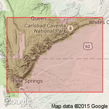
Carlsbad group. Described in Carlsbad Caverns East quadrangle where it comprises (ascending) Seven Rivers, Yates, and Tansill formations. Overlies Queen sandstone in northwest and toward southeast Goat Seep limestone. Underlies Salado formation; toward southeast interfingers with Capitan limestone. [Age is Late Permian (Guadalupe).]
Source: US geologic names lexicon (USGS Bull. 1200, p. 649).
- Usage in publication:
-
- Carlsbad Group†
- Modifications:
-
- Abandoned
- AAPG geologic province:
-
- Permian basin
Summary:
†Carlsbad Group abandoned. Replaced with Artesia group.
Source: US geologic names lexicon (USGS Bull. 1200, p. 649).
For more information, please contact Nancy Stamm, Geologic Names Committee Secretary.
Asterisk (*) indicates published by U.S. Geological Survey authors.
"No current usage" (†) implies that a name has been abandoned or has fallen into disuse. Former usage and, if known, replacement name given in parentheses ( ).
Slash (/) indicates name conflicts with nomenclatural guidelines (CSN, 1933; ACSN, 1961, 1970; NACSN, 1983, 2005, 2021). May be explained within brackets ([ ]).