- Usage in publication:
-
- Carlinville limestone
- Modifications:
-
- Original reference
- Dominant lithology:
-
- Limestone
- AAPG geologic province:
-
- Illinois basin
Summary:
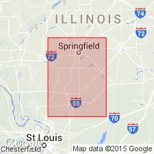
Pg. 287, 290-301, 309. Carlinville limestone. Hard, compact, brownish gray limestone, 6 to 12 feet thick, upper portion concretionary or pebbly in structure, in Coal Measures of Macoupin and Sangamon Counties, southwestern and central-western Illinois, being bed No. 11 in Virden shaft, Macoupin County. Overlain by argillaceous shale and underlain by bituminous shale including coal No. 9. Probably same as Shoal Creek limestone. Age is Pennsylvanian.
Named from outcrops in vicinity of Carlinville, Macoupin Co., southwestern IL.
Source: US geologic names lexicon (USGS Bull. 896, p. 348); supplemental information from GNU records (USGS DDS-6; Reston GNULEX).

- Usage in publication:
-
- Carlinville limestone member*
- Modifications:
-
- Overview
- AAPG geologic province:
-
- Illinois basin
Summary:
Carlinville limestone member of McLeansboro formation. According to G.H. Cady, 1921 (Illinois Geol. Survey Coop. Min. Ser., Bull. no. 26) and 1926 (Illinois State Acad. Sci. Trans., v. 19, p. 257, etc.), the Carlinville limestone lies 100+/- feet below Shoal Creek limestone and 20 to 60 feet above coal No. 8. E.W. Shaw, 1923 (USGS Carlyle-Centralia folio, No. 216), also identified Carlinville limestone as older than Shoal Creek limestone. According to Wallace Lee, 1928 (USGS Gillespie-Mount Olive folio, No. 220), the Carlinville limestone lies 53 to 81 feet below Shoal Creek limestone. H.R. Wanless, 1931 (GSA Bull., v. 42, no. 3, p. 804), placed Carlinville limestone nearly 100 feet below Shoal Creek limestone.
[June 25, 2010. Cady (1921) available online from the Illinois Geol. Survey library: http://library.isgs.uiuc.edu/Pubs/pdfs/cop/mib26/mib26.pdf.]
Source: US geologic names lexicon (USGS Bull. 896, p. 348).
- Usage in publication:
-
- Carlinville limestone
- Modifications:
-
- Not used
- AAPG geologic province:
-
- Illinois basin
Summary:
Stated that Carlinville limestone is identical with Shoal Creek limestone and that Carlinville should be abandoned.
Source: US geologic names lexicon (USGS Bull. 896, p. 348).
- Usage in publication:
-
- Carlinville limestone
- Modifications:
-
- Revised
- AAPG geologic province:
-
- Illinois basin
Summary:
Pg. 35-37. Carlinville limestone of McLeansboro group. In Carlinville quadrangle, generally consists of an upper massive limestone bed separated from a thinner lower one by dark shale. Locally there are three or four beds of limestone with intervening shale and then two or three of the limestone beds with intervening shale. Average total thickness 4.5 feet. Included in Carlinville cyclothem.
See also Carlinville cyclothem.
Source: US geologic names lexicon (USGS Bull. 638-639).
- Usage in publication:
-
- Carlinville limestone
- Modifications:
-
- Principal reference
- AAPG geologic province:
-
- Illinois basin
Summary:
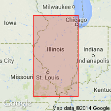
Pg. 11. Carlinville limestone. Type locality designated in SW/4 SW/4 sec. 35, T. 10 N., R. 7 W., Macoupin Co., IL. Named from outcrops in vicinity of Carlinville.
Source: US geologic names lexicon (USGS Bull. 1200, p. 638-639).
- Usage in publication:
-
- Carlinville limestone member
- Modifications:
-
- Revised
- AAPG geologic province:
-
- Illinois basin
Summary:
Pg. 37, 49 (table 1), 69, pl. 1. Carlinville limestone member of Modesto formation (new) of McLeansboro group. Reallocated to member status in Modesto formation. Stratigraphically below Burroughs limestone member and above Chapel (No. 8) coal member (new). Recognized in southwestern Illinois. Age is Pennsylvanian. Report presents new rock-stratigraphic classification of Pennsylvanian strata in Illinois. Cyclical classification retained but is entirely independent of rock-stratigraphic classification.
Source: Publication; US geologic names lexicon (USGS Bull. 1200, p. 638-639).
For more information, please contact Nancy Stamm, Geologic Names Committee Secretary.
Asterisk (*) indicates published by U.S. Geological Survey authors.
"No current usage" (†) implies that a name has been abandoned or has fallen into disuse. Former usage and, if known, replacement name given in parentheses ( ).
Slash (/) indicates name conflicts with nomenclatural guidelines (CSN, 1933; ACSN, 1961, 1970; NACSN, 1983, 2005, 2021). May be explained within brackets ([ ]).

