

- Usage in publication:
-
- Carl sandstone member
- Modifications:
-
- Named
- Dominant lithology:
-
- Sandstone
- AAPG geologic province:
-
- Appalachian basin
Summary:
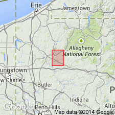
Named for exposures at Carl, Venango Co., northwestern PA. Named as a member of Shenango Formation (also known as member C). Basal 6 ft is yellowish-gray, coarse-grained, very massive sandstone with lenticular clay nodules. Upper 45 ft is greenish-gray to golden-brown, medium- to coarse-grained sandstone with local cross-bedding. Along Allegheny River in northern part of Oil City quad, becomes less massive, more shaly, and more poorly bedded eastward across quad. Red and green shale and sandstone invade horizon of upper part at Oil City and eastward along river. At Smoky Hill, 2.5 mi east of quad, red and green shales are prominently developed throughout unit. Thickness ranges from 30 to 50 ft. Apparently disconformable with underlying shale; if so, then Carl should be included with overlying Patton formation. Age is Mississippian (middle Meramec or younger).
Source: GNU records (USGS DDS-6; Reston GNULEX).
For more information, please contact Nancy Stamm, Geologic Names Committee Secretary.
Asterisk (*) indicates published by U.S. Geological Survey authors.
"No current usage" (†) implies that a name has been abandoned or has fallen into disuse. Former usage and, if known, replacement name given in parentheses ( ).
Slash (/) indicates name conflicts with nomenclatural guidelines (CSN, 1933; ACSN, 1961, 1970; NACSN, 1983, 2005, 2021). May be explained within brackets ([ ]).