

- Usage in publication:
-
- Carbon Ridge formation*
- Modifications:
-
- Original reference
- AAPG geologic province:
-
- Great Basin province
Summary:
Pg. 2, 64-66, pl. 1. Carbon Ridge formation. Proposed for rocks of Permian(?) age that occur south and east of Eureka, central Nevada. Probably included in "Upper Coal Measures" of Hague (USGS 3rd Ann. Rpt., 1883; USGS Mon. 20, 1892). Two facies distinguished: eastern, in Diamond Mountains; and western, which includes type area, south of Eureka. Both facies are unconformably overlain by Newark Canyon formation (new). In western facies, overlies Diamond Peak formation; in eastern facies, overlies Ely limestone. Composed largely of sandy or silty limestones that weather to shades of brown; dominantly thin-bedded. Maximum thickness 1,750 feet.
[GNC remark: Permian(?) age approved for this report (November 16, 1954, G.V. Cohee, GNC chairman); age is Permian (J.S. Williams, August 3, 1955).]
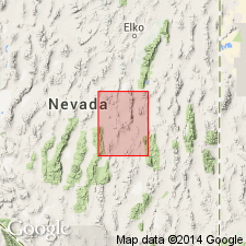
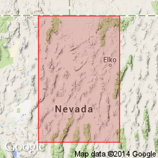
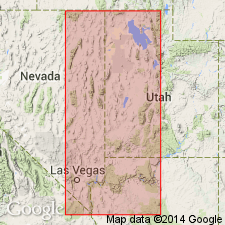
Type area: on Carbon Ridge, lying just north of mouth of Secret Canyon, vicinity of Eureka, [in secs. 30 and 31, T. 18 N., R. 54 E., approx. Lat. 39 deg. 23 min. 44 sec. N., Long. 115 deg. 56. 11 sec. W., Pinto Summit 7.5-min quadrangle], Eureka Co., central NV.
[Additional locality information from USGS historical topographic map collection TopoView, accessed Memorial Day 2018.]
Source: US geologic names lexicon (USGS Bull. 1200, p. 629); GNC index card files (USGS-Menlo).
- Usage in publication:
-
- Carbon Ridge formation*
- Modifications:
-
- Age modified
- AAPG geologic province:
-
- Great Basin province
Summary:
Pg. 2841. Carbon Ridge formation. In the Eureka area, north-central Nevada, is a sequence of interbedded conglomerate, limestone, shale, and sandstone beds, 1,500 to 1,750 feet thick. Rests unconformably on the Ely limestone and the Diamond Peak formation (Nolan and others, 1956, pp. 64-67). Fusulinid faunas in the lower part indicate early Permian (Wolfcamp) age; in the upper part, probable Leonard age.
[GNC remark (November 22, 1957, G.V. Cohee, GNC chairman, and Helen Duncan): Wolfcamp and Leonard(?) age approved for this report.]
Source: Publication; GNC index card files (USGS-Menlo).
- Usage in publication:
-
- Carbon Ridge formation
- Modifications:
-
- Areal extent
- AAPG geologic province:
-
- Great Basin province
Summary:
Pg. 181-183. Carbon Ridge formation. Discussion of southern Butte Mountains area, White Pine County, Nevada. Basal Permian rocks overlying disconformity at top of Ely limestone include some rocks which are Wolfcampian. These rocks, together with Leonardian and lower Wordian rocks constitute unit mapped as Carbon Ridge formation. Rocks of unit consist of monotonous alternating sequence of buff, fine- to medium-grained limestones and a lesser amount of white to buff, calcareous, fine- to medium-grained sandstones. Thickness 997 feet. Conformably overlies Arcturus formation. On basis of fusulinid fauna, Knight, 1956 (Jour. Paleo., v. 30, no. 4) suggested that unit was equivalent to Arcturus formation as defined by Spencer (1917). Field evidence indicates that this is incorrect and that these rocks are more likely equivalent to "Rib Hill" formation of Ely district and also correlatable to west with Carbon Ridge formation at Eureka and Havallah formation at Battle Mountain.
Source: US geologic names lexicon (USGS Bull. 1200, p. 629).
- Usage in publication:
-
- Carbon Ridge group
- Modifications:
-
- Revised
- AAPG geologic province:
-
- Great Basin province
Summary:
Pg. 91, 93 (chart 1), 102. Carbon Ridge group. Rank raised to group. In Carbon Ridge area, [Eureka County, east-central Nevada], comprises (ascending) unnamed limy shales, argillaceous limestones, silts and mudstones, Riepe Spring limestone (new), Riepetown sandstone (new), and Pequop formation. Group retains same limits as recognized by Nolan and others (1956). [Age is Late Pennsylvanian (Missourian, Virgilian) to Early Permian (Wolfcampian, Leonardian).]
Source: US geologic names lexicon (USGS Bull. 1200, p. 629).
- Usage in publication:
-
- Carbon Ridge group
- Modifications:
-
- Incidental mention
- AAPG geologic province:
-
- Great Basin province
Summary:
Carbon Ridge group. Discussion of stratigraphic interpretation of Pennsylvanian-Permian systems of eastern Great Basin. During Virgilian to earliest Wolfcampian time, following units were deposited: Strathearn, Jakes Creek (new), Carbon Ridge, Oquirrh, Ferguson Springs (new), and Pakoon.
Source: US geologic names lexicon (USGS Bull. 1200, p. 629).
For more information, please contact Nancy Stamm, Geologic Names Committee Secretary.
Asterisk (*) indicates published by U.S. Geological Survey authors.
"No current usage" (†) implies that a name has been abandoned or has fallen into disuse. Former usage and, if known, replacement name given in parentheses ( ).
Slash (/) indicates name conflicts with nomenclatural guidelines (CSN, 1933; ACSN, 1961, 1970; NACSN, 1983, 2005, 2021). May be explained within brackets ([ ]).