

- Usage in publication:
-
- Capitan limestone
- Modifications:
-
- Original reference
- Dominant lithology:
-
- Limestone
- AAPG geologic province:
-
- Permian basin
Summary:
Pg. 41, geol. map. Capitan limestone. Massive white limestone, 0 to 1,800 or more feet thick. Conformably overlies Delaware Mountain formation in Guadalupe Mountains. Top not seen but believed to unconformably underlie Castile gypsum. Age is Permian.
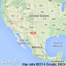
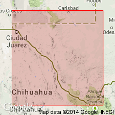
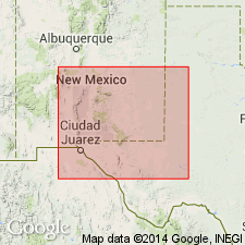
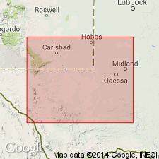
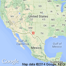
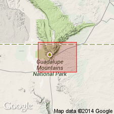
Named from El Capitan Peak which is formed of the limestone; located at southern end of Guadalupe Mountains, [Lat. 31 deg. 52 min. 38 sec. N., Long. 104 deg. 51 min. 29 sec. W., Guadalupe Peak 7.5-min quadrangle], El Paso Co. [now in Culberson Co.], western TX.
Source: US geologic names lexicon (USGS Bull. 896, p. 343).
- Usage in publication:
-
- Capitan limestone*
- Modifications:
-
- Revised
- AAPG geologic province:
-
- Permian basin
Summary:
Pg. 925, etc. Extended Capitan limestone into eastern Glass Mountains, and included in it the Tessey, Gilliam, and Vidrio deposits.
Source: US geologic names lexicon (USGS Bull. 896, p. 343).
- Usage in publication:
-
- Capitan formation
- Modifications:
-
- Revised
- AAPG geologic province:
-
- Permian basin
Summary:
Pg. 73-84, pls. 13, 14, geol. map. The strata overlying Word formation and underlying Bissett formation in Glass Mountains are herein referred to Capitan formation. They were originally divided by Udden into 3 units (ascending); Vidrio, Gilliam, and Tessey formations. They were subdivided along Gilliland Canyon, where they are separable into massive dolomite below (Vidrio), thin-bedded dolomite in middle (Gilliam), and massive dolomite above (Tessey). The work of R.E. King and writer has shown that the 3 subdivisions established by Udden are local phases of the interfingering of different facies. The natural units in western part of Glass Mountains do not correspond in age to those in the east, and neither those in east or west have any more than a local significance. For this reason it is here proposed to use the general term Capitan formation for these rocks, and to reduce the Vidrio, Gilliam, and Tessey to the rank of members of this formation. Vidrio member is 600 to 1,200 feet thick; Gilliam member is 500 to 873 feet thick; and Tessey member is 100 to 1,050 feet thick. In western part of Glass Mountains the equivalents of Tessey member and upper part of Gilliam member appear to have been removed by erosion, and the "upper massive member" of Capitan formation, 215 to 800 feet thick, is believed to correspond to lower part of Gilliam and upper part of Vidrio. Beneath this upper member is Altuda member (formerly of Vidrio formation), consisting of 450 feet of thin-bedded brown dolomitic limestone, sandy limestone, and siliceous shale, which merges into massive dolomite a short distance east of Old Blue Mountain, and is not represented as such in Gilliland Canyon. Beneath the Altuda lies the "lower massive member" of Capitan formation, 85 to 300 feet thick.
Source: US geologic names lexicon (USGS Bull. 896, Tessey entry p. 2133).
- Usage in publication:
-
- Capitan limestone
- Modifications:
-
- Overview
- AAPG geologic province:
-
- Permian basin
Moore, R.C., 1933, Historical geology: McGraw-Hill Book Co., 673 p.
Summary:
[See also entry under †Glass Mountains formation.] Moore called the Capitan limestone, in Glass Mountains, the Glass Mountains formation, a name (preoccupied) proposed by P.B. King.
Source: US geologic names lexicon (USGS Bull. 896, p. 343).
- Usage in publication:
-
- Capitan limestone*
- Modifications:
-
- Areal extent
- Dominant lithology:
-
- Limestone
- Shale
- Sandstone
- Redbeds
- AAPG geologic province:
-
- Permian basin
Summary:
Pg. 736 [footnote]. Capitan limestone. †Glass Mountains formation abandoned (preoccupied) and Capitan limestone applied in Glass Mountains to include (descending), on east side of the mountains, Tessey massive member, Gilliam thin-bedded member, and Vidrio massive member; and, in lower part of Capitan limestone on west side of Glass Mountains, the Altuda shaly member (= lower part of Vidrio member). Thickness about 2,800 feet. Fossils poorly preserved due to extensive dolomitization. Tessey appears nearly barren of fossils, except for a single locality which yielded large numbers of pelecypods (PLEUROPHORUS). Gilliam contains abundant fusulinids (in western exposures) belonging to the genus POLYDIEXODINA, which is unknown in any strata older than Capitan. Vidrio includes lime-secreting algae, cup corals, crinoid stems, echinoid spines, and a few brachiopods. Altuda contains numerous brachiopods and bryozoans. Age is Permian. Report includes correlation chart.
Source: US geologic names lexicon (USGS Bull. 896, p. 343); supplemental information from GNU records (USGS DDS-6; Denver GNULEX).

- Usage in publication:
-
- Capitan limestone*
- Modifications:
-
- Overview
- AAPG geologic province:
-
- Permian basin
Summary:
Pg. 343. Capitan limestone. Upper formation of Guadalupe group. According to N.H. Darton and J.B. Reeside, Jr. (1926, GSA Bull., v. 37, p. 420) the Castile gypsum unconformably overlies Capitan limestone. K.H. Crandall (1929, AAPG Bull., v. 13, p. 941-943), R.E. King (1931, Univ. Texas Bull., no. 3042), W.B. Lang (Feb. 1935, AAPG Bull.), and other geologists are also now satisfied (1) that Castile gypsum is younger than Capitan limestone (although there is diversity of opinion regarding the unconformity); (2) that typical Delaware Mountain formation of Delaware Mountains includes in its upper part the time equivalent of Capitan limestone; and (3) that the beds underlying Capitan limestone and called Delaware Mountain formation in Guadalupe Mountains are = only in lower part of Delaware Mountain formation of Delaware Mountains.
Source: US geologic names lexicon (USGS Bull. 896, p. 343).
- Usage in publication:
-
- Capitan limestone*
- Modifications:
-
- Revised
- AAPG geologic province:
-
- Permian basin
Summary:
Treated Tessey limestone as a distince formation, instead of including it in Capitan limestone. This is present adopted definition of the USGS.
Source: US geologic names lexicon (USGS Bull. 896, p. 343).
- Usage in publication:
-
- Capitan limestone
- Modifications:
-
- Areal extent
- AAPG geologic province:
-
- Permian basin
Summary:
In Pecos Valley of southeastern New Mexico the nonbedded Capitan limestone of reef zone grades laterally into Carlsbad limestone and is in places overlain by a thin wedge of the Carlsbad, and in other places it grades laterally into the Carlsbad limestone (here treated as a distinct formation). It also grades laterally into upper part of Delaware Mountain formation of fore-reef zone.
Source: US geologic names lexicon (USGS Bull. 896, p. 343).
- Usage in publication:
-
- Capitan limestone
- Modifications:
-
- Areal extent
- AAPG geologic province:
-
- Permian basin
Summary:
Pg. 11. Capitan and Carlsbad are names of different facies of equivalent beds. Capitan is massive reef limestone, which grades basinward into upper Delaware Mountain sandstone (Bell Canyon, new) and lagoonward into Carlsbad limestone.
Source: US geologic names lexicon (USGS Bull. 1200, p. 623-624).
- Usage in publication:
-
- Capitan limestone*
- Modifications:
-
- Revised
- AAPG geologic province:
-
- Permian basin
Summary:
Pg. 589-592, 654-656, 661-662, pl. 2. Capitan limestone. Classification of higher Guadalupe beds used in this paper differs from that used in previous reports. All beds of late Guadalupe age were placed in Capitan limestone, a chronologic unit that included Altuda, Vidrio, and Gilliam members. Name Capitan is herein restricted to that part of former Vidrio member, or reef facies, that is late Guadalupe (post-Word) age, and both it and the Altuda and Gilliam are given rank of formation. This change brings usage in Glass Mountains into harmony with that of type area of Capitan in Guadalupe Mountains, where name is restricted to a lithologic unit, the reef facies. This classification is also adopted by Lewis (1941, AAPG Bull., v. 25, no. 1). Where traced westward from Delaware Mountains into Guadalupe Mountains, or from Delaware basin toward its margins, sandstone and limestones of Bell Canyon formation (new) of Delaware Mountain group are replaced by light-gray thick-bedded or massive limestone of Capitan; in higher beds of Bell Canyon, the change takes place along edge of Reef escarpment.
Source: US geologic names lexicon (USGS Bull. 1200, p. 623-624).
- Usage in publication:
-
- Capitan limestone*
- Modifications:
-
- Mapped 1:48k
- AAPG geologic province:
-
- Permian basin
Summary:
Pg. 59-64, 75-79, pl. 3, stratigraphic sections. Capitan limestone. Thickness 1,000 to 2,000 feet. Consists in part of compact light-gray, cream-colored, or white calcitic limestone associated with dolomitic limestones.
Detailed discussion of geology of southern Guadalupe Mountains, Texas.
Source: US geologic names lexicon (USGS Bull. 1200, p. 623-624).
For more information, please contact Nancy Stamm, Geologic Names Committee Secretary.
Asterisk (*) indicates published by U.S. Geological Survey authors.
"No current usage" (†) implies that a name has been abandoned or has fallen into disuse. Former usage and, if known, replacement name given in parentheses ( ).
Slash (/) indicates name conflicts with nomenclatural guidelines (CSN, 1933; ACSN, 1961, 1970; NACSN, 1983, 2005, 2021). May be explained within brackets ([ ]).