

- Usage in publication:
-
- Canyon Springs sandstone member*
- Modifications:
-
- Named
- Dominant lithology:
-
- Sandstone
- AAPG geologic province:
-
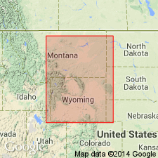
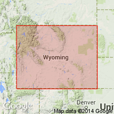
- Powder River basin
Summary:
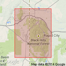
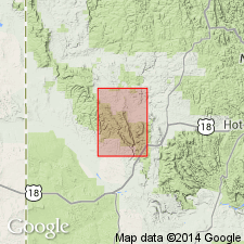
Named as basal member of Sundance formation. Type locality designated as conical butte about 4 mi west of Horton, Weston Co, WY in the Powder River basin, 1/4 mi north of road from Horton to Upton, and near center sec 23, T48N, R62W. Named for Canyon Springs Prairie immediately east of type locality. At type consists of about 26 ft of soft, fine-grained, calcareous, fossiliferous white sandstone that underlies Stockdale Beaver member (new) and overlies Gypsum Spring formation. Thickness ranges from featheredge to about 45 ft; thickens and thins considerably in short distances, and is recognizable as a member only along southern and western margins of Black Hills. Is of Late Jurassic or Callovian age.
Source: GNU records (USGS DDS-6; Denver GNULEX).
- Usage in publication:
-
- Canyon Springs sandstone member
- Modifications:
-
- Revised
- AAPG geologic province:
-
- Powder River basin
Summary:
Reallocated to member status in Rierdon formation, herein assigned to Sundance group. Is Late Jurassic or Callovian age.
Source: GNU records (USGS DDS-6; Denver GNULEX).
- Usage in publication:
-
- Canyon Springs Sandstone Member*
- Modifications:
-
- Revised
- AAPG geologic province:
-
- Chadron arch
Summary:
Red, cross-bedded sandstone tentatively assigned by Imlay (1947) to the Nugget? Sandstone in the southern Black Hills on the Chadron arch is included in Canyon Springs Sandstone Member. Is of Late Jurassic age.
Source: GNU records (USGS DDS-6; Denver GNULEX).
- Usage in publication:
-
- Canyon Springs Sandstone Member
- Modifications:
-
- Overview
Summary:
Assigned to the "lower Sundance" Formation. Predominantly deposited as medium- to large-scale dunes or giant sand waves under the influence of tidal currents. Silty and shaly beds accumulated in swale areas between sand ridges. Is of Late Jurassic age.
Source: GNU records (USGS DDS-6; Denver GNULEX).
- Usage in publication:
-
- Canyon Springs Sandstone Member*
- Modifications:
-
- Areal extent
- AAPG geologic province:
-
- Denver basin
- Powder River basin
Summary:
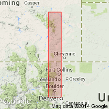
Recognized throughout report area. As the lower member of the Jurassic Sundance Formation unconformably overlies Red Peak Formation of Chugwater Group from Douglas, Converse Co, WY in southern Powder River basin, to CO State border where it unconformably overlies Red Draw Member of Jelm Formation south of State border to Ralston Reservoir, Jefferson Co, CO in Denver basin where it unconformably overlies Lykins Formation. Becomes progressively younger south from Douglas. Has been correlated with Entrada Sandstone by some. Is used at Ralston Reservoir as equivalent to lower part of Ralston Creek Formation of Jurassic age. Measured sections shown graphically.
Source: GNU records (USGS DDS-6; Denver GNULEX).

- Usage in publication:
-
- Canyon Springs Sandstone Member*
- Modifications:
-
- Age modified
- AAPG geologic province:
-
- Powder River basin
- Chadron arch
- Green River basin
- North Park basin
Summary:
Age modified to Bathonian in Johnson, Crook, and Weston Cos, WY, Powder River basin and in Fall River Co, SD, Chadron arch. Canyon Springs is Bathonian and Callovian in Routt Co, CO, Greater Green River basin and Grand Co, CO, North Park basin. Bathonian Age assignment based on presence of ammonite WARRENOCERAS in Canyon Springs on Hartville uplift of southeastern WY and at type section (near Horton, WY), Powder River basin. Correlation diagrams.
Source: GNU records (USGS DDS-6; Denver GNULEX).
For more information, please contact Nancy Stamm, Geologic Names Committee Secretary.
Asterisk (*) indicates published by U.S. Geological Survey authors.
"No current usage" (†) implies that a name has been abandoned or has fallen into disuse. Former usage and, if known, replacement name given in parentheses ( ).
Slash (/) indicates name conflicts with nomenclatural guidelines (CSN, 1933; ACSN, 1961, 1970; NACSN, 1983, 2005, 2021). May be explained within brackets ([ ]).