The National Geologic Map Database is migrating to a new infrastructure. We apologize for any service disruptions during this process.
|
|---|


- Usage in publication:
-
- Cantwell conglomerate*
- Modifications:
-
- Original reference
- Dominant lithology:
-
- Conglomerate
- Sandstone
- AAPG geologic province:
-
- Alaska Southern region
Summary:
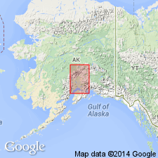
Outcrops for mi or 2 along Cantwell River about 10 or 15 mi above lower forks, Sushitna basin, southern AK. Area of outcrop may be 50, 100 or more sq mi. Consists of conglomerates and coarse sandstones, perhaps derived from Sushitna slates (new) on which unit presumably rests. Is possibly 600 or 700 ft thick. Is older than Kenai formation of late Eocene to Oligocene age.
Source: GNU records (USGS DDS-6; Menlo GNULEX).
- Usage in publication:
-
- Cantwell formation*
- Modifications:
-
- Revised
- Redescribed
- Dominant lithology:
-
- Conglomerate
- Sandstone
- Shale
- Coal
- Volcanics
- AAPG geologic province:
-
- Alaska Southern region
Summary:
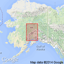
Cantwell conglomerate of Eldridge (1900) is redescribed as Cantwell formation because conglomerate is associated with great series of shales, sandstones, coal seams, and considerable volcanic materials which are also herein included in unit. Most extensive exposure extends from McKinley Fork of Kantishna to Nenana Valley and probably beyond. Is over 2000 ft thick in Nenana basin. Unconformably overlies Tonzona group (Silurian or Devonian) (new) and Tatina group (Ordovician and Silurian?) (new). Age is uncertain, possibly Carboniferous(?).
Source: GNU records (USGS DDS-6; Menlo GNULEX).
- Usage in publication:
-
- Cantwell Formation*
- Modifications:
-
- Principal reference
- AAPG geologic province:
-
- Alaska Southern region
Summary:
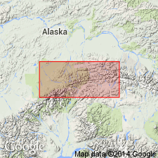
Type locality designated as east wall of canyon of Nenana River [formerly Cantwell River] from mouth of Slime Creek northward 7 or 8 mi, Healy C-4 quad, southern AK. Consists predominantly of interbedded conglomerate, sandstone, argillite, shale, and coal but also contains volcanic rocks especially in uppermost part. Thickness generally from 2000 to 5000 ft. Reference section (Wahrhaftig, 1958, pl.3) is about 10,000 ft thick. Age is Paleocene based on fossil plants.
Source: GNU records (USGS DDS-6; Menlo GNULEX).
- Usage in publication:
-
- Cantwell Formation
- Modifications:
-
- Age modified
- Biostratigraphic dating
- AAPG geologic province:
-
- Alaska Southern region
Summary:
The Cantwell Formation consists of a lower sedimentary sequence as much as 4,000 m thick and an upper volcanic sequence with a maximum thickness of 3,750 m that was deposited in the Cantwell basin, south-central Alaska. New data based on palynologic analyses of 135 fine-grained samples indicate that the lower Cantwell Formation was deposited during the late Campanian and early Maastrichtian. Analysis of the Cantwell Formation demonstrates that sedimentation occurred mainly in stream-dominated alluvial fan, axial braided stream, and lacustrine settings. These depositional systems were strongly influenced by a southward dipping, asymmetric basin floor. The presence of abundant terrestrially derived organic material, together with palynological assemblages that include marine dinoflagellates and the associated presence of oncolites, may be suggestive of a time of marginal marine influence during the deposition of the upper part of the lower Cantwell Formation. The late Campanian to early Maastrichtian timing of this possible marine influence is within the range of the Bearpaw transgressive event of the Cordilleran foreland basin. Mapping of intraformational angular unconformities and progressively tilted strata along the southern margin of the Cantwell basin provides direct evidence that thrust fault deformation and lower Cantwell Formation sedimentation were synchronous. Distinctive Cantwell Formation conglomerate clasts derived from the uplifted hanging walls of nearby thrust sheets adjacent to the southern basin margin also support a syndepositional thrusting interpretation. Provenance data and the concentration of proximal alluvial fan deposits along the northwestern basin margin adjacent to the Hines Creek fault indicate that it, too, was active during deposition of the Cantwell Formation. On the basis of the new data, the Cantwell basin is interpreted to have formed as a thrust-top basin (i.e., piggyback basin) along the Late Cretaceous suture zone between the accreting Wrangellia composite terrane and the North American continental margin. In contrast to previous studies, this reinterpretation of the formation of the Cantwell basin implies that the lower Cantwell Formation is not a synorogenic deposit directly associated with strike-slip displacement along the Denali fault system.
Source: Publication.
- Usage in publication:
-
- Cantwell Formation
- Modifications:
-
- Age modified
- Geochronologic dating
- AAPG geologic province:
-
- Alaska Southern region
Summary:
The Late Cretaceous (80-70 Ma) lower Cantwell Formation represents the initial fill of this basin and includes 4,000 m of sedimentary rock. Between Maastrichtian and late Paleocene time (70-60 Ma), rocks of the lower Cantwell Formation were deformed by nearly east-west trending folds and north vergent thrust faults. This deformation can be linked to the northward accretion and suturing of the Wrangellia composite terrane to southern Alaska. During late Paleocene to early Eocene time (60-55.5 Ma), at least 2,750 m of volcanic rocks of the upper Cantwell Formation were deposited above the folded lower Cantwell Formation. New 40Ar/39Ar ages for the upper Cantwell Formation range from 59.8 +/-0.2 to 55.5 +/-0.2 Ma and reveal that the unconformity between the lower and upper Cantwell Formations represents a 10-20 m.y. hiatus.
Source: Publication.

- Usage in publication:
-
- Cantwell Formation*
- Modifications:
-
- Overview
- AAPG geologic province:
-
- Alaska Southern region
Summary:
[Study area is] in the southern part of the Mount McKinley quadrangle along the east and west sides of Foraker Glacier, the west side of the Muldrow Glacier terminus, and in the vicinity of Mount Galen (fig. 2). All of these rocks were mapped by J.C. Reed, Jr. (1961, Geology of the Mount McKinley quadrangle, Alaska, USGS Bull. 1108-A, 36 p., scale 1:250,000) as part of the Cretaceous Cantwell Formation. Ridgway and others (1997) revised the age of the lower part of the Cantwell Formation to Late Cretaceous on the basis of late Campanian and early Maestrichtian pollen in sedimentary rocks (lithologically equivalent to unit "Tcs" of Wolfe and Wahrhaftig, 1970). Cole and others (1999) revised the age of the upper part of the Cantwell Formation to late Paleocene and early Eocene on the basis of radiometric ages of volcanic rocks (lithologically equivalent to unit "Tcv" of Wolfe and Wahrhaftig, 1970). The new 40Ar/39Ar-plateau ages reported here for the volcanic rocks of Foraker Glacier (fig. 3; table 1) indicate that these rocks are latest Paleocene and early Eocene, coeval with the upper part of the Cantwell Formation at the type area in the Healy quadrangle (Cole and others, 1999).
[Composite stratigraphic section in Foraker Glacier area (fig. 5), shows the lower part of the Cantwell Formation] consists of mudstone intervals [that] are mostly dark-gray shale with very thin to thin interbeds of siltstone. The siltstone displays horizontal, low-angle, and ripple cross-stratification. Some shale intervals contain abundant plant fragments. The sandstone-conglomerate intervals include medium- to coarse-grained gray to tan ("salt and pepper") lithic sandstone and pebble to cobble conglomerate with thin interbeds of dark-gray shale. The sandstone beds typically range from 0.3 to 1 m in thickness, and the conglomerate beds average 0.5 to 2 m in thickness. The sandstone beds commonly display trough cross-stratification and range in texture from massive to horizontally laminated. Pebbly sandstone lenses are common within the axial parts of large-scale troughs. The conglomerate beds are lenticular, well sorted, and clast supported and in some areas display well-developed clast imbrication. Average clasts range from 1 to 5 cm in diameter. The conglomerate beds typically have erosional bases and commonly grade upward into trough-cross-stratified sandstone beds. Clasts in the upper conglomerate unit are primarily argillite, quartzite, and chert, with minor amounts of sandstone and schist. Samples of mudstone from the middle and upper parts of the sedimentary sequence were analyzed for pollen but [were] barren (S. Reid, written commun., 1999). Strata interpreted to be equivalent to lower Cantwell Formation described and dated in the Healy quadrangle by Ridgway and others (1997) and [may] represent a westward extension of the Cantwell Basin. [The upper part of the Cantwell Formation consists of intervals of] mafic, mafic to intermediate lavas; pumice-lithic lapalli-tuffs; porphyritic rhyolite.
Unconformaby overlies folded Paleozoic metamorphic rocks of uncertain, possibly Devonian and Carboniferous age (Reed, 1961) and are overlain unconformably by the volcanic rocks of Foraker Glacier (fig. 4).
Source: Publication.
For more information, please contact Nancy Stamm, Geologic Names Committee Secretary.
Asterisk (*) indicates published by U.S. Geological Survey authors.
"No current usage" (†) implies that a name has been abandoned or has fallen into disuse. Former usage and, if known, replacement name given in parentheses ( ).
Slash (/) indicates name conflicts with nomenclatural guidelines (CSN, 1933; ACSN, 1961, 1970; NACSN, 1983, 2005, 2021). May be explained within brackets ([ ]).