The National Geologic Map Database is migrating to a new infrastructure. We apologize for any service disruptions during this process.
|
|---|


- Usage in publication:
-
- Cannonville Member
- Modifications:
-
- Named
- Dominant lithology:
-
- Sandstone
- Siltstone
- AAPG geologic province:
-
- Paradox basin
Summary:
[Compilation from replacement copy, dated May 1971.] Pg. 16-20; App. p. 46-48 (Section 16, measured section of H.E. Gregory, 1931, USGS Prof. Paper 164, p. 84-85, and 1951, USGS Prof. Paper 226, p. 57). Cannonville Member of Entrada Sandstone of San Rafael Group. Vari-colored sandstone and siltstone. Divided into banded earthy facies (most extensive and characteristic), gray cross-bedded facies, and interbedded sandstone-siltstone facies. Thickness 145 feet at type section, 348 feet at Cottonwood Creek, and 440 feet at Pine Creek. Is middle member of Entrada Sandstone, above Gunsight Butte Member (new) and below Escalante Member (new). Age is considered Late Jurassic.
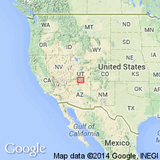
Type section (Section 16): in and near secs. 19, 30, and 31, T. 37 S., R. 2 W. Named from village of Cannonville, [in T. 37 S., R. 2 and 3 W., Cannonville 7.5-min quadrangle, Garfield Co., central southern UT].
Source: Publication; US geologic names lexicon (USGS Bull. 1520, p. 50); GNU records (USGS DDS-6; Denver GNULEX).
For more information, please contact Nancy Stamm, Geologic Names Committee Secretary.
Asterisk (*) indicates published by U.S. Geological Survey authors.
"No current usage" (†) implies that a name has been abandoned or has fallen into disuse. Former usage and, if known, replacement name given in parentheses ( ).
Slash (/) indicates name conflicts with nomenclatural guidelines (CSN, 1933; ACSN, 1961, 1970; NACSN, 1983, 2005, 2021). May be explained within brackets ([ ]).