- Usage in publication:
-
- Cannon Hill Formation
- Modifications:
-
- Named
- Dominant lithology:
-
- Sandstone
- Shale
- AAPG geologic province:
-
- Appalachian basin
Summary:
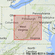
Cannon Hill Formation is here named and described from an outcrop near Rowlesburg, Preston Co., and assigned to the base of the Hampshire Group (rank raised). A reference section is designated along Route 33, east of Elkins, WV. Unit consists of tabular, flat-bottomed, quartz-rich sandstones with interbedded red, green, and gray shales. Cannon Hill is subdivided into several informal intervals which correspond closely to drillers' units. Because the Cannon Hill youngs westward, these chronostratigraphic intervals persist into the Rowlesburg Formation to the east and into the Greenland Gap Formation to the west. At its type locality, the Cannon Hill includes (ascending) "Warren" and "Elizabeth" intervals, while at its reference section, it includes "Elizabeth", "Bayard", and "Fifth" intervals. Overlies Greenland Gap Formation (rank reduced) and underlies newly named Rowlesburg Formation of Hampshire Group. Thickness at type is 233 ft (71 m). Age is Late Devonian.
Source: GNU records (USGS DDS-6; Reston GNULEX).
For more information, please contact Nancy Stamm, Geologic Names Committee Secretary.
Asterisk (*) indicates published by U.S. Geological Survey authors.
"No current usage" (†) implies that a name has been abandoned or has fallen into disuse. Former usage and, if known, replacement name given in parentheses ( ).
Slash (/) indicates name conflicts with nomenclatural guidelines (CSN, 1933; ACSN, 1961, 1970; NACSN, 1983, 2005, 2021). May be explained within brackets ([ ]).

