The National Geologic Map Database is migrating to a new infrastructure. We apologize for any service disruptions during this process.
|
|---|


- Usage in publication:
-
- Canelo Hills Volcanics*
- Modifications:
-
- Named
- Geochronologic dating
- Dominant lithology:
-
- Volcanics
- AAPG geologic province:
-
- Pedregosa basin
- Basin-and-Range province
Summary:
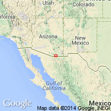
Named for exposures in the Canelo Hills, Santa Cruz Co, in the Basin-and-Range province and Cochise Co, in the Pedregosa basin. Type area is in Canelo Hills. Divided into basal interbedded volcanic and sedimentary rocks (as much as 2,000 ft thick), red to gray rhyolitic lavas (more than 1,000 ft thick), and an upper welded tuff, porphyritic, red to pink with conspicuous phenocrysts of quartz, white and pink feldspar, pumice lapilli, and lithic fragments (locally at least 6,400 ft thick). In the basal unit the volcanic rocks are rhyolitic to latitic, and consist of pyroclastic and flow rocks. The lavas are porphyritic. Sandstone, siltstone, and shale are red. Rests unconformably on Paleozoic carbonate rocks. Unconformably overlain by conglomerate at the base of Bisbee Group (Lower Cretaceous). K-Ar age due from tuff unit is 173 +/-7 Ma. Assigned to the Triassic and Jurassic. Geologic map.
Source: GNU records (USGS DDS-6; Denver GNULEX).
- Usage in publication:
-
- Canelo Hills Volcanics*
- Modifications:
-
- Overview
- AAPG geologic province:
-
- Basin-and-Range province
- Pedregosa basin
Summary:
Lower part of formation in Canelo Hills correlated (correlation chart, fig. 2) with radiometrically dated rocks of red beds of Gardner Canyon (Upper Triassic), and upper part recognized only in Canelo Hills and west flank of Huachuca Mountains considered to be Early Jurassic on basis of radiometric age. Is in Pedregosa basin and Basin-and-Range province.
Source: GNU records (USGS DDS-6; Denver GNULEX).
- Usage in publication:
-
- Canelo Hills Volcanics*
- Modifications:
-
- Areal extent
- Overview
- AAPG geologic province:
-
- Basin-and-Range province
Summary:
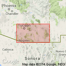
Extended with question to the northwestern part of Santa Rita Mountains, Pima Co, AZ in Basin-and-Range province. Assigned to the Triassic and Jurassic.
Source: GNU records (USGS DDS-6; Denver GNULEX).
- Usage in publication:
-
- Canelo Hills Volcanics*
- Modifications:
-
- Geochronologic dating
- AAPG geologic province:
-
- Pedregosa basin
- Basin-and-Range province
Summary:
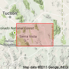
Samples collected from a tuff in Canelo Hills Volcanics, in the Huachuca Mountains, AZ. Age is Late Triassic and Early Jurassic.
(1) Rb-Sr age on biotite 144 +/-6 Ma. Sample locality: Lat. 31 deg. 23 min. 30 sec. N., Long. 110 deg. 23 min. W.;
(2) K-Ar age on biotite 165 +/-6 Ma. Sample locality: Lat. 31 deg. 24 min. N., Long. 110 deg. 23 min. W.;
(3) K-Ar age on biotite 173 +/-8 Ma. Sample locality: Lat. 31 deg. 29 min. 30 sec. N., Long. 110 deg. 32 min. W.
Source: Modified from GNU records (USGS DDS-6; Denver GNULEX).
- Usage in publication:
-
- Canelo Hills volcanics
- Modifications:
-
- Geochronologic dating
- Paleomagnetics
- Overview
- AAPG geologic province:
-
- Basin-and-Range province
Summary:
Report presents the results of a paleomagnetic and radioisotopic study of the Jurassic Canelo Hills volcanics in Santa Cruz Co, southeast AZ in Basin-and-Range province. Is composed of a thick sequence of silicic tuffs and flows and volcaniclastic conglomerates and sandstones. Unconformably overlies Paleozoic rocks. Underlies Bisbee Group (Cretaceous). Hayes and others (1965) divided the formation into three informal members: lower, middle and upper members. Recent mapping [unpublished] in northern Canelo Hills has shown that the red sandstones, conglomerates, and tuffs of the "lower" member actually rest depositionally on top of the "upper" massive welded tuffs. Thus, the problematically too old age of 173 +/-7 Ma for the "upper" member reported by Hayes and others (1965) is compatible with new field interpretation. New Rb/Sr isochron date indicates an age of 151 +/-2 Ma for the upper part of the unit ("lower" member of Hayes and others (1965)). Paleomagnetic analysis yielded useful data from 15 sites--10 of normal polarity and 5 of reversed polarity. Resulting paleomagnetic pole is at 62.2 deg N, 130.3 deg E. This pole is considered consistent both in position and age with the Late Jurassic episode of rapid apparent polar wander defined by paleomagnetic data from the Summerville and Morrison Formations.
Source: GNU records (USGS DDS-6; Denver GNULEX).
- Usage in publication:
-
- Canelo Hills volcanics
- Modifications:
-
- Age modified
- Revised
- AAPG geologic province:
-
- Basin-and-Range province
Summary:
Field relationships near Canelo Pass in Canelo Hills, Santa Cruz Co, AZ, Basin-and-Range province, show that "lower" Canelo Hills volcanics [Volcanics] of Hayes and others (1965) was deposited on their "upper" Canelo Hills; there is no evidence that contact is a fault. "Lower" Canelo Hills is here referred to informally as "rocks of Mount Hughes" and name Canelo Hills volcanics is restricted to the "middle" and "upper" parts of the Canelo Hills of Hayes and others. Revision of Canelo Hills is supported by a Rb-Sr whole rock age of 151 +-2 m.y. (Kluth and others, 1982) for rocks of Mount Hughes which is 25-30 m.y. younger than ages reported by other workers for "upper" Canelo Hills rocks. Composite stratigraphic column of four-unit subdivision of rocks of Mount Hughes shown in fig. 4. Revised stratigraphy (fig. 7) shows revised Canelo Hills of this report as Early Jurassic age, occurring in Canelo Hills and Santa Rita, Huachuca, and Empire Mountains, and to be age equivalent to Pacheco Formation in Sierrita Mountains. Rocks of Mount Hughes are shown in fig. 7 to be Middle and Late Jurassic age, occurring in Canelo Hills and Huachuca Mountains and are age equivalent to Gardner Canyon Formation in Santa Rita and Empire Mountains, Redolfo [sic] Formation in Sierrita Mountains and Recreation Redbeds in Tucson Mountains.
Source: GNU records (USGS DDS-6; Denver GNULEX).
- Usage in publication:
-
- Canelo Hills Volcanics
- Modifications:
-
- Revised
- AAPG geologic province:
-
- Basin-and-Range province
- Pedregosa basin
Summary:
Unpublished remapping in Lone Mountain area, Santa Cruz and Cochise Cos, AZ, Basin-and-Range province and Pedregosa basin by Kluth (1982, Ph.D. dissert., U. AZ) and Vedder (1984, M.S. thesis, U. AZ), revises stratigraphy of Canelo Hills and Glance Formation of Hayes and Raup (1968, USGS I-509). Hayes and Raup map their lower member of Canelo Hills as an isolated block in fault contact with the younger members of Canelo Hills, Glance Conglomerate, and Morita Formation. Unpublished mapping shows upper member of Canelo Hills to be depositionally, not structurally, overlain by "lower member" of Canelo Hills of Hayes and Raup and that the "lower member" can be traced laterally into Glance Conglomerate without encountering any major faults. The "lower member"-Glance are overlain depositionally by the Morita Formation. Thus authors, following the unpublished mapping of Kluth and Vedder, assign the rocks comprising the "lower member" of the Canelo Hills of Hayes and Raup to the Glance.
Source: GNU records (USGS DDS-6; Denver GNULEX).
For more information, please contact Nancy Stamm, Geologic Names Committee Secretary.
Asterisk (*) indicates published by U.S. Geological Survey authors.
"No current usage" (†) implies that a name has been abandoned or has fallen into disuse. Former usage and, if known, replacement name given in parentheses ( ).
Slash (/) indicates name conflicts with nomenclatural guidelines (CSN, 1933; ACSN, 1961, 1970; NACSN, 1983, 2005, 2021). May be explained within brackets ([ ]).