

- Usage in publication:
-
- Canebrake conglomerate
- Modifications:
-
- Original reference
- Dominant lithology:
-
- Conglomerate
- AAPG geologic province:
-
- Salton basin
Summary:
Pg. 22 (fig. 1), 23, pl. 2 (geol. map). Canebrake conglomerate. Defined as the coarse marginal conglomerate facies of Palm Spring and Imperial formations. Consists of gray conglomerate of granitic and metamorphic debris. Thickness at type section about 7,000 feet. Most westerly exposures are fanglomerate that laps onto and against crystalline "basement" rocks. Southeastward along strike, lower 4,000 feet of conglomerate grades into Imperial and Palm Spring formations; upper 3,700 feet persists basinward into Carrizo Valley as a gray pebble and cobble conglomerate that rests on Palm Springs formation; this conglomerate thins to about 2,500 feet on south side of Coyote Mountains. In Indio Hills, Canebrake is difficult to distinguish from overlying Ocotillo conglomerate (new). In Mecca Hills, overlaps onto Orocopia schist; southeast of Box Canyon, overlies Dos Palmas rhyolite (new); southward from Salton Sea, Truckhaven rhyolite (new) wedges into the Canebrake. Age is Pliocene.
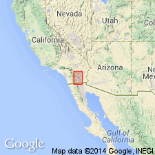
Type section: at the southeastern base of Vallecito Mountains where formation is 7,000 ft thick, 3 mi west of Fish Creek Wash [in northeastern corner of Cuyapaipe quadrangle, San Diego Co., southern CA], southwestern Imperial Valley region. Named from Canebrake Wash, [in T. 14 and 15 S., R. 6 and 7 E., Cuyapaipe quadrangle, San Diego Co., southern CA].
[Additional locality information from USGS GNIS database, USGS historical topographic map collection TopoView; accessed April 8, 2018. US geologic names lexicon (USGS Bull. 1200, p. 605) states type section is in Imperial Co.]
Source: Publication; US geologic names lexicon (USGS Bull. 1200, p. 605).
For more information, please contact Nancy Stamm, Geologic Names Committee Secretary.
Asterisk (*) indicates published by U.S. Geological Survey authors.
"No current usage" (†) implies that a name has been abandoned or has fallen into disuse. Former usage and, if known, replacement name given in parentheses ( ).
Slash (/) indicates name conflicts with nomenclatural guidelines (CSN, 1933; ACSN, 1961, 1970; NACSN, 1983, 2005, 2021). May be explained within brackets ([ ]).