

- Usage in publication:
-
- Cane River beds
- Modifications:
-
- Original reference
- Dominant lithology:
-
- Sand
- Clay
- AAPG geologic province:
-
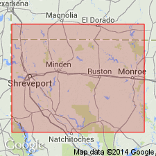
- Arkla basin
Summary:
Pg. 220, 224, 227, 235-236; AAPG Bull., v. 10, no. 1, p. 7. Cane River beds. Name suggested by H.V. Howe, for basal part of St. Maurice formation as originally defined and heretofore used. In the Cane River are included the 75 to 150 feet of beds above Wilcox formation and below the massive Sparta sand, which outcrop in narrow belt trending northeast across southern Sabine and Natchitoches Parishes. Basal member consists of glauconitic sand and sandy clay, but in some places marine tuff is present at base. Glauconitic clays predominate in southern part of outcrop, but north from Bienville Parish they become sandier, until in northern Bossier Parish they are represented entirely by sands, in part glauconitic. The Cane River beds in records of wells drilled east and southeast of the outcrop are made up chiefly of glauconitic clays with subordinate beds of sand. The fauna was identified by Vaughan in 1900 as corresponding to that of Lisbon beds. [Age is middle Eocene.]
Named from excellent exposures on Cane River at Natchitoches, western LA.
Source: US geologic names lexicon (USGS Bull. 896, p. 332).
- Usage in publication:
-
- Cane River member
- Modifications:
-
- Principal reference
- Revised
- AAPG geologic province:
-
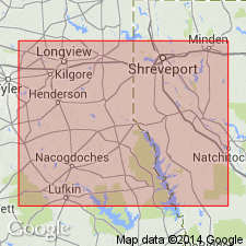
- Arkla basin
Summary:
Pg. 1339-1346. Cane River member of Claiborne formation. As restricted in this paper is a glauconitic, sandy marl and a glauconitic, clayey sand, characterized by OSTREA SELLAEFORMIS var. LISBONENSIS and ORTHOPHRAGMINA ADVENA. Occurs stratigraphically above Wilcox formation and below Reklaw member in Louisiana. Is basal member of Spooner's Cane River formation, which extended to top of Weches member of this report. [Age is middle Eocene.]
Type locality: at Baden Hill on Cane River, 0.5 mi north of Natchitoches, western LA.
Source: US geologic names lexicon (USGS Bull. 896, p. 332).
- Usage in publication:
-
- Cane River formation
- Modifications:
-
- Revised
- AAPG geologic province:
-
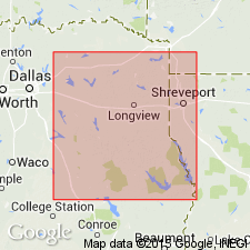
- East Texas basin
Summary:
Pg. 1355. Near eastern edge of Nacogdoches County, eastern Texas, immediately west of Attoyac Bayou, the Queen City member pinches out and the Reklaw and Weches members combine to form Cane River formation. [Age is middle Eocene.]
Source: US geologic names lexicon (USGS Bull. 896, p. 332).

- Usage in publication:
-
- Cane River formation*
- Modifications:
-
- Overview
- AAPG geologic province:
-
- Arkla basin
- East Texas basin
Summary:
Cane River formation of Claiborne group. In northeastern Texas Cane River is applied by A.C. Ellisor to beds that are said to underlie Reklaw member and to compose basal part of Mount Selman formation. In western Louisiana (type locality) the Cane River has been treated as a marine member of St. Maurice formation (now discarded), including all beds between Sparta sand above and Wilcox below, thus including equivalents of Weches, Queen City, and Reklaw of Ellisor. (See H.K. Shearer, AAPG Bull., v. 14, no. 4, p. 433-450, 1930; C.L. Moody, AAPG Bull., v. 15, no. 5, 1931; and H.V. Howe, AAPG Bull., v. 17, no. 6, p. 613+, 1933.) The original definition is that in current use by the USGS. Age is middle Eocene. Present in western Louisiana, and northeastern and eastern Texas.
Source: US geologic names lexicon (USGS Bull. 896, p. 332).
- Usage in publication:
-
- Cane River formation*
- Modifications:
-
- Areal extent
- AAPG geologic province:
-
- Arkla basin
Summary:
Pg. 6 (table 2), 7. Cane River formation of Claiborne group. Mainly brown lignitic shale, abundantly glauconitic and fossiliferous in upper part; interbedded with sparsely glauconitic and fossiliferous sand and brown shale in middle and lower parts. Becomes more sandy to north, and at outcrop area about 5 miles north of county line, consists mainly of medium- to fine-grained sand. Thickness 330 to 370 feet. Separated from overlying Sparta sand of Claiborne group and underlying Wilcox formation by unconformities. [Age is middle Eocene.]
Geographically extended into Columbia County, southern Arkansas.
Source: Publication; US geologic names lexicon (USGS Bull. 1200, p. 606).
- Usage in publication:
-
- Cane River formation
- Modifications:
-
- Areal extent
- AAPG geologic province:
-
- Arkla basin
Summary:
Pg. 5, pl. 1. Cane River formation of Claiborne group. Crops out in southwestern part of Chestnut salt dome area, Natchitoches Parish, Louisiana. Composite section obtained partially from auger holes on south side of dome is 107.5 feet thick. Includes a lower 13-foot noncalcareous sequence of sandy blue-green and brown clay, a middle 27-foot calcareous fossiliferous member of blue-gray, green, and dark-brown glauconitic marl, and an upper 67-foot noncalcareous sequence with few glauconite beds. Overlies Carrizo formation; underlies Sparta formation. [Age is middle Eocene.]
Source: US geologic names lexicon (USGS Bull. 1200, p. 606).
For more information, please contact Nancy Stamm, Geologic Names Committee Secretary.
Asterisk (*) indicates published by U.S. Geological Survey authors.
"No current usage" (†) implies that a name has been abandoned or has fallen into disuse. Former usage and, if known, replacement name given in parentheses ( ).
Slash (/) indicates name conflicts with nomenclatural guidelines (CSN, 1933; ACSN, 1961, 1970; NACSN, 1983, 2005, 2021). May be explained within brackets ([ ]).