

- Usage in publication:
-
- Canal Run Formation
- Modifications:
-
- Named
- Dominant lithology:
-
- Sand
- Silt
- Clay
- AAPG geologic province:
-
- Atlantic Coast basin
Summary:
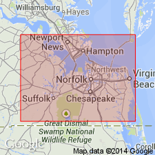
No name derivation given. Found in Isle of Wight Co., southeastern VA. Consists of fluvial sand, silt, and clay. Maximum thickness is 15 ft. Overlies Sedley Formation; underlies Kilby Formation. Age is Pliocene or early Pleistocene.
Source: GNU records (USGS DDS-6; Reston GNULEX).
For more information, please contact Nancy Stamm, Geologic Names Committee Secretary.
Asterisk (*) indicates published by U.S. Geological Survey authors.
"No current usage" (†) implies that a name has been abandoned or has fallen into disuse. Former usage and, if known, replacement name given in parentheses ( ).
Slash (/) indicates name conflicts with nomenclatural guidelines (CSN, 1933; ACSN, 1961, 1970; NACSN, 1983, 2005, 2021). May be explained within brackets ([ ]).