- Usage in publication:
-
- Canadaway fauna
- Canadaway group
- Modifications:
-
- Original reference
- AAPG geologic province:
-
- Appalachian basin
Summary:
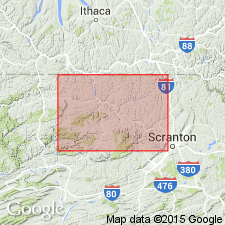
G.H. Chadwick, 1933 (Geol. Soc. Amer., Preliminary list of titles and abstracts of papers to be offered at the 46th Annual Meeting, Chicago, Illinois, Dec. 28-30, 1933, p. 19, 82, 83, 84). The so-called "Chemung" strata on Genesee River carry a distinct and later faunal assemblage, herewith named Canadaway fauna (and group), which succeeds the true Chemung biota of Tioga County, northwestern Pennsylvania. The Canadaway includes from Dunkirk black shale to Cuba sandstone. Assigned to Chautauguan.
Source: US geologic names lexicon (USGS Bull. 896, p. 329).

- Usage in publication:
-
- Canadaway group
- Modifications:
-
- Principal reference
- Dominant lithology:
-
- Sandstone
- Shale
- Siltstone
- AAPG geologic province:
-
- Appalachian basin
Summary:
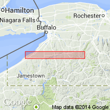
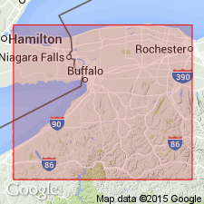
Pg. 351. All brachiopodous ("Chemung") formations along Genesee River were deposited after close of true Chemung and while "red beds" were making in Chemung area. To these pseudo-Chemung later beds from base of the Dunkirk to base of Cuba sandstone, writer proposes to apply the substitute and distinctive name Canadaway group, and to those from base of Cuba sandstone to base of Wolf Creek (or Panama) conglomerate, in which the fauna has been modified by loss of DELTHYRIS MESACOSTALIS and accession of CAMAROTOECHIA(?) DUPLICATA, the name Conneaut group. The respective type sections are along Canadaway Creek, in western New York [Chautauqua County, near Dunkirk], and Conneaut Creek crossing Pennsylvania-Ohio line. Both are, of necessity, chosen where the formations are thinner and are, therefore, passing over into the "Naples" (usually called "Portage") facies. Conneaut and Canadaway groups belong to the Chautauquan. [On p. 323 he stated:] Canadaway group includes, on Canadaway Creek, in descending order, Northeast shale, Shumla sandstone, Westfield shale, Laona sandstone, Gowanda beds, and Dunkirk black shale; on Genesee River it includes Machias beds (=Northeast shale), Rushford sandstones (=Shumla sandstone, Westfield shale, and Laona sandstone), Chemung facies, locally Caneadea shale, and Canaseraga sandstone (=Dunkirk shale). Fall Creek conglomerate of Tioga County, Pennsylvania, is included in Dunkirk shale. [Age is Late Devonian.]
Source: US geologic names lexicon (USGS Bull. 896, p. 329).

- Usage in publication:
-
- Canadaway group
- Modifications:
-
- Biostratigraphic dating
- AAPG geologic province:
-
- Appalachian basin
Summary:
Pg. 859, 862. The fossiliferous strata formerly called "Chemung" on Genesee River are now known to differ in presence of 130 species not found in true Chemung strata below, and in absence of 240 species (including many characteristic forms) of typical Chemung fauna, while there are less than 100 species in common. These beds, with the "ATHYRIS ANGELICA fauna" constitute Canadaway group, which traced eastward goes wholly above type Chemung. On Lake Erie the Canadaway is readily subdivided into (descending): Northeast shale (I.C. White's "Portage"); Shumla sandstone; Westfield shale; Laona sandstone; Gowanda (formerly Portland beds, preoccupied); and Dunkirk black shale. [Age is Late Devonian.]
Source: US geologic names lexicon (USGS Bull. 896, p. 329).

- Usage in publication:
-
- Canadaway group
- Modifications:
-
- Biostratigraphic dating
- AAPG geologic province:
-
- Appalachian basin
Summary:
Pg. 136. Latest count shows 250 true Chemung species (assigned to Senecan) fail to cross line into overlying Canadaway group (Chautauquan), as against only 90, mostly long range, forms that do; and in their place 135 new species with a dozen new genera appearing for the first time above this line, which corresponds westward with top of the old (type) Portage. [Age is Late Devonian.]
Source: US geologic names lexicon (USGS Bull. 896, p. 329).
For more information, please contact Nancy Stamm, Geologic Names Committee Secretary.
Asterisk (*) indicates published by U.S. Geological Survey authors.
"No current usage" (†) implies that a name has been abandoned or has fallen into disuse. Former usage and, if known, replacement name given in parentheses ( ).
Slash (/) indicates name conflicts with nomenclatural guidelines (CSN, 1933; ACSN, 1961, 1970; NACSN, 1983, 2005, 2021). May be explained within brackets ([ ]).

