The National Geologic Map Database is migrating to a new infrastructure. We apologize for any service disruptions during this process.
|
|---|


- Usage in publication:
-
- Canada Falls Member
- Modifications:
-
- Overview
- Dominant lithology:
-
- Basalt
- AAPG geologic province:
-
- New England province
Summary:
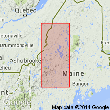
Volcanic rocks of the Canada Falls Member of the Frontenac Formation crop out in three northeast-trending lens-shaped bodies in southwestern ME. Estimated thickness of the largest is 1000 to 2000 m. Predominantly green basalt, which weathers light green. Exposures are of two types: well-pillowed and poorly cleaved and poorly pillowed and well-cleaved. Pillows range in diameter from 10 cm to 2 m. A thin pyroclastic layer of volcanic bombs and tuff is located near base of unit. Also contains minor beds of intercalated siltstone and mudstone slate that generally drape over the pillow basalt and are only a few meters thick. Author considers Frontenac to be no older than Silurian or latest Ordovician.
Source: GNU records (USGS DDS-6; Reston GNULEX).
For more information, please contact Nancy Stamm, Geologic Names Committee Secretary.
Asterisk (*) indicates published by U.S. Geological Survey authors.
"No current usage" (†) implies that a name has been abandoned or has fallen into disuse. Former usage and, if known, replacement name given in parentheses ( ).
Slash (/) indicates name conflicts with nomenclatural guidelines (CSN, 1933; ACSN, 1961, 1970; NACSN, 1983, 2005, 2021). May be explained within brackets ([ ]).