

- Usage in publication:
-
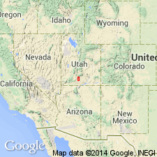
- Canaan Peak Formation*
- Modifications:
-
- Named
- Dominant lithology:
-
- Conglomerate
- Sandstone
- Mudstone
- AAPG geologic province:
-
- Paradox basin
Summary:
Named for exposures around Canaan Peak in T37S, R1E, Garfield Co, UT in Paradox basin. Type section on south face of peak up tributary at head of Wahweap Creek in SE1/4 NW1/4 sec 9, T37S, R1E. Is predominantly light-brown, gray, massive to poorly sorted, pebble to cobble (mostly quartzite, chert and dense to fine-grained porphyritic igneous rocks, but also sandstone, siltstone, conglomerate, argillite and limestone) conglomerate with some conglomerate lenses. Interbedded light-gray to light-brown, usually fine- to medium-grained, some coarse-grained to conglomeratic sandstone and light-gray arenaceous mudstone with some ironstone concretions and white siltstone galls. Is 395 ft thick at type; ranges from 40 ft thick near Pine Lake to 1,000 ft thick near trough of Table Cliff syncline. Lower contact placed at change from very fine grained sandstone or mudstone of Kaiparowits Formation to pebble-cobble conglomerate or conglomeratic sandstone of Canaan Peak. Is conformable and locally intertongues with red to purplish-gray fine-grained rocks (mudstone, claystone and argillaceous limestone) of the Pine Hollow Formation, a new name. Thought to be a coarse fluvial deposit affected by crustal instability in south-central UT. Lower part has Late Cretaceous, Campanian palynomorphs; upper part may be Paleocene. Previously mapped as part of Wasatch Formation.
Source: GNU records (USGS DDS-6; Denver GNULEX).
- Usage in publication:
-
- Canaan Peak Formation
- Modifications:
-
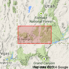
- Areal extent
- Revised
- AAPG geologic province:
-
- Paradox basin
- Plateau sedimentary province
- Great Basin province
Summary:
New exposures described in southern UT by Goldstrand (1991, unpub. dissert.), on southern Paunsaugunt Plateau, Kane Co [Plateau sedimentary province] and east side of Pine Valley Mountains, Washington Co, [Great Basin province]. On Table Cliff Plateau [Paradox basin] upper part removed and assigned to informal "Grand Castle formation" because of lithology and because Pine Hollow Formation separates Grand Castle from overlying Claron Formation. (Grand Castle assigned to basal part of Claron on west side of Markagunt Plateau.) Palynomorphs indicate late Campanian (Bowers, 1972) to early Paleocene (Goldstrand, 1991) age. [Bowers, p.19-21, states, "According to Tschudy, the palynomorphs from the Canaan Peak ... are suggestive of Claggett or Judith River equivalence (middle to lower Campanian)." "...4,000 feet of sedimentary rocks ... between the Canaan Peak ... and the lowest Campanian rocks ... favor a younger (possible middle to late Campanian) age for the lower part of the Canaan Peak."] Eaton (1991, GSA S.P. 260) interpreted late Campanian palynomorphs in basal Canaan Peak as being reworked from underlying Kaiparowits Formation during Maastrichtian. [Eaton, p.60, states: "...a latest Campanian age is at least suggested for the base of the Canaan Peak ..., providing the palynomorph samples were not reworked from underlying rocks.] Unit may be Maastrichtian to early Paleocene age.
Source: GNU records (USGS DDS-6; Denver GNULEX).
For more information, please contact Nancy Stamm, Geologic Names Committee Secretary.
Asterisk (*) indicates published by U.S. Geological Survey authors.
"No current usage" (†) implies that a name has been abandoned or has fallen into disuse. Former usage and, if known, replacement name given in parentheses ( ).
Slash (/) indicates name conflicts with nomenclatural guidelines (CSN, 1933; ACSN, 1961, 1970; NACSN, 1983, 2005, 2021). May be explained within brackets ([ ]).