The National Geologic Map Database is migrating to a new infrastructure. We apologize for any service disruptions during this process.
|
|---|


- Usage in publication:
-
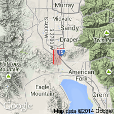
- Camp Williams unit
- Modifications:
-
- First used
- Dominant lithology:
-
- Mudstone
- Siltstone
- Sandstone
- AAPG geologic province:
-
- Wasatch uplift
Summary:
Named as an informal unit in the Salt Lake group for Camp Williams on the Jordan River, Salt Lake Co, UT on Wasatch uplift. No type locality designated. Composed mostly of poorly consolidated mudstone and siltstone and lesser amounts of impure sandstone that forms ledges. Locally has a basal conglomerate of igneous detritus with boulders 2-4 ft across. Is at least 100 ft thick. Characterized by red and tan color, a contrast to the white marlstone of the unconformably underlying Jordan Narrows unit (first used) of the Salt Lake group. A deep soil developed on upper part. Unconformably overlain by Harkers fanglomerate (new) at many localities. No fossils found. Assigned to the middle Miocene to early Pliocene on basis of stratigraphic position. Geologic map.
Source: GNU records (USGS DDS-6; Denver GNULEX).
For more information, please contact Nancy Stamm, Geologic Names Committee Secretary.
Asterisk (*) indicates published by U.S. Geological Survey authors.
"No current usage" (†) implies that a name has been abandoned or has fallen into disuse. Former usage and, if known, replacement name given in parentheses ( ).
Slash (/) indicates name conflicts with nomenclatural guidelines (CSN, 1933; ACSN, 1961, 1970; NACSN, 1983, 2005, 2021). May be explained within brackets ([ ]).